
Words & Images Hamish Southcott
The Great Southern Brevet (GSB) tackles a 1,100km loop of epic lower South Island landscapes. With climbing approaching 18,000m, you know you’re in for a real test.
Part 1 – Let the carnage begin
As the start time fast approached, I felt underdone compared to previous editions of the event. The GSB began its life in 2012, under the stellar guidance of the King (Dave King). It escaped my radar until the 2016 edition, when serious FOMO had me lining up to tackle this iconic event. For that, and the 2023 event, I put in some serious k’s; but this year was different. Honestly, I was over-training and went into it undercooked. Little did I know that the 2025 vintage would be the toughest to date; a view shared by many.
Along with nearly 200 riders, I lined up in Tekapo for the relaxed start time of 9.30am. It was a neutral start to avoid start-line chaos before regrouping a few kilometres out of town. Then, it was all on; the race had begun. For many, this was more than just an event; it was a race to take line honours. For others, myself included, finishing would be reward enough.
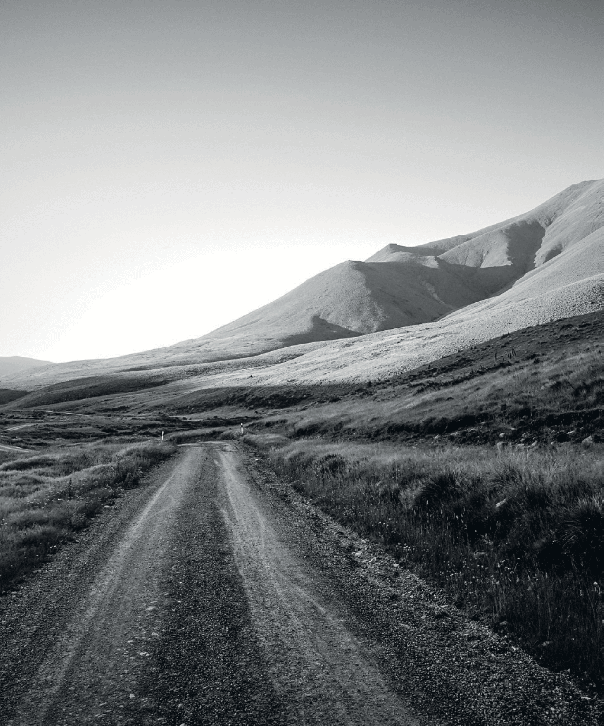
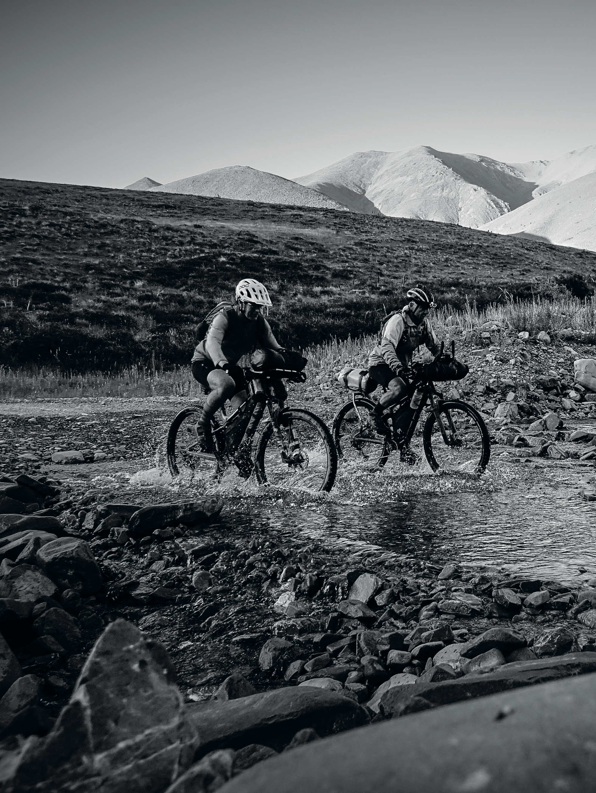
The first 40km was brutal. Imagine riding down a river bed, and you might get the idea. This initial shakedown caused a raft of challenges for many; from flat tyres to stray drink bottles, the carnage had truly begun. Personally, I had a lucky escape as a fist-sized bolder, kicked up by a rider, catapulted over my head. It was a relief to head towards the hills and smooth gravel. As we entered Black Forest Station beside Lake Benmore, I started to struggle. It was probably due to a lack of training, but I always take a few days to find my groove during these events. For the next few hours, we zig-zagged along the pylon road to the Benmore Dam, then the Alps to the Ocean trail and finally Omarama for a feed.
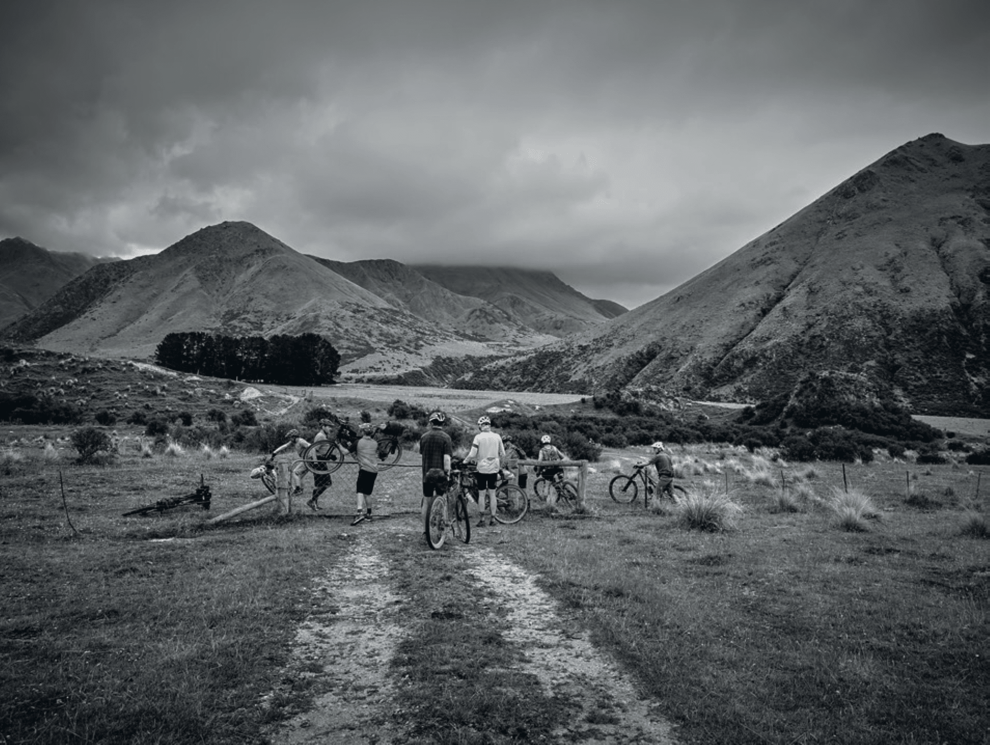
The Four Square was doing a roaring trade as my Lycra-clad brethren refuelled their tanks. The sensible ones called it a day, but I pushed on with Richard Reddecliffe to make the most of the good weather. Broken Hut Road soon spat us out at the base of another mountain range. Our target now was Little Omarama Saddle (1357m). I was feeling pretty whacked by that stage, so there was a fair amount of walking. The walking, alongside the late part of the day, saw us crest the saddle in darkness. As we bombed down the rocky descent, I wished I had more than just my seat post-suspension. There was no time for that passing thought; we needed to find a bivy spot and get some sleep.
Part 2 – The game-changing Southerly
It wasn’t the restful sleep I was hoping for. I won’t go into all the details but it involved chronic cramp, excessive water and possibly an empty water bottle. But that’s all you’re getting out of me. What happens on the GSB definitely stays on the GSB!
The rain during the night had eased up just in time to pack up and get back amongst it. It was a dreary start to the day as I navigated the 4WD track on the Manuherikia River flats. Compared to yesterday, the conditions were ideal, but all good things must come to an end eventually…. more on that later. My one-track mind was focused on getting a feed and the nearest town was Oturehua, some 40km away. En route, we rode beside the Netflix film set for John Steinbecks ‘East of Eden’. The director sure missed a trick with such talented extras streaming on past. Our posse of riders increased to five as we made good time along the smooth gravel. This was like a state highway compared to the start of yesterday.
It was slim pickings at the local pub, but it was enough to get us to the next town of Omakau, another 30km down the road. About now, you’re probably getting the idea that this is a glorified pub crawl… and what happens on GSB stays on GSB! It’s also an excuse to empty your bank account as you go on a feeding frenzy; that’s why it’s not an annual event—you need to spend two years saving enough money just to line up at the start.
Omakau was a short refuel stop before we headed towards Thomsons Gorge. As we approached the hills, the southerly front set in—and it kept us company for much of the day, dropping the temperature to unseasonal lows. The descents became bone-chilling, with the climbs giving us a welcome chance to warm up. The day’s high point was a little over 900m and, while cold, we were blissfully unaware of the havoc the storm was creating for the front riders on Mt Pisa, another 1000m higher. The descent was epic, and the rain eased as we dropped elevation. We stumbled upon some miners doing test drilling for the proposed Santana Minerals mine between Bendigo and Ophir. If given the go-ahead, this large-scale mine will destroy the area’s natural beauty.
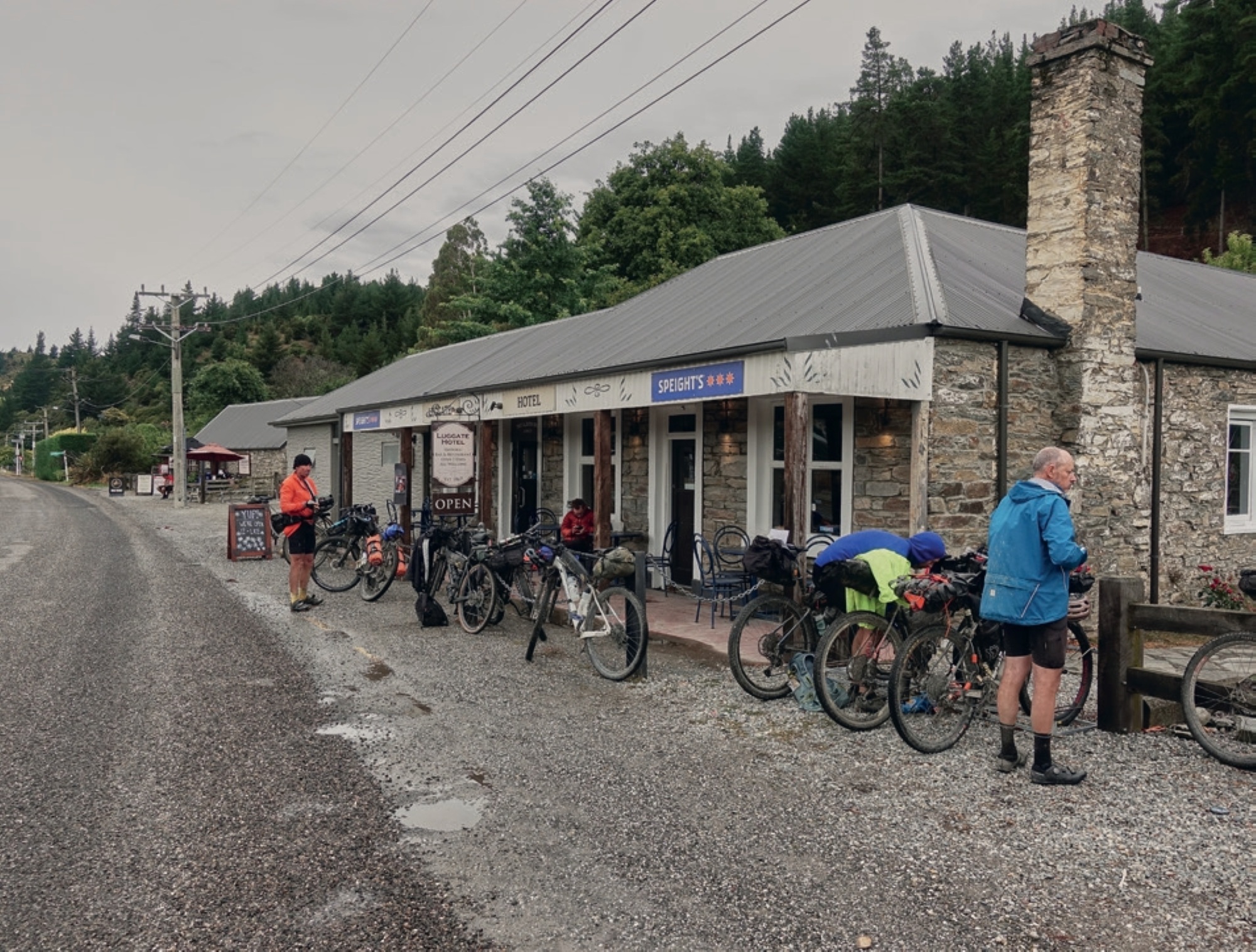
Thomsons Gorge Road soon spat us out onto State Highway 8. The route to Luggate was mostly tarseal, which made for quick progress. Once in Luggate, it was straight to the local store and then the pub; it would have been rude not to! While we’d hoped for more than fried food, we scoffed it down anyway and evaluated our options. Other rider’s stories began filtering in; many had opted to bypass the next section, others had turned back at altitude to escape the storm, and others ended up off route. While the storm seemed to have cleared, the forecast showed it was setting in again later. Staying in Luggate was a no-brainer—who can turn down a hot shower? Not having a towel wasn’t going to stop me! And I sure needed a good sleep after a sluggish day on the bike. The day’s tally was a paltry 135km, pitiful!
Part 3 – More than a pipe dream
The storm looked to have passed as a calm morning rolled in. A shout out to Richard for setting up his tent fly to bivy under. Dry gear and a good sleep, it really is the little things that matter! At 5am, we rolled out of Luggate to tackle Mt Pisa, a 1963m peak. I’d only ever descended what we were about to climb, which was epic; the climb, however, filled me with dread. It’s funny how the mind tricks you, though, as it was way more rideable than I’d anticipated.
Early morning traffic blasted past; drivers were lost in thought, heading into the working day. Suckers! The short tarseal climb was soon replaced with a 4WD track; the climb up the Pisa Range Ridge Track had begun. The track starts with a steady climb through farmland, past the Alfern Creek Conservation Area and its small remnant grove of Kānuka and Hall’s tōtara. En route to the trig at 1,440m, the climb becomes steeper, and the views become more spectacular. As we climbed towards Lake McKay, the clouds started to clag in, and the cold began to bite as a few snowflakes drifted past. On a good day, the lake offers the most scenic views on the Pisas. Today was not that day. Climbing provided a respite from the cold, and the summit was tantalisingly close. A short drop to Sally’s Pinch and then the final push to the summit. That was half the job done; Cromwell was our next goal.
The 12.3km descent was a steep and rugged drop of 1,882m down the Tinwald Burn Ridge Track. Comments online say that this track should only be attempted by experienced adventurers. Riding a fully rigid bike, I can vouch for this, but the views are bloody epic! As we dropped elevation, the weather began to warm up. It was time to break out the sunnies and sunscreen. The Lake Dunstan Cycle Trail had us making good time, and we soon set up camp at the Cromwell Subway. Getting here had taken nearly nine hours, and we’d only travelled 67km! I’ve got no words! After eating our weight in Subway and stocking up at the supermarket, it was time for the Lake Dunstan Cycle Trail. This trail links the heritage towns of Cromwell and Clyde. It passes through landforms shaped by nature and the gold miners and dam-builders who toiled here during the last two centuries. Following their footsteps, world-class track builders have constructed clip-on boardwalks bolted to impressive rock walls, and an 86m suspension bridge. This is some seriously epic engineering.
A short detour to Clyde before Paul Churton and I headed towards the Old Women Range, our next obstacle in pursuit of glory. This area, around Clyde, is graced with stone fruit orchards in full production. One orchard had kindly put out apricots, the largest cherries I’ve ever seen, and Flatto peaches. Just like it says on the label, these are flat peaches. Getting a hit of fresh fruit was a real boost as we rode into the setting sun.
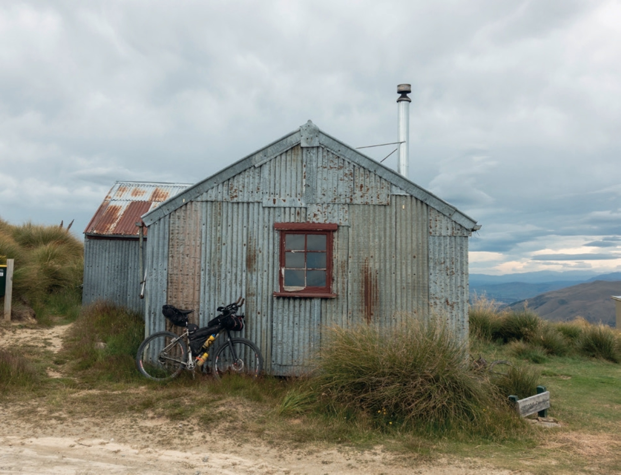
A few k’s up Fraser Dam Road, bad light ended play, and we pulled stumps for the day. Our people then called their people so we could secure a night’s stay at the luxurious All Pipe-No Hype Lodge. Truly a magnificent find! Luckily, there was ample space, and our sales pitch had Max and Simon scrambling to enjoy the lodge’s hospitality. It was indeed a great find. Until it wasn’t. My cosy pipe had somehow punctured my sleeping mat. Perhaps it was a rogue piece of fibreglass, but needless to say, I won’t be giving the All Pipe-No Hype Lodge a stellar review.
Part 4 – The case of the mysterious wonder drug
It may be a surprise to many, but sleeping in the All Pipe-No Hype Lodge with a holey sleeping mat is far from ideal. Who knew? I’ve always found sleeping during these events a real struggle, hence I often turn to some performance-enhancing drugs. Hold on, I know what you’re thinking… time to call up the World Anti-Doping Agency. But back up ya Penny Farthing and let me explain. It’s quite simple; it starts with C and ends with E. No, no, no, it’s not cocaine! I’m not some kingpin drug baron. It’s only coffee. Say what? Yes, crazy, I know. As I’m not an avid consumer of said beverage, it profoundly affects me. Those who know me will be shocked by this revelation. When my twin daughters were growing up, I told them that drinking coffee would mean they’d be short like their mum. Since I’ve stopped growing, I figured I’d be ok.
Darkness still held its grip on the mountains as I tackled the mighty Old Women Range. The solitude of an early start is great; at last, I’d found my groove! Everything had fallen into place the previous day. That Mt Pisa climb was bloody brilliant!
The Old Women Range lies within the Kopuwai Conservation Area and is a landscape of exposed, rolling, tussock-clad mountains. While previous riders had experienced snow-covered tracks, most of this had gone, and we had sensational views. The All Pipe-No Hype Lodge sat at 264m, and over the next 26km, I climbed to 1,745m. While soaking in the view, I glanced at my Garmin in horror. The last 30km had taken five hours. You can call off the public flogging; clearly, coffee isn’t the wonder drug I made it out to be.
What goes up must come down too, right?! The long descent towards the Nevis was just reward. We weren’t the only crazies getting amongst the action, there were also teams competing in the MAGNIficent Adventure Race. I thought we had a challenge on our hands; it was nothing compared to these hardy souls.
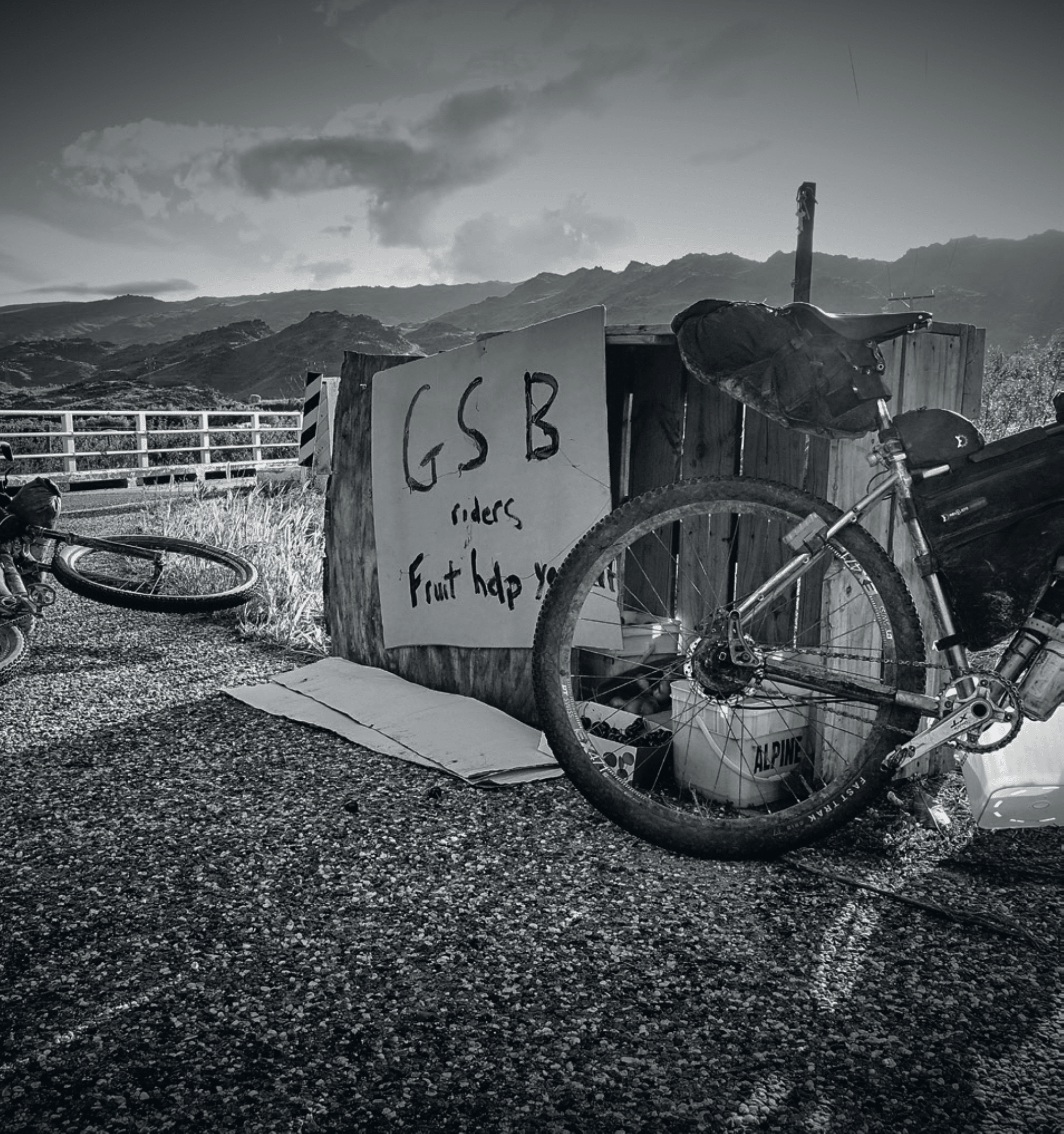
As we hurtled down the 4WD track, a mirage appeared on Duffers Saddle. Luckily, this was the real deal as Team INEOS (don’t mention the rugby) was waiting. The corner store/local pub was a welcome sight. A big shout out to Dan and Russel. These guys have a knack for turning up when you least expect it and need it most. They had the barbie going, so bacon butties and a cold drink hit the spot. Dan has been spreading koha amongst the GSB fraternity for many years. Thanks Dan, you’re a bloody legend!
Time to move on from my bromance and get back to pedal pushing. The Nevis Valley was calling. A joyous gravel descent soon had us in the valley proper. The Nevis Valley is a very isolated area with a diverse backstory. From a trail route for Māori to early European farmers, and the discovery of gold. Its isolation did not protect it from the gold rush as prospectors poured in to find gold in them there hills! Remains of this time are evident in the numerous stone buildings, settlement and cemetery.
They say timing is everything, and we sure struck it lucky. A tailwind propelled us along the valley towards the Hector Mountains. The smallish hill (things aren’t “small” on the GSB) was a sign one obstacle was nearly complete and another one awaited. Before fanging it down to Garston, Paul and I stopped at the historic Garston Ski Hut. With a bit of internet sleuthing, I discovered that in the 1930’s the truck transporting the prefabricated hut broke down several kilometres short of the ski field. So that is where it still sits today. With stunning views, it wasn’t a bad place to break down.
As the fanging began, my mind shifted to the hole in my sleeping mat. I had no idea how to fix it. That was future Hamish’s problem! But current Hamish needed to get 44km down the road to meet future Hamish in Lumsden. Top effort if you’re keeping up with my ramblings. This is an insight into the mind of a tired cyclist. The dream would be to get a bed, but it looked like there was no room at the inn. The campground might be the only option.
I raced ahead on my time trial, setting speeds unseen (by me, at least) during the GSB. The plan was to beat the Four Square closing time, get some dinner and then wrangle the mat. Two out of three ain’t bad. That mat had me bamboozled. The good folk at the Indian takeaway shop were kind enough to let me flounder on their floor as I searched—in vain—for the leak. As the reality of my predicament soaked in, the fresh-as-can-be Justin wandered in. As we were just over halfway, all pretences—and my introverted tendencies—had been shelved. The result was that anyone who listened got queried about a spare bed. I tried them all, from the takeaway owners to the local BnB. Enter stage left, Justin, my next candidate. Well, my luck turned. His room, at the Royal Mail Hotel, had a spare bed. My relief was palpable; this was better than Christmas! And, it got even better; I even had a real towel to use with the shower— no need to make do with my smelly cycle top.
Again, I’d only made a tiny dent in this behemoth course; a mere 143km!
Part 5 – The dire consequences of a supermarket visit
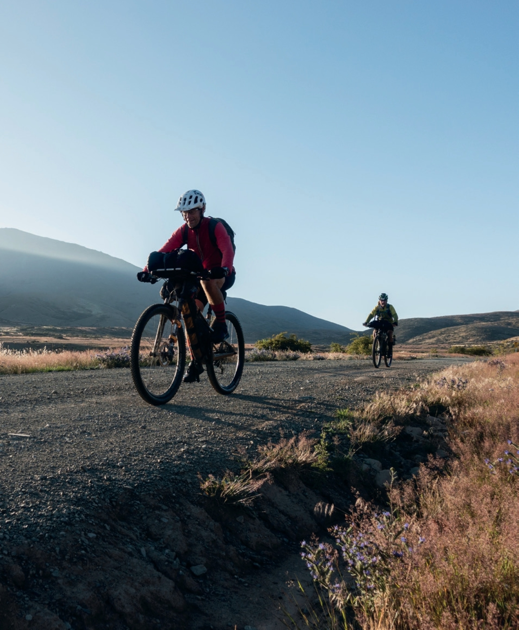
The previous night’s forecasted storm looked to be losing intensity, but it still had enough momentum to power me forward. First a bed, then a tailwind… this is what it must feel like to win Lotto! Approaching Waikaia, the remnants of the southerly blew through and kept things wet. But it didn’t last; I soon needed sunscreen.
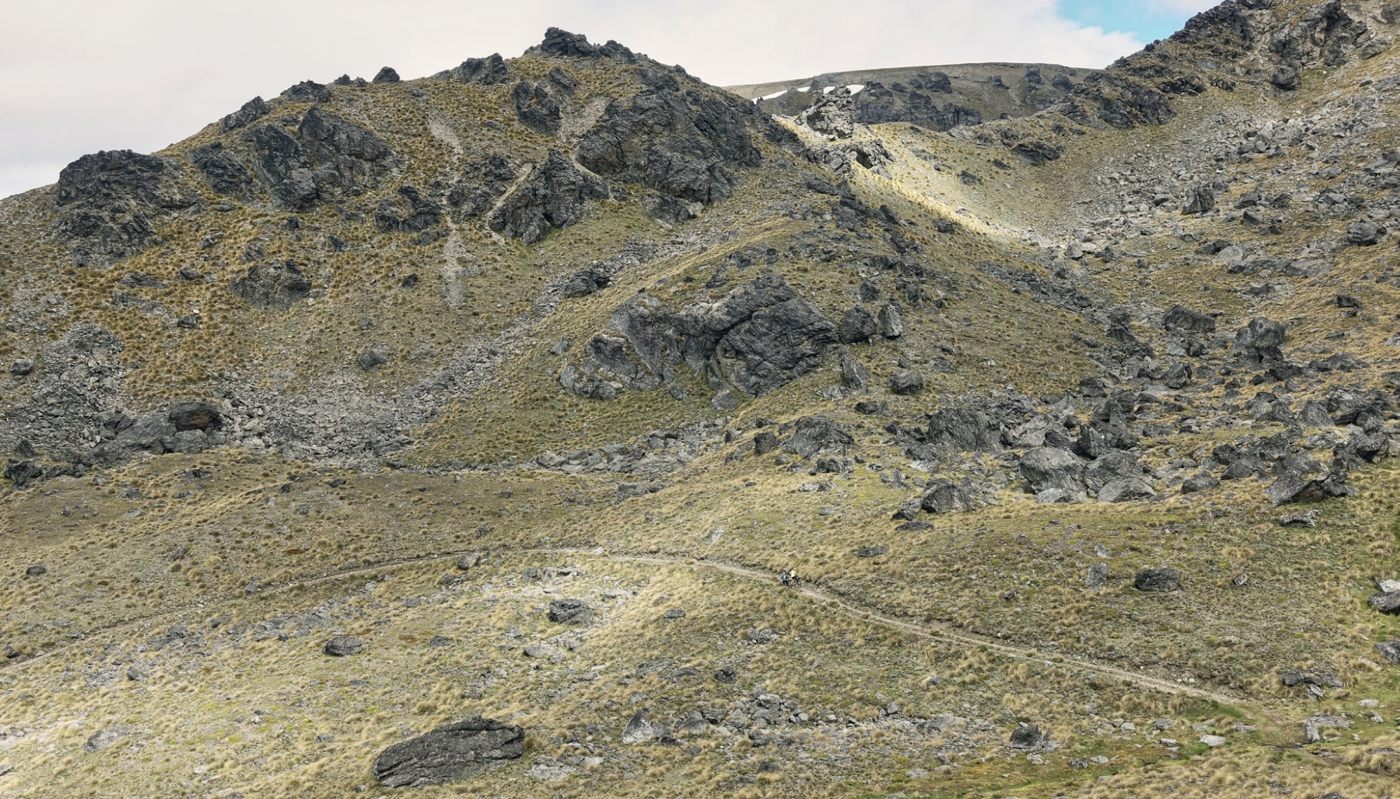
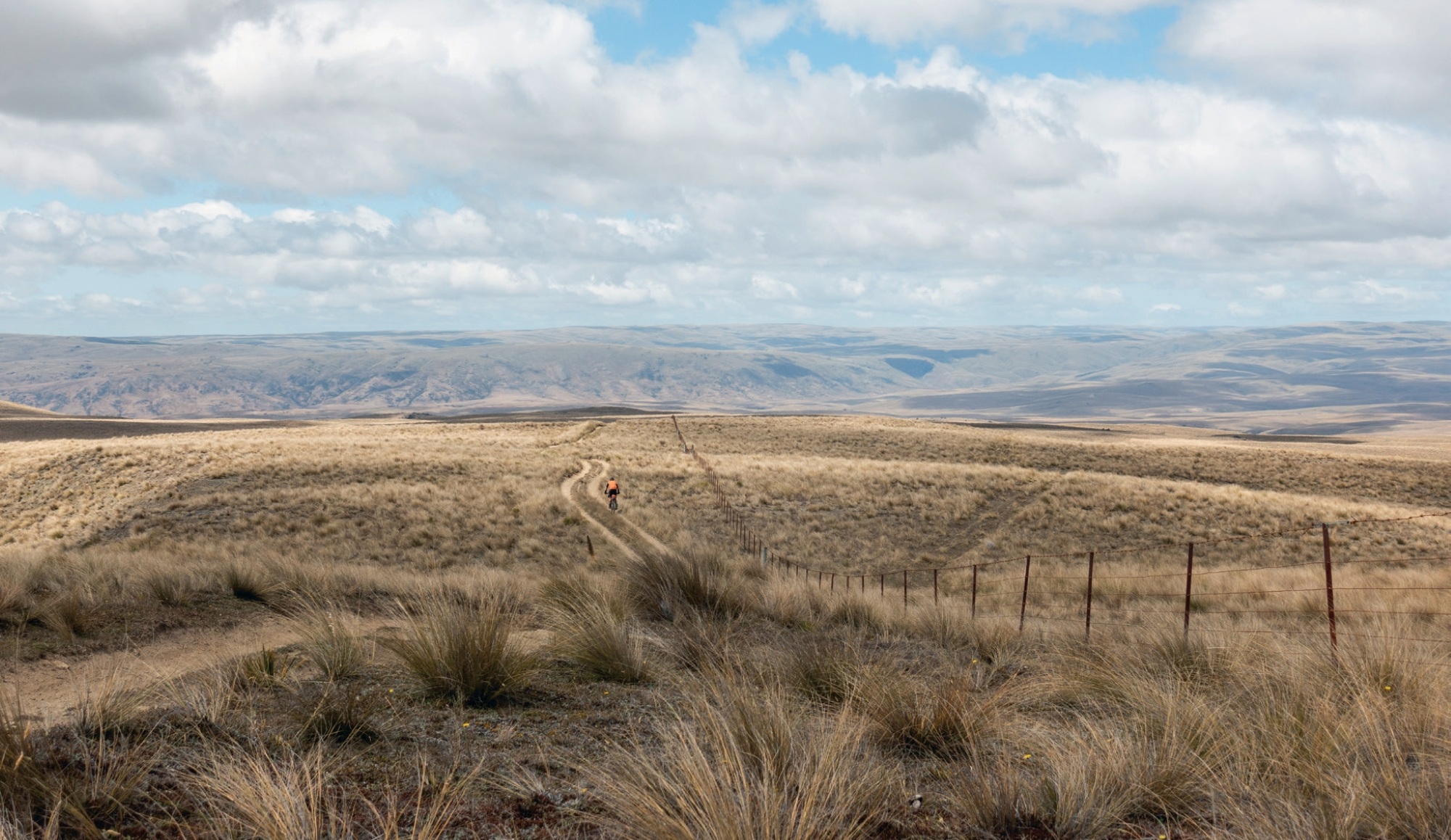
It was easy going to Piano Flat before the rolling road started climbing through lush beech forest. At around the 646km mark, the riding was replaced by a fair chunk of walking. The Old Man Range rises between Southland and Otago and stretches 40km. Its highest point is the Obelisk at 1,682m, and that’s where I was heading. But I still had to climb the steep southern flanks. With the bulk of the climbing done, most of the ride was along the ridgeline on the high plateau. My legs didn’t have the oomph of the previous few days, so it was a bit of a plod.
Unique schist rocks that contrast the barren, wild and sweeping tussock vistas dominate this range. This is a vast landscape, seemingly never-ending. Justin was in full relaxation mode when I arrived at the AA Hut. I couldn’t blame him; that couch looked mighty comfy. And it sure was; I could have spent hours just chilling. Alas, there was more terrain to cover. So the plodding continued towards the Obelisk and then the descent. Thank f*ck for that! Just as I needed a boost, Matt Hughs was waiting trailside. But I have to admit, in my half-cooked state, I initially didn’t recognise him. Sorry, Matt! He was on course to warn of an upcoming navigation challenge. Clearly, it went in one ear and out the other as I still screwed it up.
Another gnarly descent through Spaniard Gardens ensured the brake rotors burned to maintain control. Once down, it was onward to the Purple Haze singletrack. I’m not gonna lie, I was spent and this was the last challenge I wanted. This would be an epic ride on a good day without a laden bike. Just not today; I didn’t have juice in the tank to manhandle my steed over the small pinches. The Sphinx Rock Track was well endowed with countless switchbacks. On a never-ending ride of pure joy, this trail snaked its way down to the Roxburgh Gorge Trail. A full suss would be nek-level but, as they say, ya ride what ya brung! Paul and I were conscious that the supermarket was due to close at 9pm, a deadline we didn’t want to miss.
Thankfully, we bloody made it—and suffered the consequences. Never go food shopping when you’re hungry or tired. Your bank balance will never be the same! I spent over $70 and struggled to eat half of it. I hate wasting things at the best of times, so this was indeed a dark chapter.
Part 6 – No time for confession
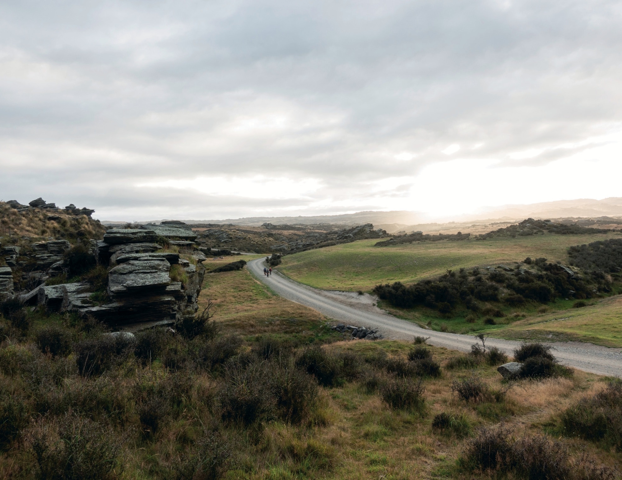
Kick-off was fast approaching at 7am. It was all a bit hazy; the days had started to merge. The sedate rail trail matched the gentleman’s start time. While this didn’t last, I knew that the bulk of the big mountains had passed, so surely it was going to get easier. Surely? Time would tell. In the meantime, I had some sweet gravel to ride. The next few hours of epic gravel took me to the Old Dunstan Road. This is one of the country’s most historic roads, with construction completed by 1862. The road facilitated movement between Dunedin and Central Otago. Its most important period following completion, as it was the main route to the Dunstan goldfields until 1864. Following a fairly direct line from the Taieri Plain to the Manuherikia Valley, the road crossed four mountain ranges and was the most direct route for those on foot or horse. The biggest difficulty was the exposed nature of the route’s highland, which left users vulnerable to poor weather. I can vouch for that, as I’ve been hammered by bad weather on previous rides over the route. On this occasion, Lady Luck was on my side to provide near-perfect conditions. The first highlight was the Poolburn Dam. This reservoir is located on the Ida Valley side of the Rough Ridge Range. It was completed in 1931 as a storage area for irrigation water to feed the fertile land of the Ida Valley. It covers over 300 hectares when full. The area now covered by water once had five hotels (including the infamous Drunken Women Inn) alongside this popular goldfields road.
The road continues to climb before the route veers off Long Valley Ridge Road into the Serpentine area. This vast tussock land was once home to one of New Zealand’s most isolated goldfields and towns. It even boasted the Presbyterian Serpentine Union Church, built in 1873 by public subscription from the miners resident on the surrounding diggings. Located at 1,000m, it is still the highest church in New Zealand.
Legend has it that during the first service, the minister arrived late, so after waiting some time, the congregation of miners went down to the hotel for refreshments, and drank to keep out the winter cold. The service opened with a well-known hymn, and the congregation demanded an encore. After expressing strong disapproval, the preacher went on with a shortened service. Had I known this, I would have made the effort to stop for confession. Perhaps just as well I didn’t, I’d still be there now!
Deep Creek Road allowed for fast riding; and, before long, one became three. I caught up with Justin Freeman and Darryl Cotton, who I hadn’t seen since day one. The temperature gauge was heading back up just in time for the day’s first major climb. It was back to the Old Dunstan Road and a climb up the Rock & Pillar Range. But before the 4WD climb, we stumbled upon Dan, who had bacon butties and cold drinks ready to roll. It was soon back to the climb, which would eventually take us to 1,425m. Cloud engulfed the ridge, hiding the dramatic landscape. This area was home to New Zealand’s first ski field. Between 1932 – 1953 the ski field was well used. That all changed when Coronet Peak opened.
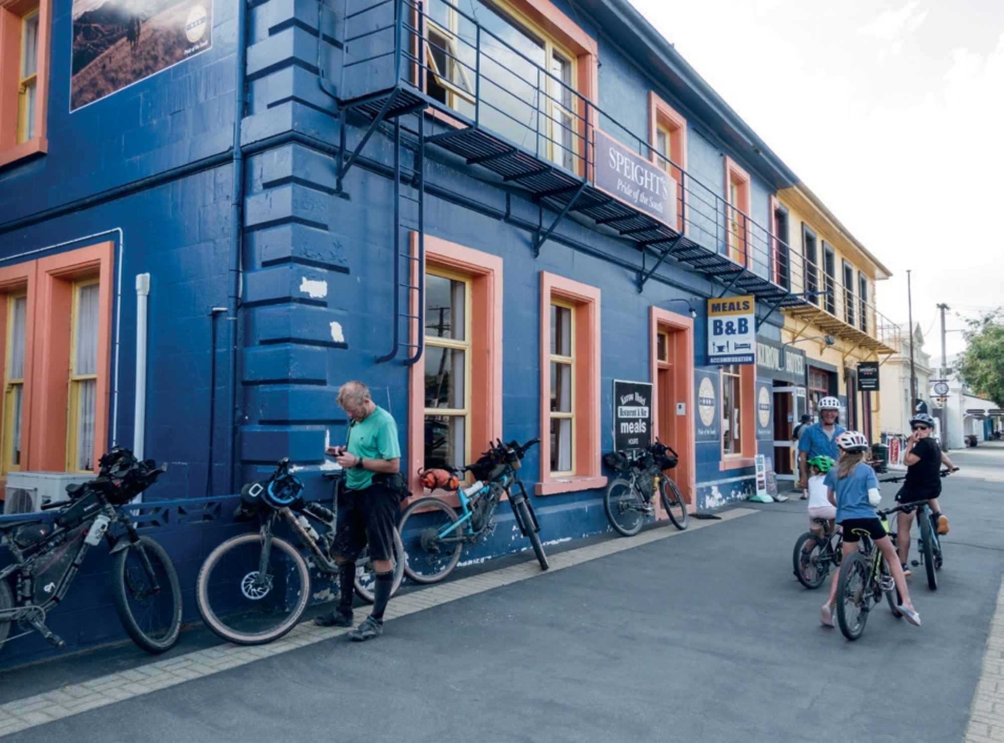
The 4WD descent was epic, probably better with suspension, but epic nonetheless. I was feeling reasonable at the top, but the lack of suspension left me shattered at the bottom. Next stop, the Middlemarch Pub. Yeah, boi! While the locals gave us the nine-yard stare, they were friendly. The new publican even offered me a job. True southern hospitality! Justin and I had been keen to push on. But, after a feed, the exhaustion set in, so we called it quits and stayed at the campsite.
Part 7 – Closing in on retirement
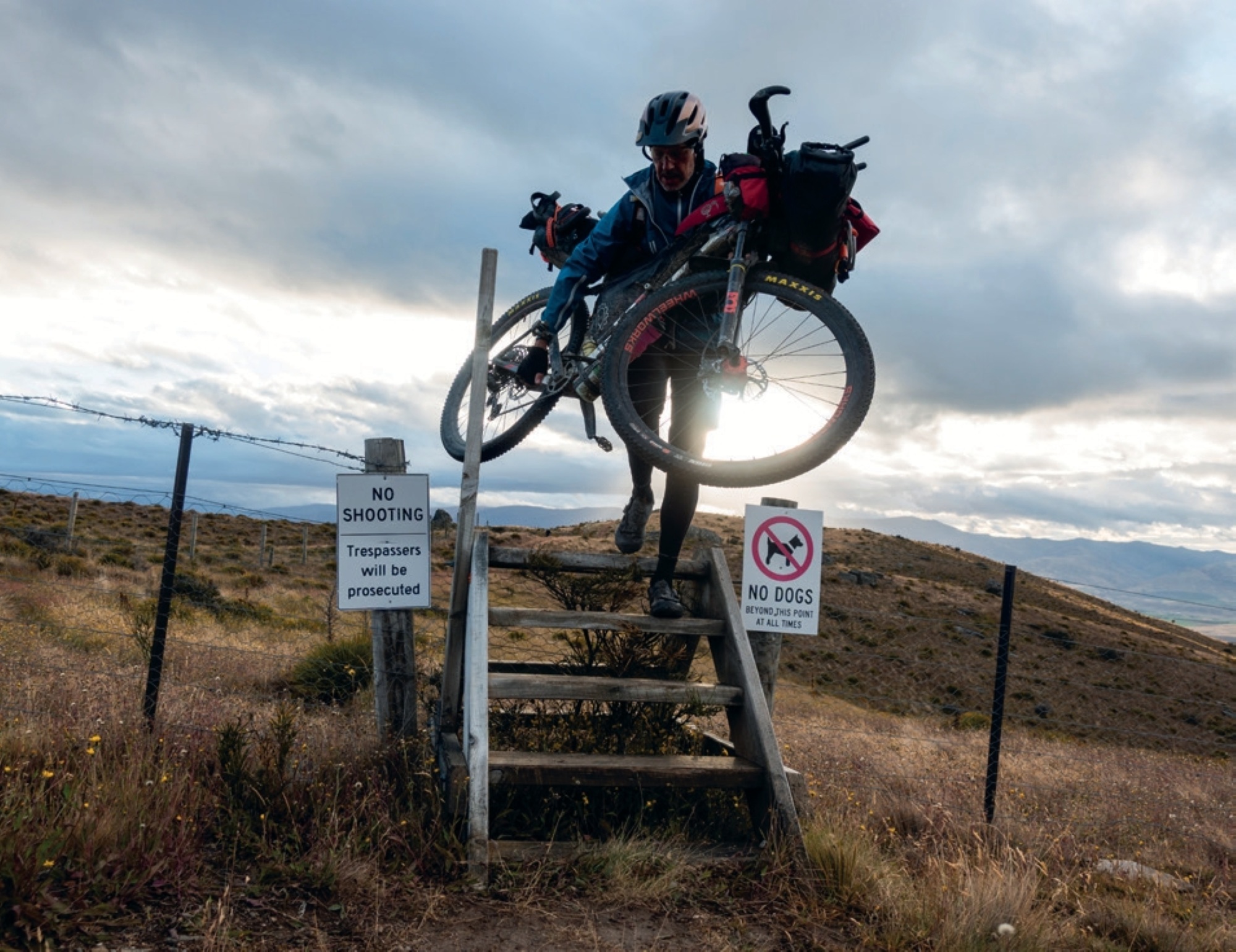
The penultimate day had arrived! At this stage, I just wanted to get it done. In fact, I’d been counting down the days to my retirement, like that’s going to happen! From Middlemarch, we took the gravel roads to Hyde and got treated to some excellent riding on Hartfield Road. From there, we had a short stint on the Rail Trail before detouring at Daisybank. At this stage, you’d be thinking, why are we riding through a farmer’s yard? Luckily, this had come up at the race briefing, so we knew it was coming. The grass track slowly traverses through rolling farmland before joining Hamilton Diggings Road and Orangapai Road. The Hamilton area was named after Captain Hamilton, who, along with two others, took up Run 204, known as Hamilton’s Station. In late 1863, gold was reported and the field initially proved very rich, yielding thousands of ounces of gold. Some 2000 miners first worked the area, peaking at 4000 in 1864. Gold has now been replaced by livestock.
At Waipata, we rejoined the Rail Trail before Ranfurly, where it was time for a feed. Once refuelled, it was time to tackle Dansey’s Pass (935m). After a quick stop at the Dansey’s Pass Pub (sadly closed), we started the gentle climb. Dan joined us for this next leg, and by the time we had dropped just below the pass, there were 10 riders. Leaving the road, we headed through farmland to ride part of the Otekaieke Bridal Track and then farm tracks following the Otekaieke River.
The track has multiple river crossings, most of which are ridable. I was guilty of getting sucked into the mob mentality and pushing myself harder than normal. I was feeling good until I wasn’t. I pushed it too hard on a steep pinch and pulled a muscle in my upper back. Being so close to the finish, I was never going to give up. I downed a few concrete pills, eased off the pace and carried on. That aside, it was great riding, easily the day’s highlight.
After a solid few hours, we joined the gravel road and headed to Kurow. You guessed it, the pub was too hard to resist. It was time for a real feed. And what a feed it was! Justin, Darryl and I loaded enough food for tomorrow’s final push and pedalled into the early evening. After 37km, we set up camp near Cattle Creek. It was never going to be a great sleep without a mat, but it was only one night. And the last night at that!
Part 8 – The ridiculous time trial
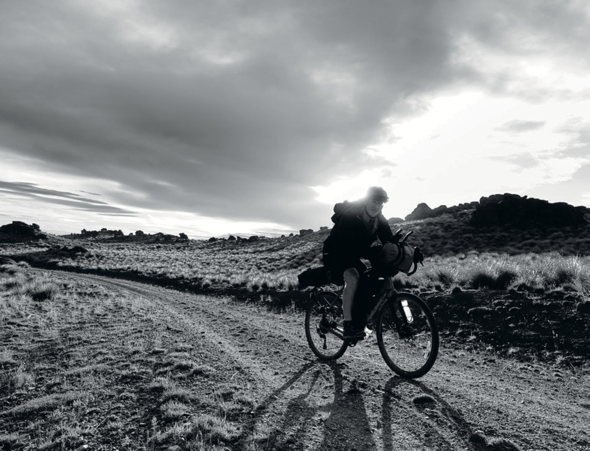
As anticipated, sleep was hard to come by. But that didn’t matter; I chugged a can of my old mate, coffee, for the final push. Darkness was replaced by low fog that cloaked the Hakataremea Valley. With the last climb (yip, it sure was), the cloud lifted, and we were treated to more magnificent views. The Hakataremea Pass road sits at 947m and provides exceptional views of the Mackenzie basin. The descent down to Haldon Road flew by with near-perfect riding conditions. With the finish line so close, I knew we had a chance to break seven days. It was a slim chance, but if we maintained a healthy average speed, then we might scrape in. While I can’t recall the speed, it easily surpassed any average speed over the previous week. The time trial to the finish had begun. We were only racing ourselves; it was bloody ridiculous! Darryl and I took advantage of our aero bars and had turns pulling our three-person peloton to glory.
As the k’s ticked by, our average speed dropped, which was further dented by a slight headwind. If only I’d done interval training! Glory waits for no man, so we dug in, to hell with the wind! The last k’s passed in a blur; Tekapo was within sight. With two minutes to spare, Darryl and I rolled into the Church of the Good Shepherd. It was done. And I was definitely done! We had bloody done it! Matt and Nathan welcomed us in with a celebratory beer. Don’t mind if I do. That 9.30am brew hit the spot.
With over 19,000m of climbing, this was the hardest GSB I’ve done. In a word: brutal. The attrition rate reflects this: 59 of the 182 starters finished the course. And 121 riders completed some or all of the course. While I finished 34th, I was just stoked to finish. Luckily, I had reasonable weather. The front of the pack was subjected to a near-hypothermic storm, winter-like snow conditions and headwinds that made staying on your bike a wrestling match. Chapeau to those who battled through and got the job done.
A big thanks to Matt, Hoog and Dave King… you’re bloody legends! To the landowners who opened their pieces of paradise, you contributed to a unique adventure. And to the locals I met, and the good buggers I rode with, thanks for the great times. Now I’m off to enjoy my retirement… yeah right!