
Words Liam Friary
Images Jake Hood
“Queenstown already has enough trails!” – said no one, ever.
Enter the Coronet Loop Trail – a very welcome addition to the plethora of fantastic trails in and around Queenstown. The iconic southern town provides a home for many forms of riding culture; from gravity and jump to XC, tracks and cycleways, there is something available for everyone to enjoy, from the local shredder to the repeat visitor who heads there every chance they get. And, if you still haven’t experienced the riding in Queenstown, what are you waiting for?! Just be warned: this is the sort of place that will have you returning again and again, as you find more and more trails to ride with every visit.
As for the new Coronet Loop Trail – the Queenstown Trails Trust, in collaboration with Soho Properties, the QEII National Trust and Mahu Whenua, opened it in March 2022, after five years of hard graft and planning. The remoteness of this particular trail only emphasises just what a remarkable feat this collaboration – and the trail building itself – really is. The Queenstown Trails Trust is a charitable trust responsible not only for the planning and development of the Coronet Loop Trail, but more than 200km of trails in the Whakatipu Basin as well.
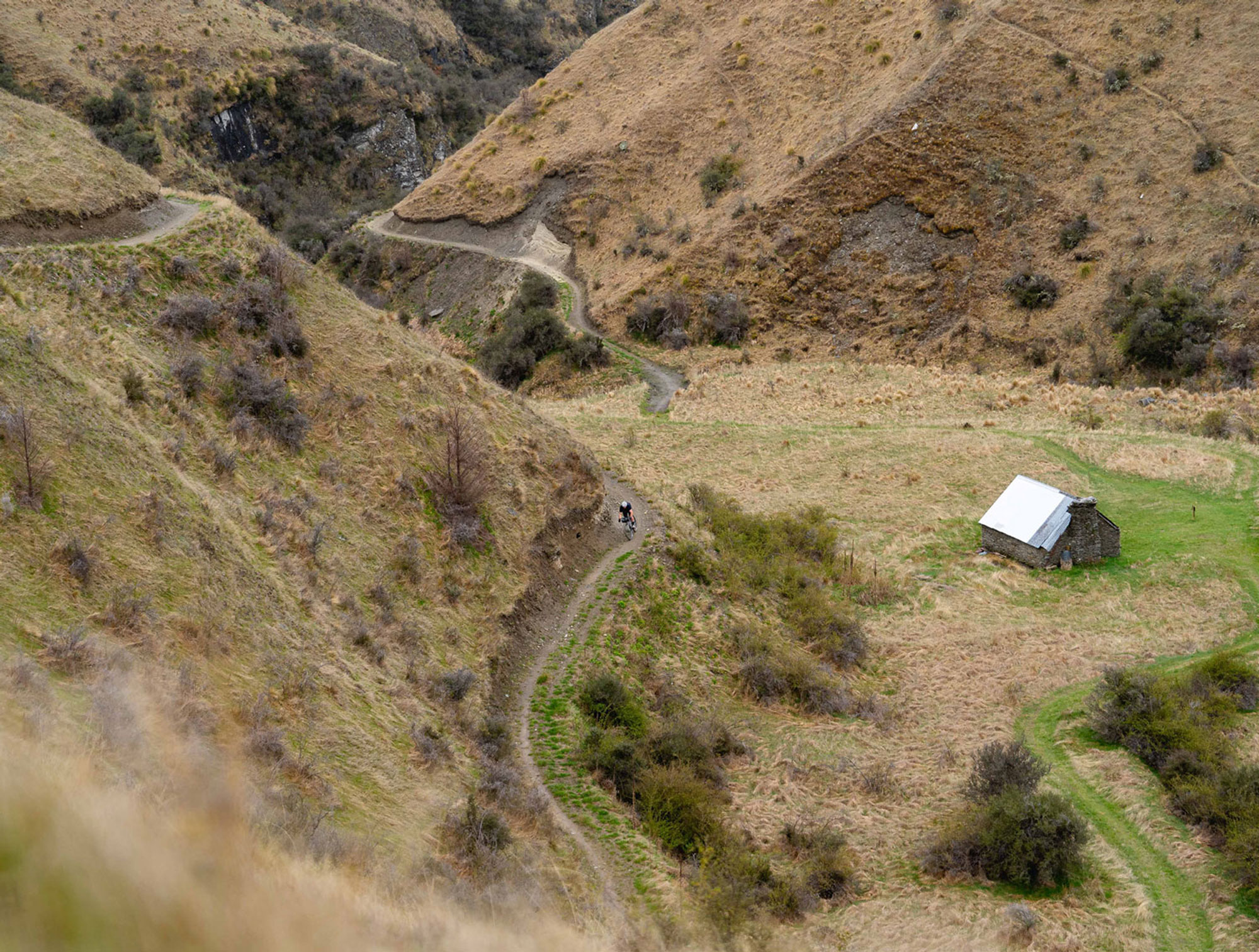
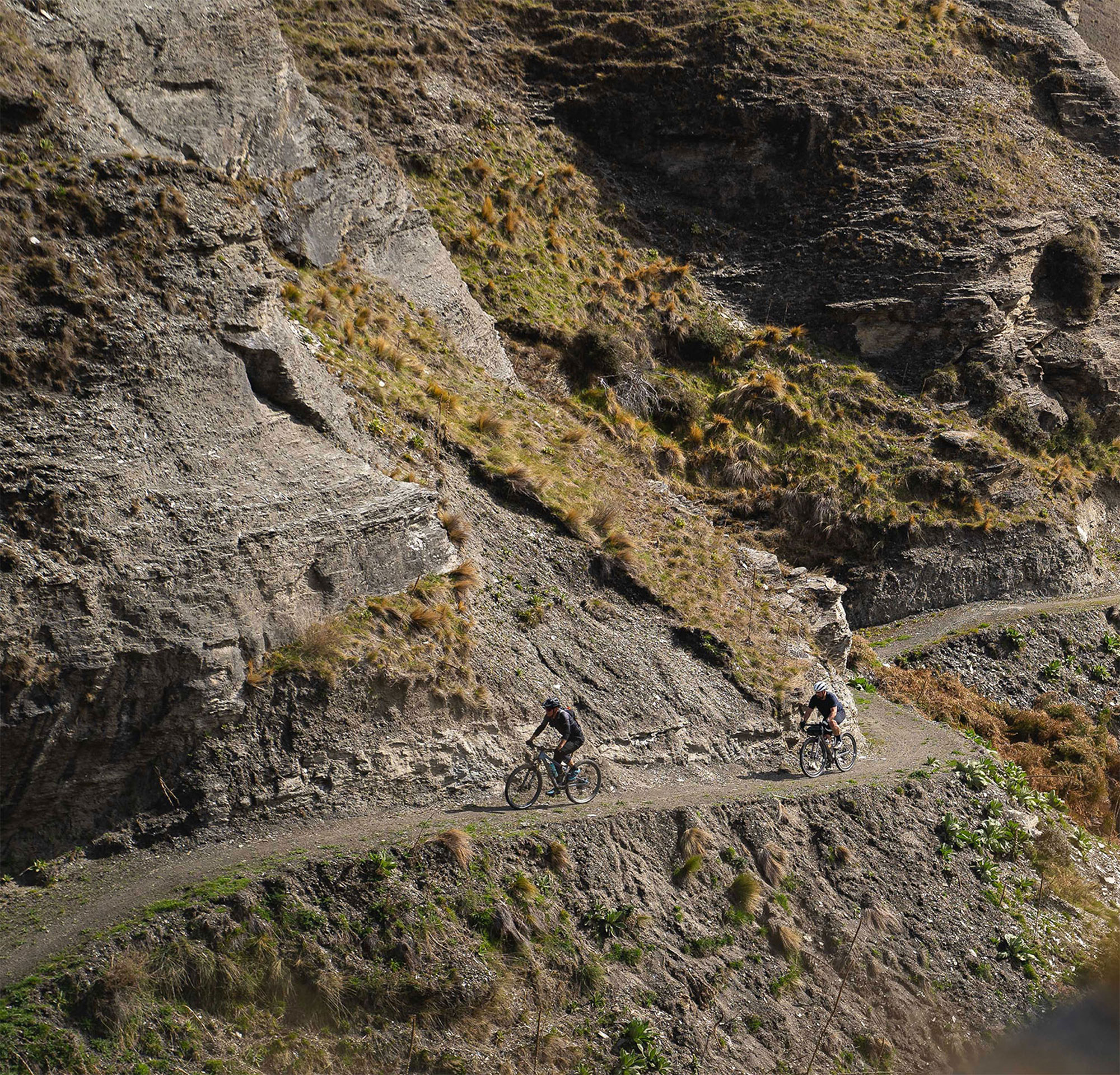
As far as backcountry mountain biking trails go – the Coronet Loop Trail has it all. The singletrack winds its way into the wild, through lush bush and across river gorges, deep in Queenstown’s remote backcountry. All of this, plus the rich history of mining in the area, ensures a non-stop sense of wonder as you make your way around the loop. The 50km trail has been well-crafted by technical trail builders and teams of volunteers, navigating its way around the mountains with gorgeous vistas that are forever changing. In terms of fitness, a moderate level is recommended due to the 1700m elevation gain across the entire loop.
The History
The area was once a hot spot for gold miners, who arrived in the 1860s, seeking their fortune in the Shotover and Arrow Rivers. It was a bleak existence for those who had travelled from far and wide in an attempt to strike it rich, and although 340kg of gold was mined from the Arrow River in 1863, many were unsuccessful in their attempts to find their fortune. The remoteness of the area required some hairy travel techniques just to get to it, making it hard to believe it’s now possible to complete this loop in a single day of enjoyment aboard a modern bicycle.
The Ride
As mentioned, the Coronet Loop Trail is a 50km track, which is graded as an intermediate Grade 3, and takes roughly 4 – 8 hours to complete. It’s considered a more challenging experience than the rest of the Queenstown Trail Great Ride, so it’s worth bearing that in mind before setting out for the day.
All that is to say, if it’s a backcountry adventure you’re after, this is the trail for you. The trail can be ridden in either direction and is a two-way track that is shared with downhill riders and walkers alike. It’s worth noting that there is a more technically challenging section of trail as it climbs up and over into Skippers Canyon, on the Tradesman’s and Pack Track and Sack trails – to bypass this, you’ll need to take the Skippers Pack Track or follow Skippers Road before joining the climb up to Greengate Saddle. Remember this is remote backcountry, so we recommend pre-trail fuelling in Arrowtown before you head out, like we did, carrying plenty of food and hydration, and celebrating your achievement when you return later in the day.
The Experience
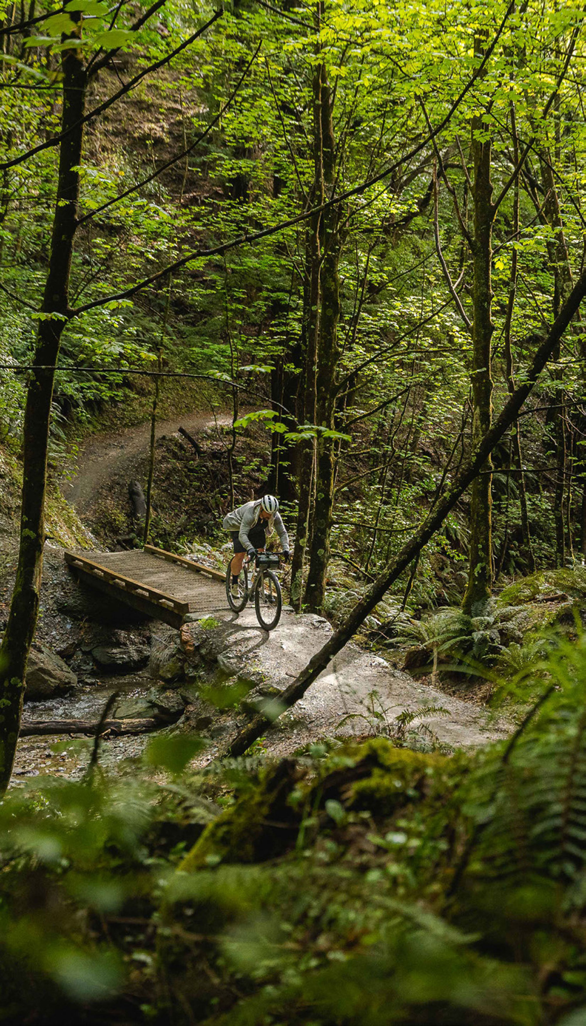
We took our own advice and grabbed a caffeinated brew and a scone before we tackled the loop from the trailhead in Arrowtown. Mark (Willy) Williams, CEO of Queenstown Trails Trust, legendary local rider and mountain bike racer, would be guiding us for this ride and, after our second round of brews, we were ready. I pedalled for a few minutes and, before I knew it, we were buried in the beautiful Bush Creek. The trail follows the creek through native beech forest and, thanks to another recent upgrade, now has several sturdy bridges fording the numerous river crossings. The trail climbs up a series of switchbacks onto the southern face of Coronet Peak. We stopped for a short break to eat a snack, drink water, and take in the splendid scenery before continuing to follow the Coronet Face Water Race. This precarious trail, hugging the side of the mountain, was previously used in the gold rush era to transport water to the Arthur’s Point sluicings, some remnants of the past remain as a reminder of the area’s rich history.
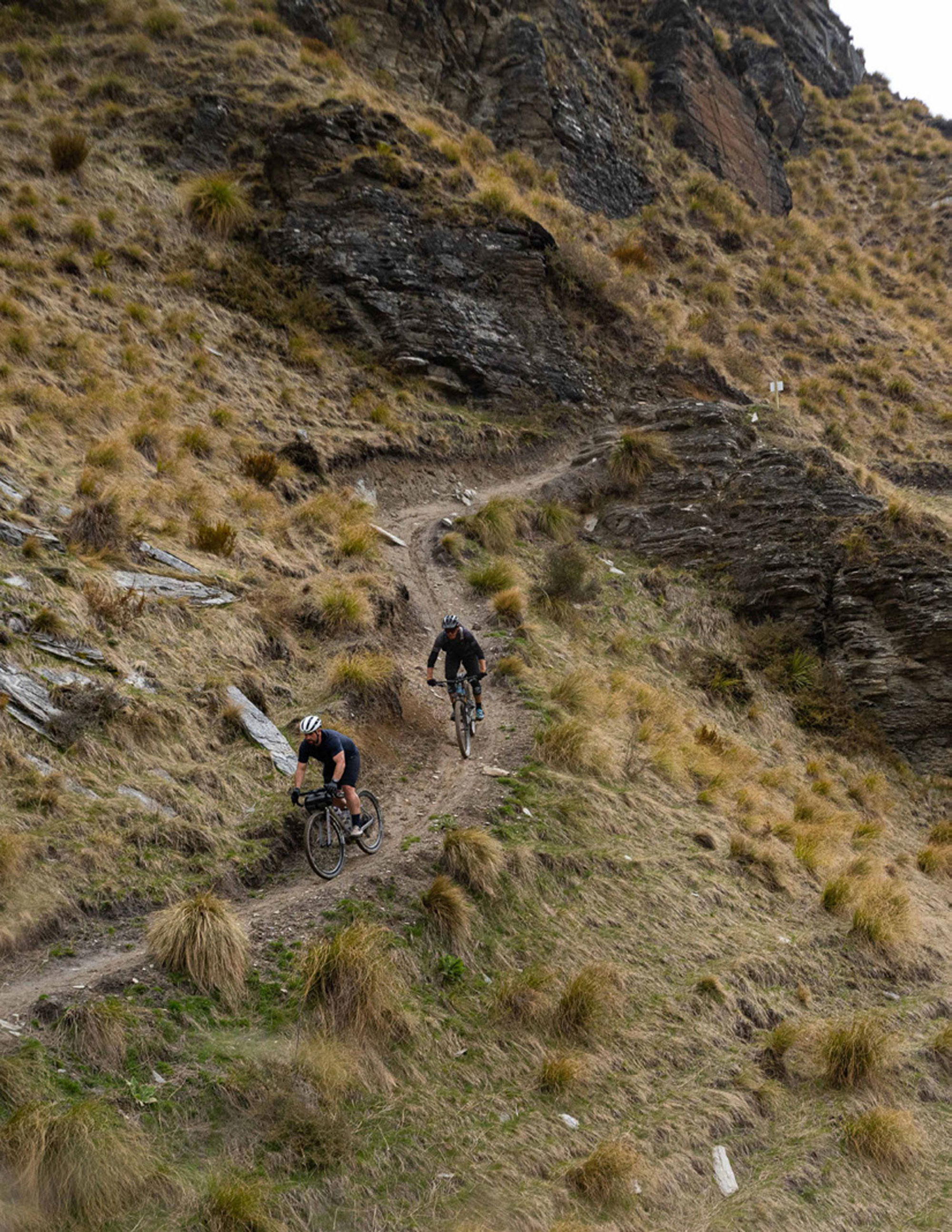
We got around the southern side of Coronet Peak, with Lake Whakatipu glimmering in the distance. I was in awe of the view but didn’t have the breath to say much as we summitted the highest point of Skippers Saddle (949m). I have ventured into Skippers Canyon by bike numerous times and was excited to be back again on the recently renovated Pack Sack and Track trail. The long view down the aptly named Long Gully sees the trail twist and turn out of sight. It’s here that you transition into more backcountry riding and leave the confines of society behind. The trail helps you easily navigate this transition as it twists tightly down the expansive, dusty valley. I descended into the trail, where the rowdiness of riding a gravel bike quickly became evident. I was nearly bucked from my bike at the beginning but managed to stay upright somehow. We transitioned back onto flowy singletrack, which took us down the mountainside, offering endless picturesque views.
The remoteness of this particular trail only emphasises just what a remarkable feat this collaboration – and the trail building itself – really is.
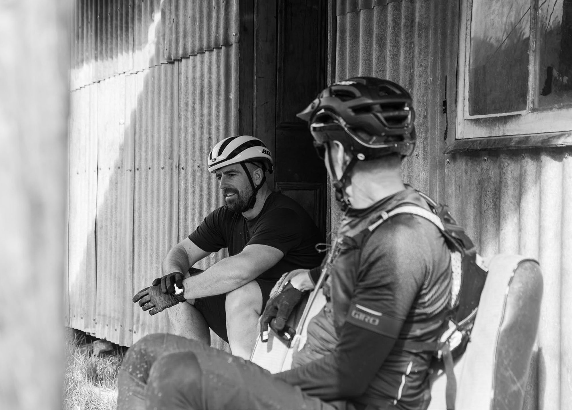
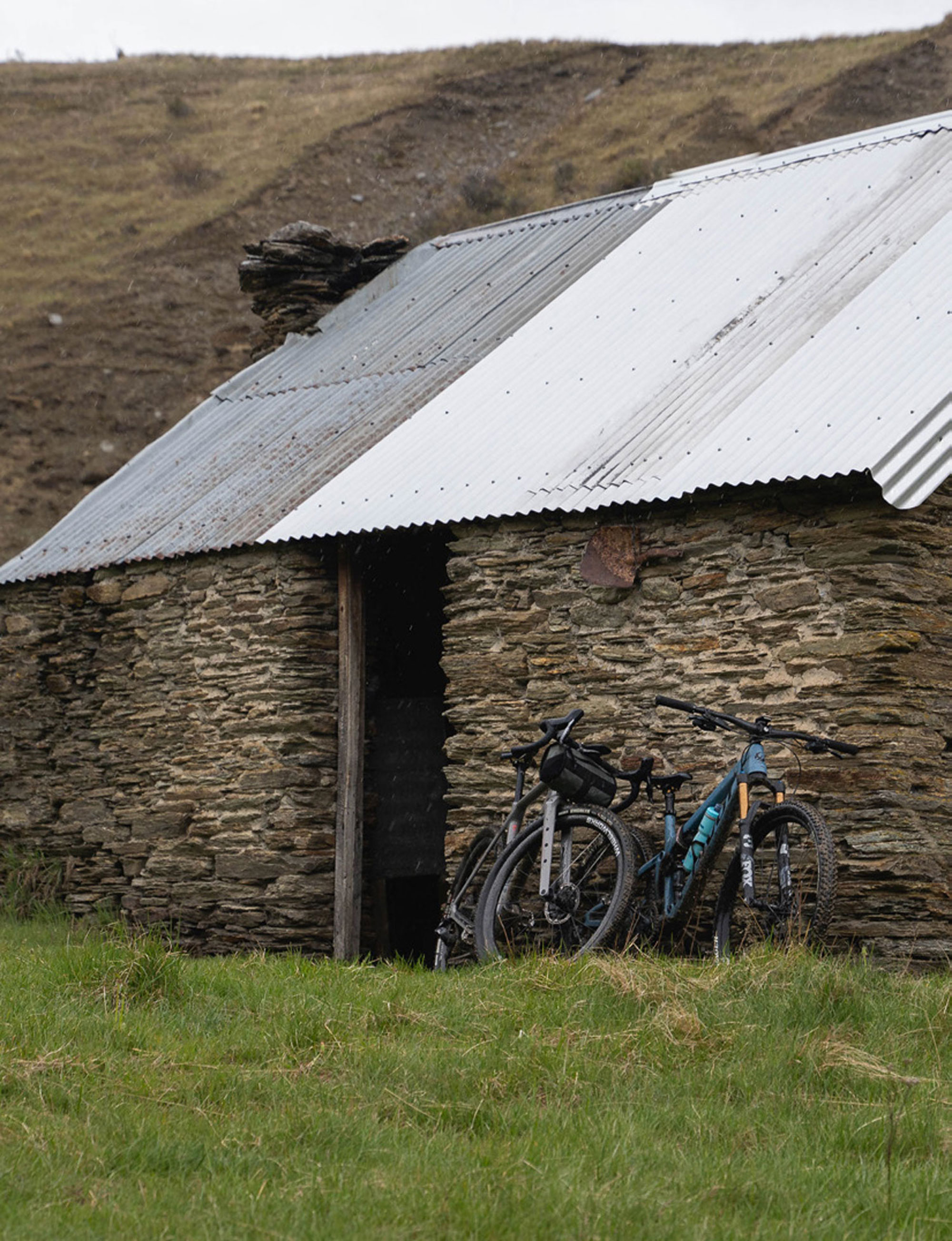
Mentally, I transcended into a flow-state where the worries of the world evaporated as I focused on the physical task at hand: riding the bike. Being out in the wilderness really makes you switch off and helps you to restore; there’s something about being in a remote location that really allows you to shift gears from the blur of everyday life into something more purposeful and intentional. The jaw-dropping scenery helps with that, too. Soon, the situation had returned to climbing and a series of switchbacks up Greengates Saddle. The nuggety climb was worth it, however, as Greengates Hut was down a fun and flowing descent. This was our next snack stop – at the 25km mark, roughly halfway through the trip. Although the day had started out sunny and warm, as we reached the saddle, thick storm clouds gathered momentum and suddenly the lights turned out. Beautiful blonde mountain grasses turned to dark beige. The mountain tops were now completely buried in thick clouds and visibility was heavily reduced. Our rain jackets were quickly pulled around our shoulders as the heavens opened. An intense, but short, rainstorm bucketed down. The historic Greengates Hut provided us with shelter, just as it would have done for many years gone by. Legend has it that the nearby Greengates Hotel, at the confluence with Deep Creek, spent its final years being run as a piggery, serving bacon sandwiches to weary miners heading out to make their fortune. All that remains now, though, is an ageing schist hut with four bunk beds, a few worn pots and an old fireplace. The rain started to clear, so we ventured into the next part of the trail.
Golden mountains, fresh creek crossings and a couple of spectacular waterfalls.
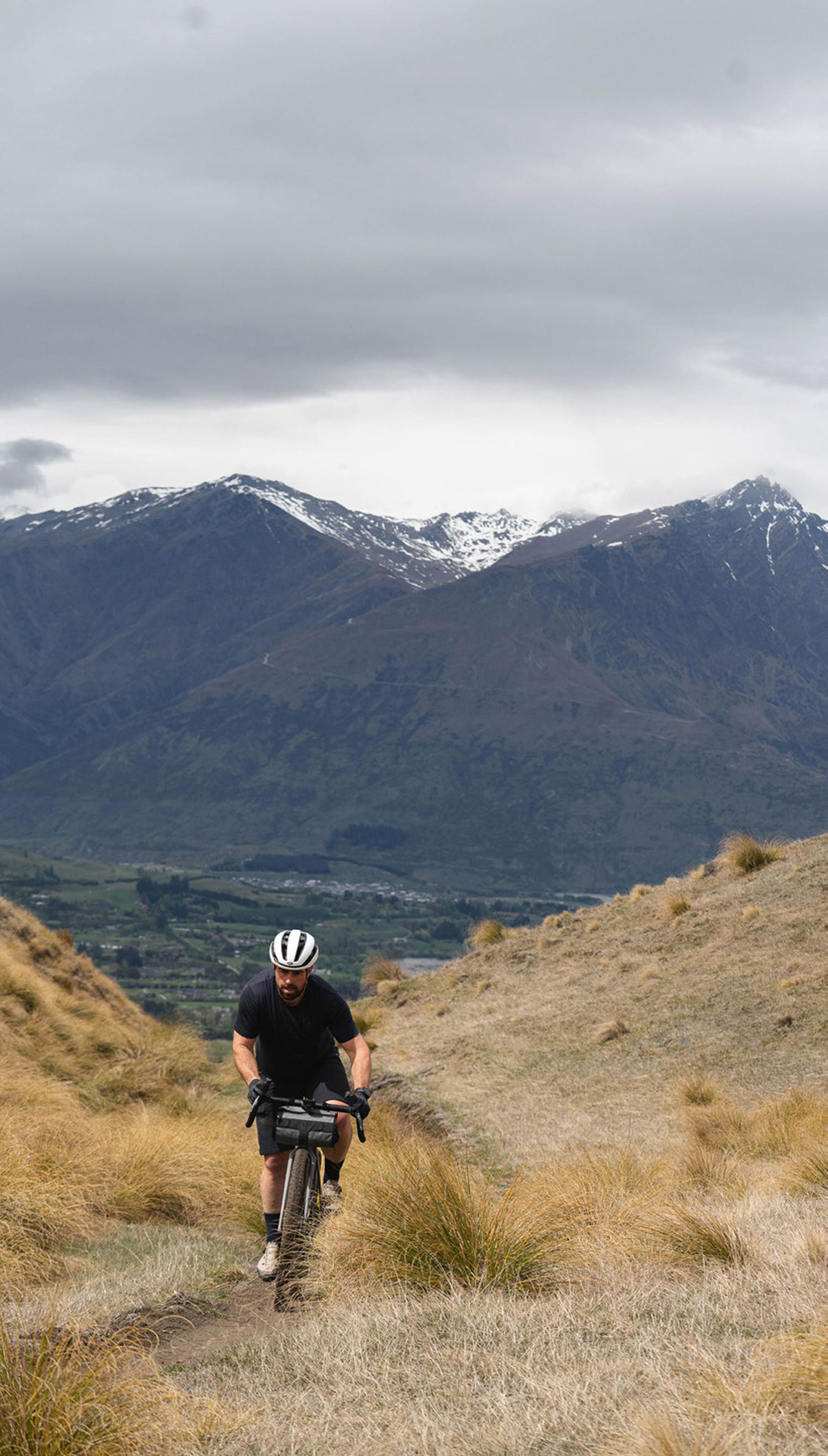
We headed upstream and over the precariously perched Picnic Rock before a bloody fun, long descent towards the valley floor. The remoteness was evident on this part of the trail; it’s an area that until now has been inaccessible – thankfully it’s been opened up for people to enjoy, as the scenes are unreal. Golden mountains, fresh creek crossings and a couple of spectacular waterfalls. The final climb for the day’s excursion awaited us. A dirt track was neatly etched into the landscape, eventually leading us to Eight Mile Hut. The storm clouds passed, and the sun’s afternoon rays defined the mountain’s shadows. It’s here that I felt fatigued but stoked to be out on such an incredible trail. More snack consumption made the last push easier. Before tackling the final section of trail, Willy and I shared tales about our lives to date. I was fascinated to learn how his endurance racing career saw him on podiums at epics such as Pioneer, Cape Epic, Trans Rockies and BC Bike Race – to name a few. Throughout his time at Queenstown Trails Trust, he’s helped develop an incredible network of trails in the Southern Lakes District, with more routes planned to open in the near future.
We continued on and, before long, we merged with the Macetown Road. This is a sandy, double-track, 4×4 road that’s got a ton of creek crossings through the Arrow River and plenty of potholes. You need to be diligent and, as the day takes its toll, that’s not always easy. The road is quite remarkable and it’s astounding that it was built back in 1884. I battled the sandy base – and my gritty drivetrain – down the road. For a more challenging finish to the day, an alternative miner’s track is available, marked with orange DOC triangles. It’s exposed, overgrown and not for the faint-hearted, but it’s there for anyone brave enough to seek it out – not us on this occasion! On reaching the Norman Spencer bridge and a few more signs of civilisation, the trail narrowed, with a few stairs to climb. We again rode through dense bush and past plenty of waterfalls leading us back to Arrowtown. The experience of the day mixed with tiredness and joyfulness, and my gratitude to those who have opened up this part of our country for us all to enjoy.