

Words: Liam Friary
Images: Cameron Mackenzie
There are many places in Aotearoa that are jaw–droppingly stunning. But, when it comes to totally unique landscapes, there’s not many that could rival Central Otago. As the leaves started to fall and the hours of available sunlight shortened, we headed there to explore the region’s trails, tracks, and near on everything in between. The region is littered with a rich history, has a strong sense of pride and is ‘ballsy’ like the fine Pinot Noir that it produces.
It wasn’t hard to rope in my riding partner, Bob Tuxford; I simply mentioned where we’d be heading, and he said ‘yes’ in mere seconds. We packed our saddle bags with gear, stuffed some grub in our frame bags and aimed to connect the region’s trails and barren high country in the space of five days. This time around, we’d stay in digs and not huts, which meant we could pack a little lighter and travel a bit further. This would be a rather large loop, from Alexandra to Alexandra, consisting of over 400 kilometres and over 5000 metres of climbing. It was ambitious, but not unachievable. Just like that, we were off…
Day One –
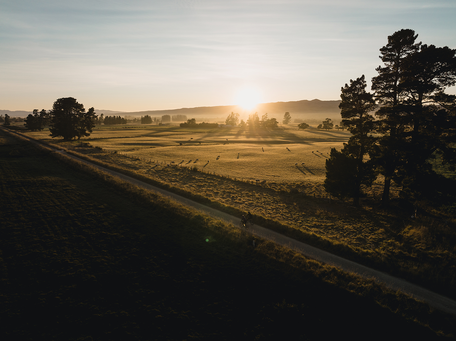
The crisp autumn air was apparent as I stepped onto the porch of our motel room. The sun’s light was just starting to appear on the mountain ranges surrounding the town of Alexandra. A few farmer’s Utes passed by, off for a day’s work. It was a far cry from the ever-present bumper-to-bumper traffic in our major cities and, in many ways, the pace was exactly what we’d come here for. Our day – or rather days – of work weren’t all that different from those working the land; we’d both work our bodies, use all of the available daylight, and finish off the day with an ale.
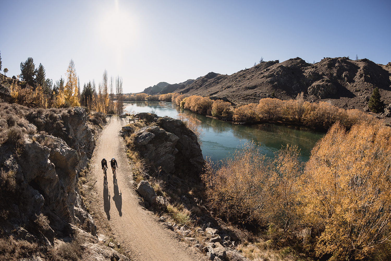
Straight out of the motel and across the Alexandra Bridge, built in 1882, we entered the Roxburgh Gorge trail. Autumn is best witnessed from our mighty southern isle, especially in these parts as the golden colours are so vivid. The leaves were still on the trees and there was a heap on the trail too, which made for a light crunching sound as we rolled over them. It was a rather swift transit to the jet boat which would take us down the Clutha River to the other side of the trail. It should be said that spades are in the ground for the trail extension and, in years to come, there will be no need for the jet boat.
But, in saying that, it does add an ‘adventure’ element to the ride, and we learned a lot about the history on the river, through Laurence the super charismatic boat driver.
History – Roxburgh. The Roxburgh district is believed to have been a camping place for Māori travelling parties in pre-European times. Nathaniel Chalmers, who came down the Clutha River on a mokihi raft in 1853, was probably the first European visitor. Andrew Young and James Woodhouse discovered gold in 1862, at the junction of the Teviot and Clutha Rivers, and mining camps sprang up on both banks of the Clutha, above and below the Teviot junction. Dredging on the Clutha River began in 1862–63 and at the time of the dredging boom (c. 1900), upwards of a dozen dredges were working in the district. During the early 1880s, hydraulic sluicing and elevating were also employed in the Teviot area. Nowadays, the primary activities of the district are sheep farming and fruit growing. Stone, pip, and berry fruits are produced in abundance.
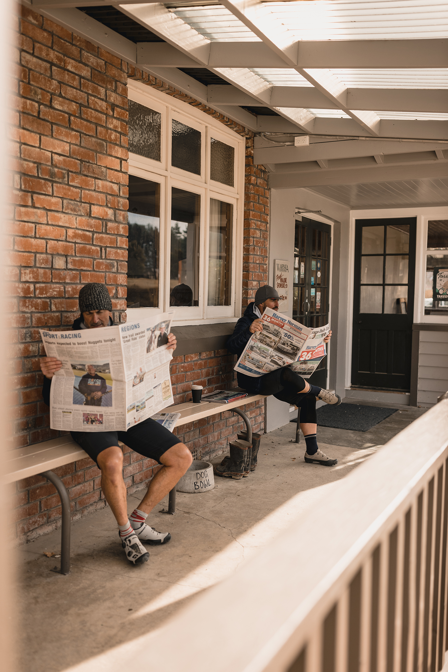
The scenic flow trail continued as we rolled towards Roxburgh. A natural rhythm developed, as we rode along the riverbanks surrounded by tall shadows, dark rocks, moon-like landscapes and deep blue water, all under crystal clear skies. We rolled into Roxburgh for a late lunch which con- sisted of cheese rolls, flat white and cake, of course! A few people rolled around the main street but other than that it was quiet. The trail continued towards our evenings digs in Millers Flat. Something must have been in those cheese rolls as we ramped up the intensity on this part of the trail. It twisted in and out as it danced beside the river’s edge, with the light quickly dwindling behind the mountains. The day’s riding came to an end in Millers Flat, at Ormaglade Cabins – which was pleasantly just off the trail without much around. A sip of whisky to toast the day, followed by a hot outdoor bath, went down rather well.
Day Two –
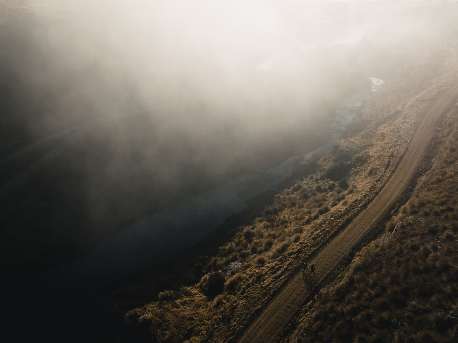
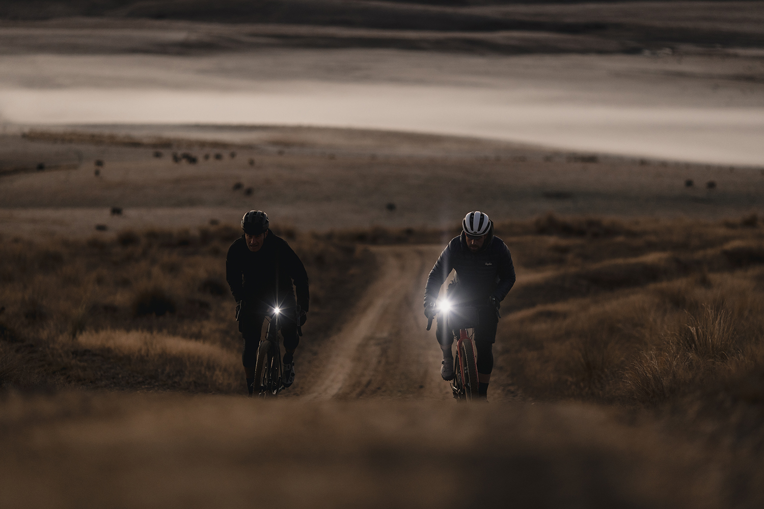
After doing some earlier research, I marked a few ‘off the beaten track’ places to venture out to, if we felt inclined. So, over a beer the previous night, we decided to head out to Lake Onslow before sunrise. It would be a return trip – and it wasn’t for the faint hearted, with quite a climb up; plus, we’d be on the bikes just after five in the morning and it would mostly be on dirt roads. Despite this, we wrapped up and headed off in the darkness. It was eerie, with the mist hanging in the basin, and just the sound of our tyres rolling over the unsealed roads. As we climbed, descended and climbed some more, we started to see the faint light of a new day, way in the distance. Then, suddenly, the early morning mist burned off and the sunrise cast a new colour palette across the mountain ranges. It was like watching a painting come to life. In the light, the vastness and sheer remoteness of the land became evident. At the top, a deluxe dirt road traversed the tops of the ranges as Lake Onslow appeared, shrouded in low clouds.
Lake Onslow – Over the last century, the Teviot River has been dammed and the water used for mining operations, irrigation and the production of hydroelectricity. Lake Onslow, at the head of the river, was created in 1890 by damming an area of land called the Dismal Swamp. The sharing of the water storage in Lake Onslow has been a feature of water resource use on the Teviot River. A new Lake Onslow arch dam, constructed in 1982, raised the level of the lake by five metres and drowned the original dam. The water to power the five Teviot River stations flows from Lake Onslow.
This was worth the early morning effort (as it nearly always is) and before long we headed back for a late breakfast. The midday mark had just passed and soon we were back on the bikes and headed onto the Clutha trail, travel- ling to Lawrence for the evening. The rhythm of the flow trail continued and was well suited to our gravel rigs. At times, we perhaps rode at too quick a pace, and scuffed a few corners or skidded, but that shows just how fun it was. The remote and beautiful Beaumont Gorge hugged the river and made us feel like we were completely removed from ‘real life’.

Day Three –
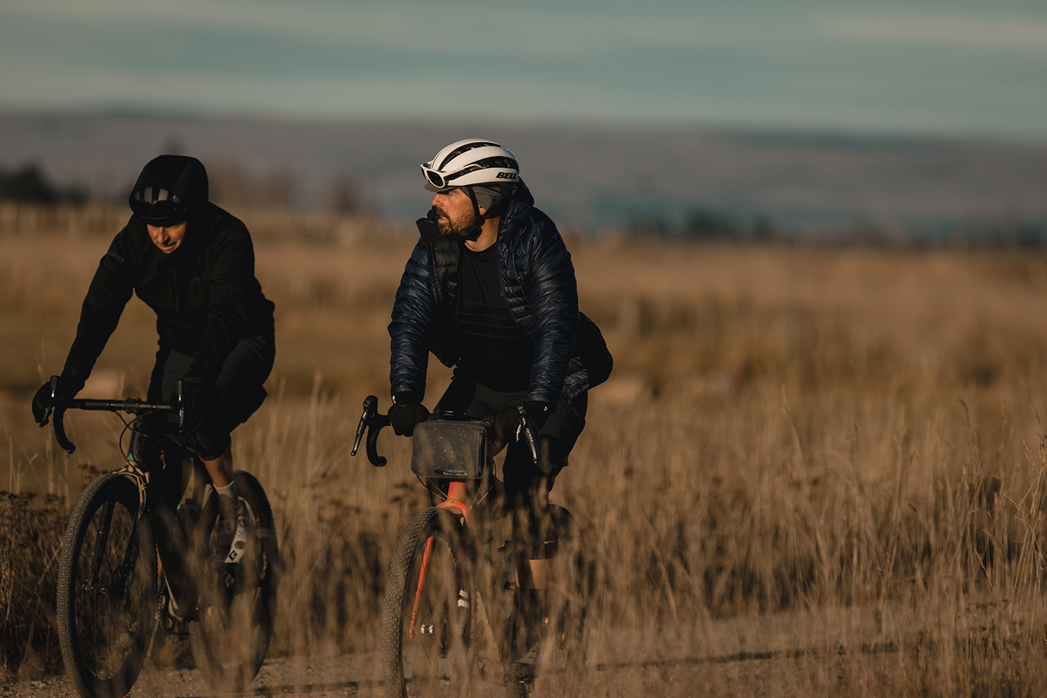
This was the point at which I took a gulp of anticipation when I was originally scouting the route. But quicker than I’d thought possible, we were here, ready to embark on this long–range transfer across to Middlemarch. As we ventured out of Lawrence – which honestly took less than a minute – it was just above two degrees. It was bloody cold in the valley, and we had to throw on the down jackets. Just a few clicks from town, we encountered gravel roads, steep climbs, undulations, and washboard gravel. The tough gravel surface, along with the climbs, were damn relentless – but the riding did keep us warm. The landscapes made up for the suffering, with vast pastures surrounding us and bugger all traffic!
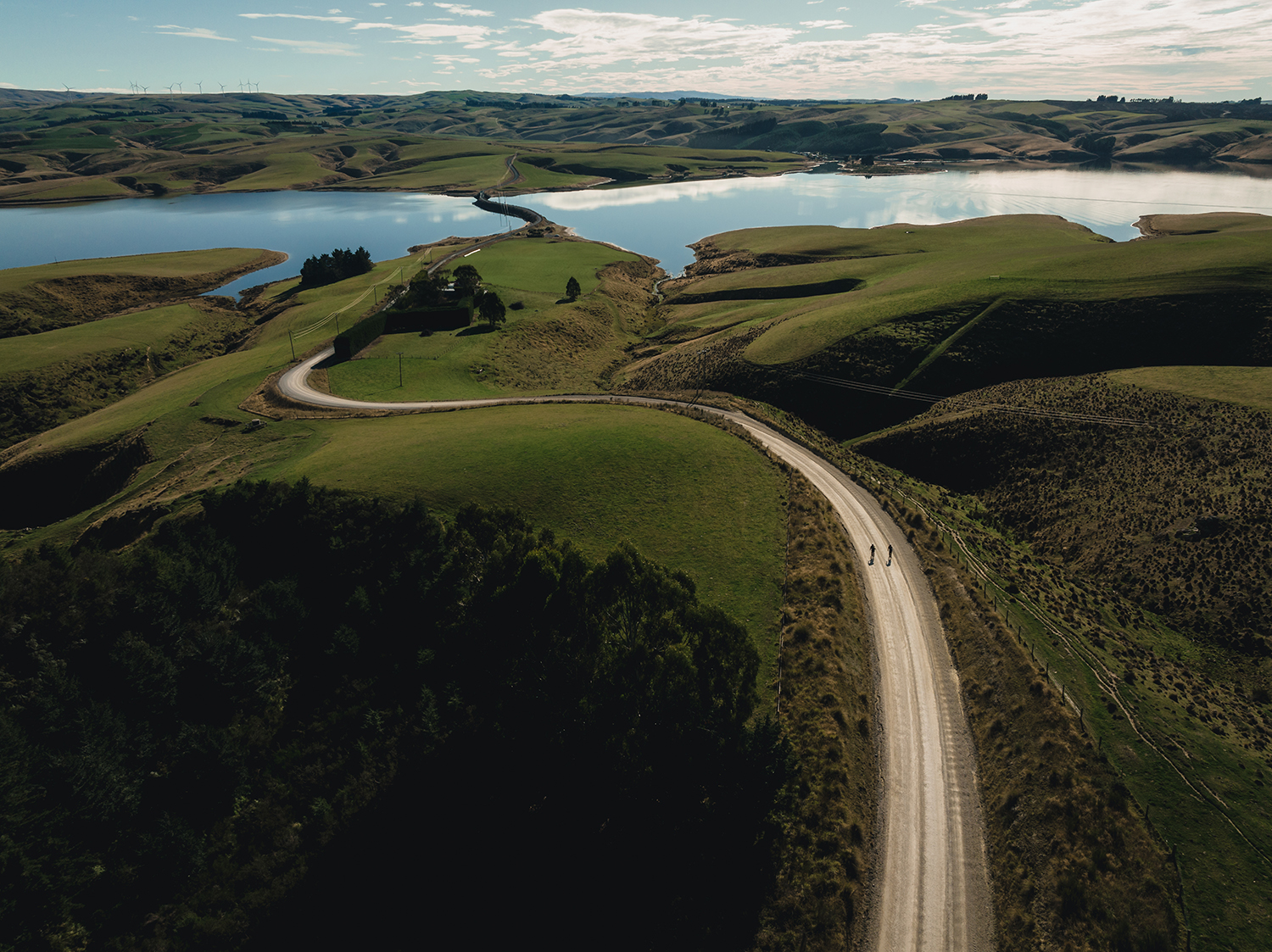
Lake Mahinerangi – This remote reservoir is stocked with perch and brown trout, making it a favourite fishing spot for keen fishermen. This ‘lost lake’ came about due to a dam on the Waipori River, used to generate hydroelectricity. The lake is 12km in length, and sits over 600 metres above sea level. Waipori district was once a thriving goldmining area. Today, it lies beneath the waters of Lake Mahinerangi. When the lake is low, the tops of dead trees which once sur- rounded the township, are the only evidence that it ever existed, along with the cemetery on the hill, which is still used for burials by local people.
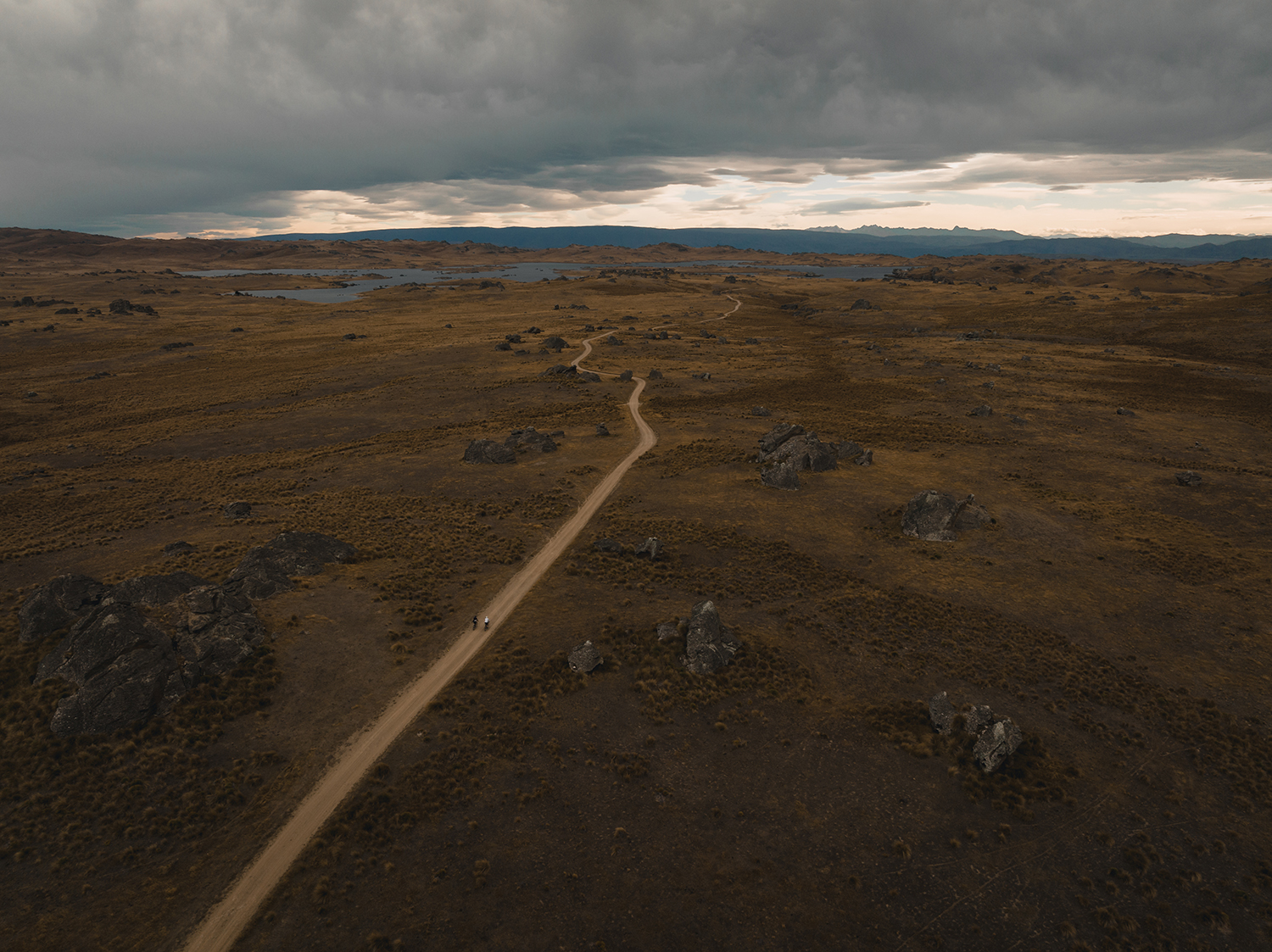
Entering the high country was next on the menu, however, it wasn’t just one ascent – it was more like steps! So, we went up, down and then up again. But, as we climbed towards the heavens, it got more remote, and the wind started to absolutely howl. Unfortunately, the gusty weather wasn’t in our favour, as it was a headwind! The lack of civilization, sur- rounding mountains and endless horizons made me feel virtually insignificant. It was like entering another world as we got further and higher.
But the starkness wasn’t so stark if you looked a little closer; the landscape is simply unreal and makes you appreciate just being out there. Even with the wind, the brilliant baron land was full of texture: little rocky outcrops, harsh (but splendid) dirt roads, reservoirs, and brown tussock under vast blue skies. I like that the mind starts to wander a little when you venture into these places, and the time, day, date, and even week, starts to become irrelevant. You can just get totally lost in the moment when the focus point is just an inch in front of your tyre.
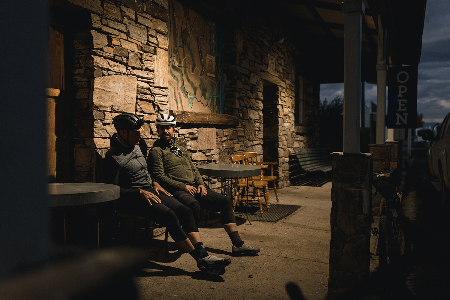
The day’s large ‘transfer’ was a rowdy descent into Middlemarch. For such a small town it felt quite big after the country we’d just traversed. The day’s tool had us feeling shattered, so we scrubbed up in our digs and headed to the local watering hole around the corner. The Strath Taieri Hotel is a real bar, with an old-school saloon front. The grub was good, as were the ales and the banter in the front bar, but it wasn’t too long before we had to collapse onto our beds.
Day Four –
We needed an easier day after the previous day’s relentless affairs. I’d studied the terrain and mapped out the route previously, with the intention of linking as many Great Rides together as possible, so we couldn’t not include the Otago Central Rail Trail.
Otago Rail Trail – The gold rush had already started waning when residents of Dunedin, then New Zealand’s richest town, started lobbying for a railway through to Central Otago, in 1871. It took hundreds of men fifteen years, from 1891, to build the 150km track from Middlemarch to Clyde. They used picks, shovels, wheelbarrows and explosives. Stones were hauled in by sledge, sand for mortar was carted in by pack horses. For many years, the line stretching from Cromwell to Dunedin carried a steady stream of freight and people. Then cars became faster and more common and, in 1984, New Zealand Railways’ government-imposed monopoly on freight was removed.
In the 90’s it took seven years for the conversion from dis- used rail line to New Zealand’s first and longest rail trail. New decks and handrails were installed on all of the trail’s 68 bridges. All the sleepers, rails and crushed rock ballast were removed. The Otago Central Rail Trail, opened in February 2000, was New Zealand’s first. The Department of Conservation bought the line in 1993, three years after the last train. It took six years and over $850,000 to convert the trail for cyclists, horse riders and walkers.
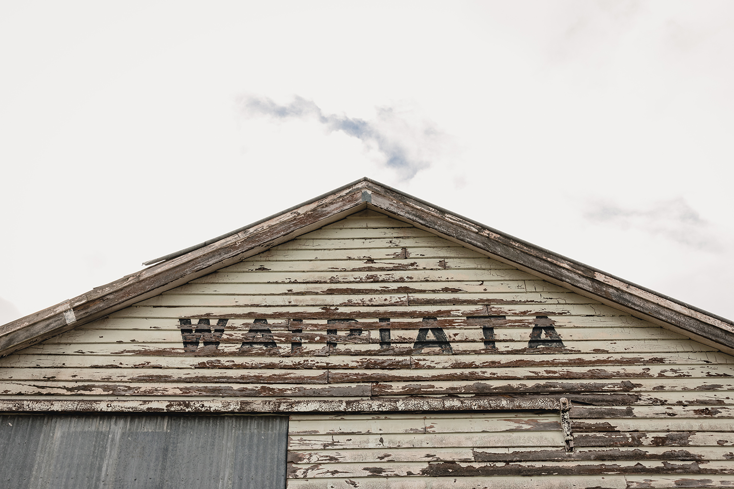
So, from Middlemarch, we’d head to Waipiata, which was one of the easiest days on this loop. Darkness lingered around our cabin at Middlemarch Holiday Park, as I struggled to pull the duvet back and get out of bed. I eventually crawled out, flicked on the kettle, and quickly threw some clothes on. It wasn’t long before we were on the Otago Rail Trail, digesting our porridge amid the early morning mist. The open, flat trail tucked between the mountains in the valley, and made a nice ‘rest day’ for the legs. It was a short ride on paper, but we decided to ride early and get to Waipiata for a late lunch. We’d heard great things about this country pub and its famous pies! Yarns, tunnels, viaducts, and historic places passed the time on the trail. It was quite enjoyable and allowed for a solid pace which ramped up towards the end as pies and beers were front of mind.
Day Five –
It felt like an eternity, but we would be returning to civilization on our final day of our journey. I mean civilization in the respect of more than a few streetlights and a population greater than 1000. It was a mere 500 metres before we’d left the small streets of the village. Within moments I longed for it. Waipiata is worth the detour off the map and delivers a good authentic country experience. I’ll certainly be back, and the connection with this small community and their fine hospitality is now etched into my memory.
The edges of the mountains were only faintly visible under the dark dawn sky as we pedaled towards them. This was the second biggest day, on paper, and it emulated day three’s expedition. In similar fashion to that day, we’d need to traverse the high country once again. As we rode further into the country, we could hear the deep echo of gunfire coming from the duck hunter’s maimais. We pedaled towards the mountain range and, with the Māniatoto Plain lingering behind us, we’d climb over this range to reach the outskirts of Alexandra. It wasn’t long before our bodies started to heat up under our multiple layers but, surprisingly, the legs felt great. Perhaps there was strength coming through from days in the saddle, or the protein from the previous night’s steak, or the two sleeps, or the recovery drinks (beers) – whatever it was, I’d take it!
Poolburn Reservoir – Also known as Poolburn Dam, this reservoir in Central Otago was built during the Great Depression, for irrigation but also as an employment initiative: the water is used by farmers in the Ida Valley. Brown and rainbow trout were introduced into the reservoir, but only brown trout remain. However, freshwater crayfish, or koura, is on offer too. The Poolburn Reservoir was used to depict Rohan in The Lord of the Rings film trilogy.
The dam was something to behold, and the shacks lining the shores of the reservoir were nothing special but everything you’d need up here in the wilderness. Corrugated iron lined the rooves, and tiny toilet shelters were buried amid the arid rocky land with the mountains silhouetted in the background. I couldn’t imagine a better place to spend a few days escaping life’s endless churn. I suppose we were a long way from that churn too, as we were deep in our world of riding from point to point, just going with the flow. That’s the simplicity of being immersed out here – it clears away the stresses of daily life.
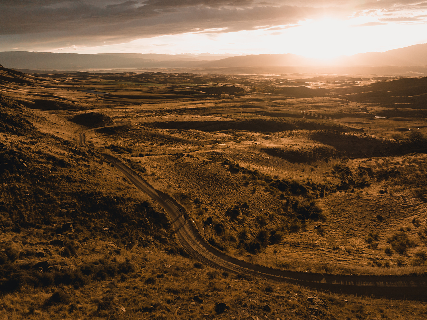
The wind howled…. and howled some more. We parked up for a spot of lunch under some rocks. Following that, was an epic descent on seemingly endless gravel lanes. The sun started to set as we plummeted down to Alexandra, and the mountains in the background and basin below shone in a warm glow of orange. Under fatigue, but still flogging each other, we were trying to drain the tank completely. It’s often moments like these – when you are under a cloud of adrenaline and endorphins, feeling tired but not broken – there’s always a bit more you can give. We kept swapping turns at the front, as we pushed into the last of the light towards town. The taste of pizza and, more importantly, beer must have given us the extra oomph we needed.
As darkness shrouded us, we crossed back onto the Otago Central Rail Trail. With just a few clicks down the trail, we’d be back in Alexandra. As we pushed on down the path, small light pockets escaped through the almost–dark skies, lighting up the rock around us. This is a totally unique landscape, and a sense of euphoria came over me as we edged closer to town. Perhaps it was because we’d be leaving this behind, or the sense of accomplishment, or the sheer gratitude for being immersed in these incredible surroundings for days on end. The epic journey concluded at the Ferris Road Brewery, with many beers and pizzas. It was hard to even fathom what we had just witnessed, or explain the areas we had traversed. My skin felt warm, as if it had retained a glow from this golden land.
Without a doubt, this Otago loop offered up some of the best trails, gravel roads and tracks we’ve encountered to date. It’s not just the isolation or the unique landscape that make it so special but the people and the determined souls within it, making something of this harsh environment. I’m not done exploring this region yet and, after being there for five days, I think I’ll need five weeks next time, to uncover some more gems. One comment that stood out in the final descent, was from Bob: “This is by far one of my top three rides ever ridden,” he said, whilst grinning from ear to ear after giving me a fist pump. Now, without revealing his age, this guy has been around the racing traps of yesteryear and has traveled the globe with his bike in tow, so that’s really saying something.
For more information head to www.centralotagonz.com