
Words by Lester Perry
Images by Brennan Thomas
NZ’s a special place and, as someone who was born here, it’s easy to become blasé, take what we have for granted, and feel that you’ve seen it all. There’s no doubt that some riding trips can open your eyes, leave an indelible mark, and etch memories into our minds forever. It’s never just the ride; it’s the scenery, the smells, the weather and, even more so, the people.
What did I know about Gisborne and the East Coast region? Not much, other than it being the first place in the world to see the sun each day, and that a trip there offers a glance back at the way things used to be in NZ. For these reasons alone, I jumped at the offer to come for a visit when contacted by Tourism Tairāwhiti.
As it transpired, an old riding buddy of mine, Haimona Ngata, relocated to Gisborne a few years back after moving away to the big smoke of Auckland. ‘H’, as he’s affectionately known, spent years riding freestyle BMX but, like many with his background approaching mid-life, injuries mean he now spends increasing amounts of time on gravel and road bikes, exploring the Tairāwhiti Gisborne area. Knowing how much good riding is easily accessible from Gisborne central, and knowing the region would be attractive for those seeking adventure in a place not on the typical cycle tourist itinerary, H put together a route and pitched an idea to Tourism Tairāwhiti with the aim to attract new riders to the region, particularly our cousins over the ditch in Australia. That’s where the next piece of our ‘Ride 35’ puzzle came from; Lancefield in Victoria, Australia.
Growing up in Melbourne, Mitch Docker spent 15 years racing professionally, mostly in the World Tour, based in Girona, Spain. Since retiring in 2021, Mitch splits his time between his ‘Life in the Peloton’ (LITP) podcast project and its various commitments, commentating on many World Tour races, and being a dad to his three young kids. Initially a conversation between himself and fellow pro, Luke Durbridge, Mitch launched LITP in 2016, offering listeners an insider’s view of the pro peloton. Eight years on, LITP has grown to become more than just a podcast, but a roof for Mitch to house a multitude of projects under. This is where he enters our ‘Ride 35’ story. Through a series of unsolicited Instagram messages, H managed to twist Mitch’s arm into joining this mission with us, to discover a part of NZ he knew nothing about, with people he didn’t know. From my limited time with him, there certainly seems to be an element of “jump in feet first and let the details figure themselves out” to Mitch; it’s an attitude that aligns perfectly not only with the region we rode, but the crew we rode with and the side quests along our journey.
Day 1
GISBORNE – MOTU
125km
1,365m elevation gain
5:32:42 moving time
Day one, let’s crack into it! In an attempt to see the famous Gizzy sunrise, I was up at sparrow’s fart. Unfortunately, cloudy skies meant no Jesus-rays for me so, instead, I settled for a gentle roll down the coast from Wainui Beach. The place was alive already; surfers cruised around looking for prime peelers, joggers jogged, and dog walkers poop- scooped. A nice, gentle way to begin not only my day, but the first day of our ‘Ride 35’ trip. Lungs filled with the sea breeze, I punched the pedals back to my accommodation to finish loading my bike bags and get the mission going. I was ready. But first, coffee!
As we gathered at a central Gisborne cafe to discuss our plans and fuel up to roll out, a group of cross-country motorbike riders rolled in. Equally inquisitive about what each other were up to, we discovered they’d just finished a route similar to ours. They marvelled at our lightweight setups and lack of engines!
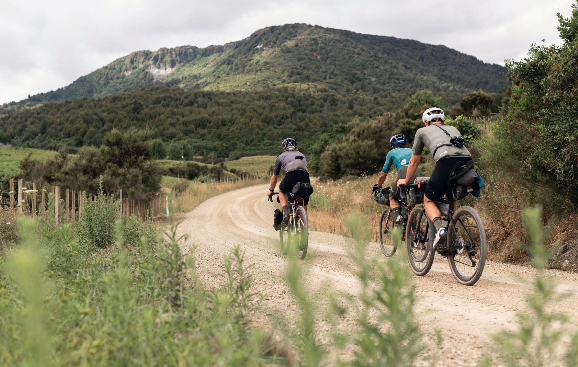
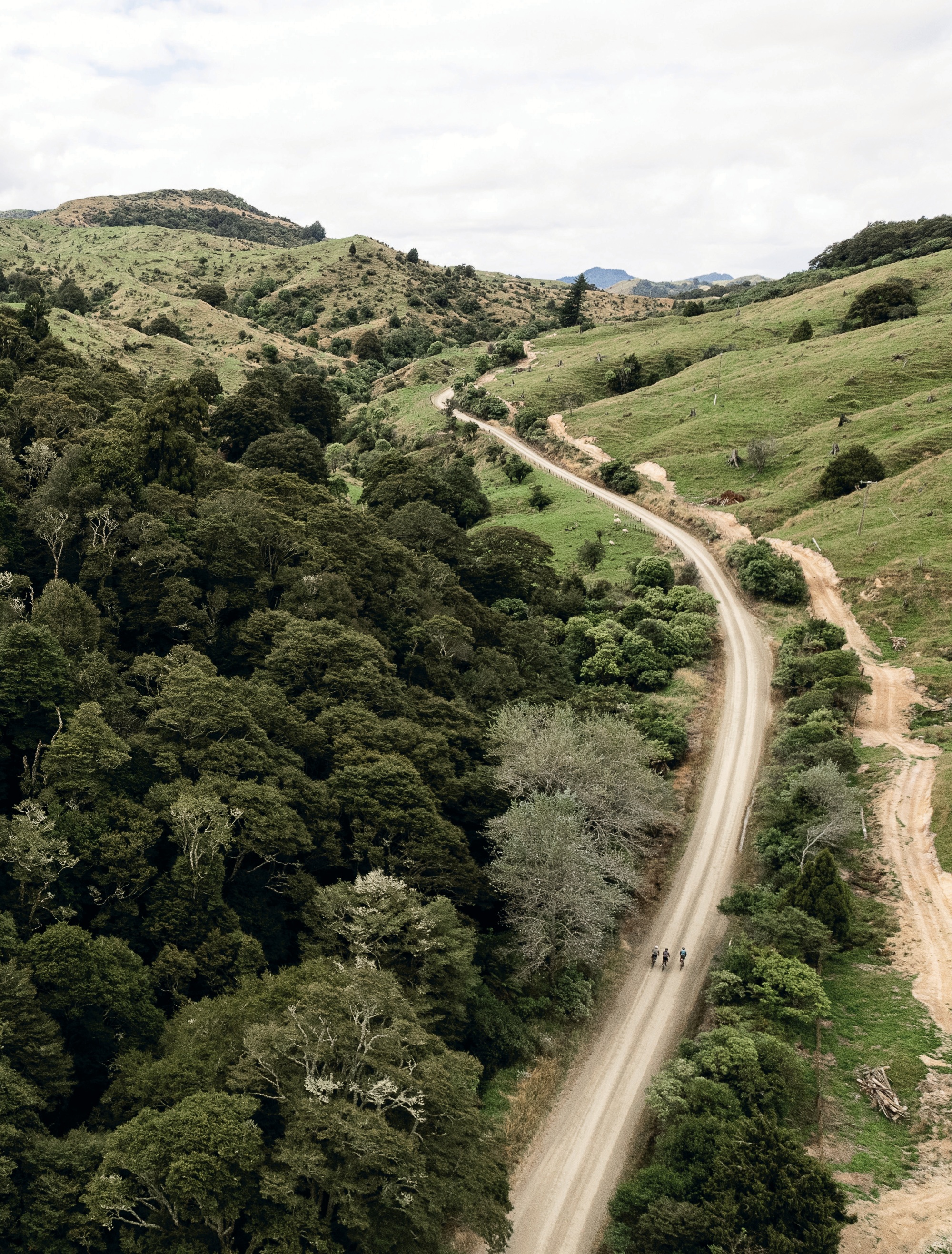
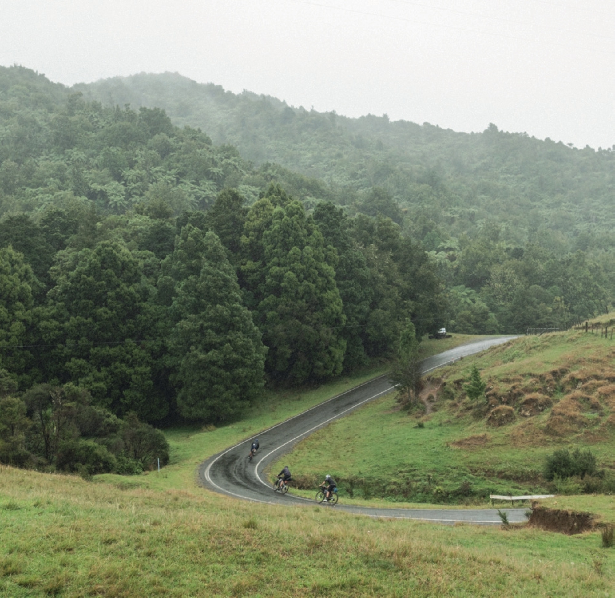
Fuel in the belly, we were off. Rolling out of town, we headed due south past the Poverty Bay Golf Course, and onto Centennial Marine Drive, which promptly hugged the coastline and eventually turned to gravel, giving us our first taste of “Gizzy Grav”. Rounding the headland, we exchanged waves with fishermen trying their luck at the Waipaoa river mouth as we hooked right along the stop banks cycle trail and began to head north.
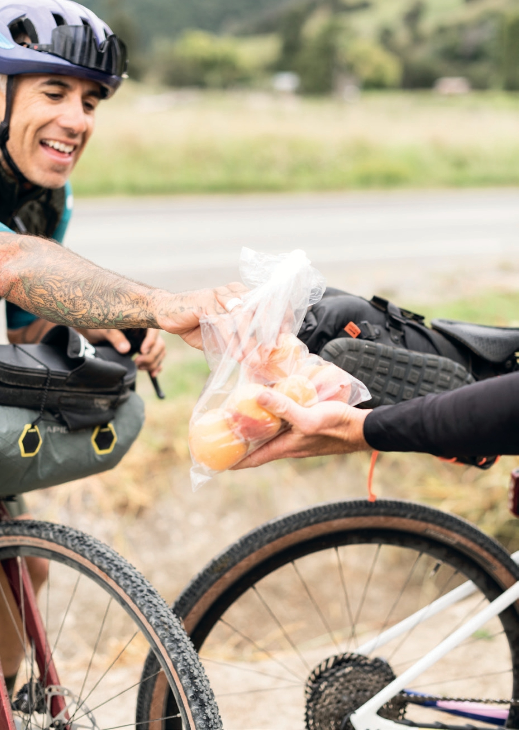
Forty kilometres into our ride, we came across a roadside produce stall—complete with a hand- painted sign, shade umbrella, fresh flowers and a floral table cloth. Such was the detail and contrast to the surrounding farm lands, it looked like the whole setup was staged for our photographer. One bite into the fresh nectarines, though, and we knew this was the real deal; the juice stains on our shirts proved it. Immediately after the snack stop, the flat lands of the coastal paddocks gave way to rolling hills, and the beginning of 80 kilometres or so of mainly climbing.
We continued on towards our next stop, the Eastwoodhill Arboretum. I wasn’t sure what to expect from this place. All I knew was that we were to have lunch there, there were a lot of trees, and it was a park of some importance. As we rolled through the entrance, it was evident this was a special place. Home to over 25,000 species of tree, shrub and climber plants this is a real Garden of Eden. The story of how Eastwoodhill came to be is an interesting and somewhat lengthy one, so I’ll cut to the chase. William Douglas Cook was born in 1884 to Scottish parents who had arrived in New Zealand in 1879. Having drawn a successful ballot for the land he had named “Eastwoodhill” in 1910, he immediately got to work planting everything from flowers to vegetables and trees. Come WW1, he was shipped off, joining the Light Artillery and fighting in Egypt, Gallipoli, and France. Like most, the war wasn’t kind to him, and he was sent to Britain to recuperate after losing part of his finger in Gallipoli, then the sight in his right eye in France. Inspired by wealthy family and friends with sprawling, well-established properties in the UK, as soon as he returned home, he set to work planting “Poplar Avenue”, the entrance to the property that remains today. As they say, the rest is history. Today, Eastwoodhill is the largest collection of Northern Hemisphere species in the Southern Hemisphere. Why? Douglas Cook watched the nuclear arms race in the mid-20th century, and having seen the carnage of WW1, he wanted to create an ‘ark’ to preserve northern hemisphere trees in case of nuclear war in the north. Rumour has it Cook was known as a “shovel foot”, wearing just one gumboot and nothing else, while outside working on his property, the gumboot protecting just his ‘shovel foot’ as it pushed his shovel into the soil.
It was at Eastwood that we discovered a secret fuelling food of Mitch’s: Pinky Bars. Yes, those chocolate-coated marshmallow and caramel bars. As the band Metallica’s show rider stipulated bacon at every meal, and a “no brown M&Ms” clause, Mitch’s rider was just a stack of Pinky Bars and they would become a quiet feature of our trip; we’d never know when we would glance over to find Mitch enjoying their marshmallowy goodness.
Signing off from our time at Eastwoodhill, we were barely warmed up by the time we reached the infamous Rere Rockslide Waterfall just 14km up the road. The rock slide is somewhat of an institution in the area, and particularly around New Years’ time the place is thronging with festival goers sliding down the falls’ mossy slope on everything imaginable, from truck tyre tubes to chilly bin lids. Today, though, fortunately for us and thanks to its captain—an enthusiastic young teen—there was an inflatable boat on hand. In true Mitch fashion, he stripped to just his knicks in seconds, took the helm of the boat under the guidance of the young captain and careened his way down the slope. The sixty-metre slide goes by quickly, and once you’re up to speed, you’re at the mercy of the elements; there’s nothing to do other than surrender and slip into the pool at the bottom. Although Rere Rock Slide was a great way to cool down from the warmth of the afternoon, I regretted the wet chamois for the next few hours.
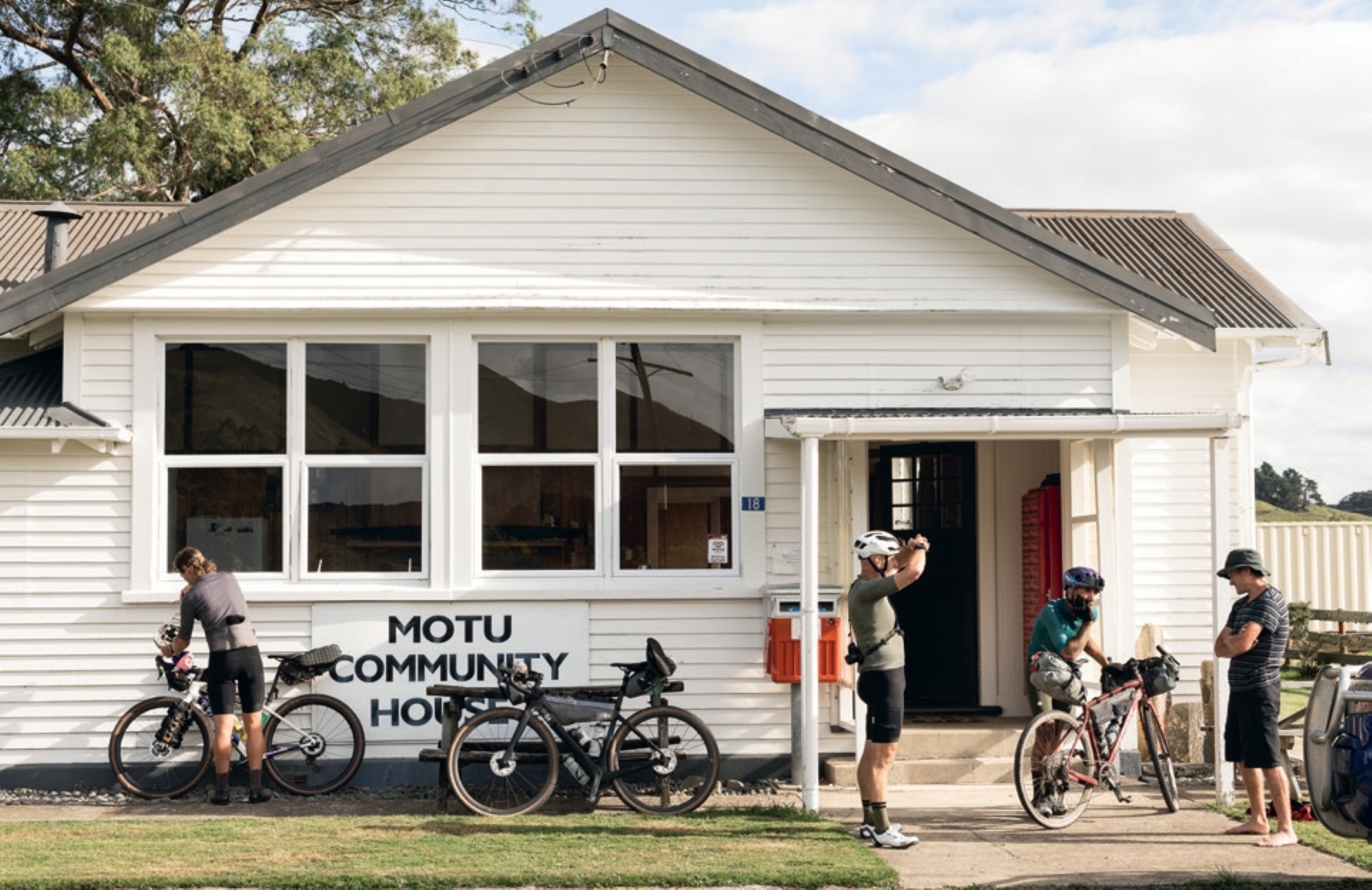
Soon after our rock sliding experience, we were back on the gravel, through Wharekopae area and heading north once again. Although we were climbing, the relaxed gradients and quiet roads let us cruise along the gravel, dissecting our way through the higher peaks on either side of the road. A short stretch on State Highway 2, a quick look through “blink and you’ll miss it” Matawai village, and we were hot on our way to our first accommodation, The Motu Community House.
In the early 1900s, the Motu area was a thriving community complete with a large hotel just across from the Motu Community House. The house, built in 1924, is a former post office, store and community hub that was purchased some years ago by the local community and put into a trust. It now operates as accommodation for whoever needs a place to stay, sleeping 10 across a few shared rooms. It has a large kitchen and lounge area, and is the perfect stopover for those riding the Ride 35, or Kopikopiko bikepacking routes.
Arriving at the Community House, we were met by Jim Morrison. Jim is the big boss of Motu Trails, managing and tending to the trails with a small crew of helpers. If it wasn’t for Jim and his team, the Pakihi track, which we would ride on day two, would be long gone. We traded stories and learned of the demise of the once bustling town over a hearty home-cooked meal arranged by Kaz, one of the locals (this can be arranged when booking a bed at the Community House). Rumour has it a former principal of the school would take his eight pupils away for a yearly “camp”, which in reality was three days’ hunting in the surrounding hills, returning home with fresh meat to feed their families. Our day was done, and we turned in, excited to see what the following day would bring.
Day 2
MOTU – TE KAHA
126km
1,208m elevation gain
5:58:08 moving time
Up at dawn, we tucked into a big breakfast, complete with steaming fresh bread, bacon and eggs and multiple cups of black coffee. With a start like this, our day was sure to be a good one.
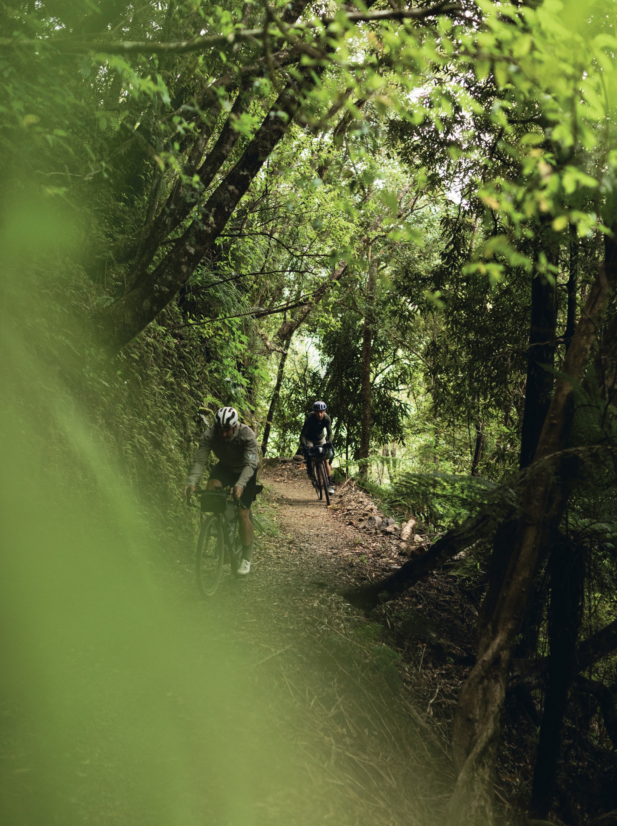
Five minutes into our ride up the Motu Road, we were climbing. We climbed for around 30 minutes, watching the terrain change from rolling farmlands to rugged native bush. The climbs in the area are generally a low-grade affair, designed for horses and low-powered trains. Reaching the high point of Onukuroa Hill, we surveyed the distant hilltops and chatted under a large shelter. Jim tells of the German gentleman who built the shelter, every join of its timber frame crafted to perfection and well over-engineered for its purpose. As pīwakawaka flitted around checking what we were up to, we checked the map to get our bearings, and headed for Pakihi track, just a gentle roll down the hill on an amazing stretch of gravel road, flanked by monster native trees and bush. Motu Road featured in the Rally of New Zealand, a round of the World Rally Championship (WRC) in the 1980’s and 90’s. As we descended, I got a small taste of what the drivers would have experienced, albeit at a much lower speed, but my exhilaration was no less than theirs.
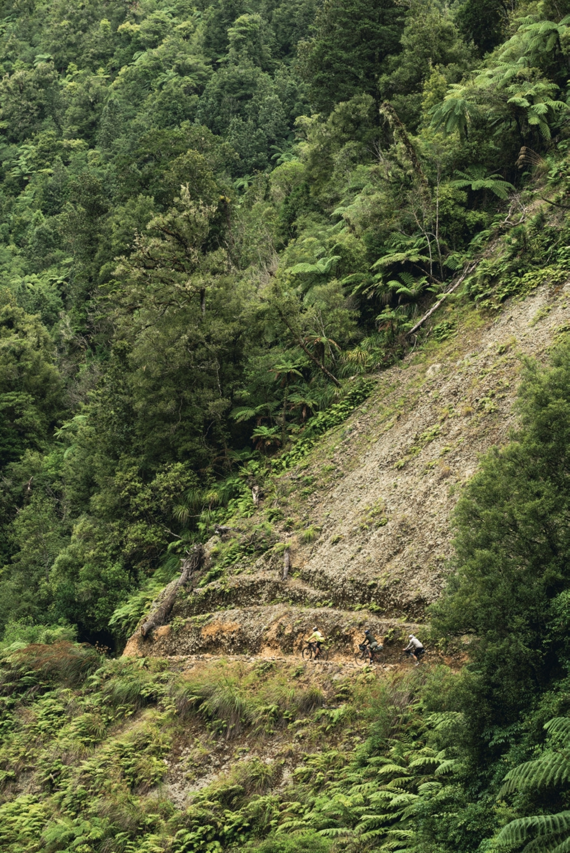
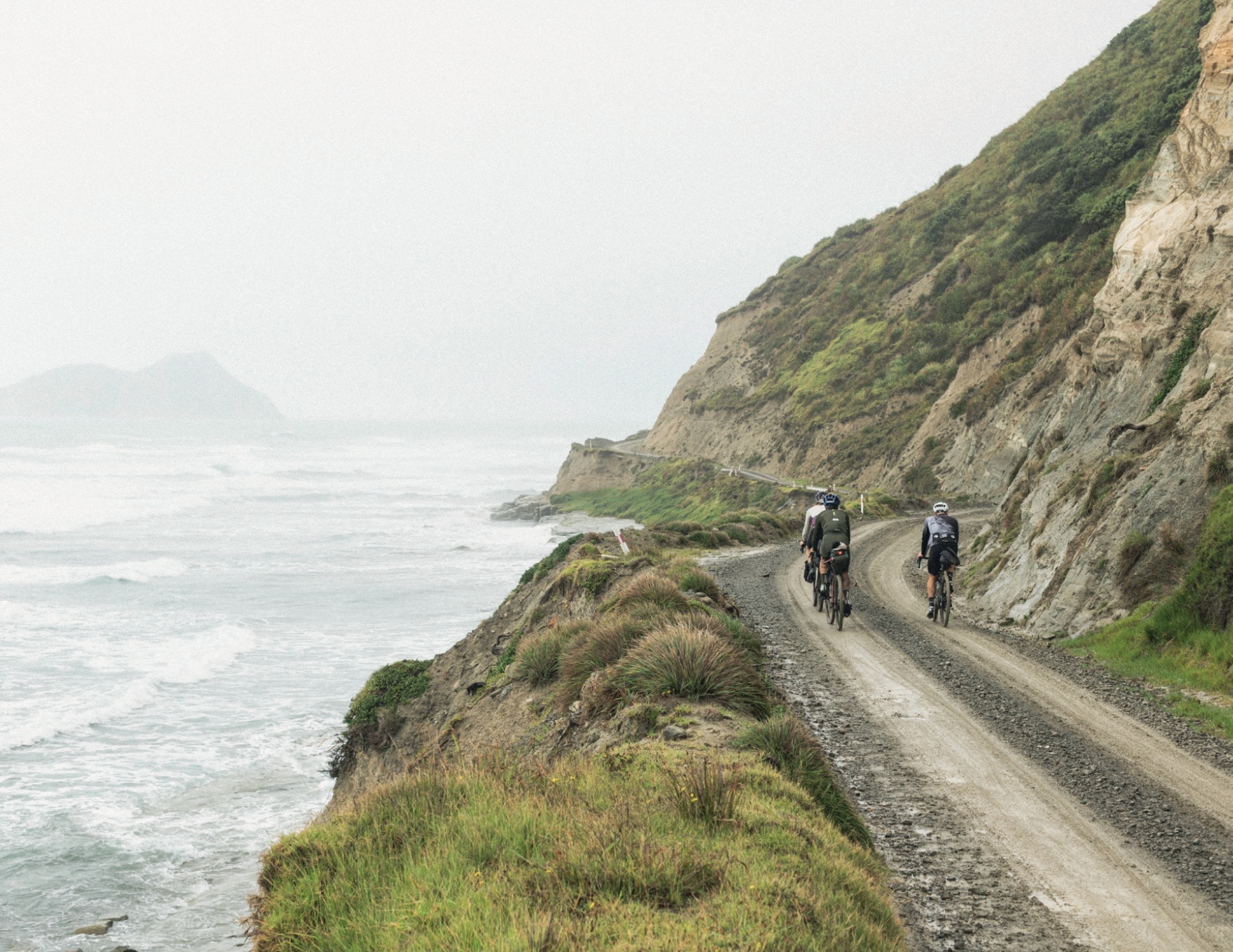
Seventeen kilometres from my last sip of black coffee, we hooked left off the Motu Road, and entered the Pakihi track. The track is a 20km long descent, dropping from 600m down to near sea level. Beginning in 1906, from Ōpōtiki, the track was carved through the rocky hills as a more direct route for droving stock to Gisborne’s port and was completed in late 1913. Due to the steep, unstable ground, multiple slips caused chaos and, eventually, transport was quicker via newly established roads in the area. It fell into disrepair, but from the early 1990’s the track was used by early mountain bikers who weren’t deterred by multiple hike-a-bike sections. These days, thanks to the tireless work of Jim and his team, the trail is passable without the need for hike-a-bike, and is achievable on the skinny tyres of a gravel bike.
I’ve heard the Pakihi referred to as a Grade 1 trail with Grade 6 consequences. I think this nails it. The actual act of riding the trail is simple, there’s nothing too technical to be aware of, but if you put a wheel off the edge of the benched in track, you could easily disappear down the bank into a ravine, or the river. Given the track was originally for pack-horses, the gradient is gradual and a whole lot of fun descending.
Jim directed us to a left-hand turn off the main track and into a steeper section of trail leading to the Pakihi Hut. The hut is a classic backcountry affair, with messages scratched into the paint from visitors past. A quick look around and a message of our own in the intentions book, and we were back on our bikes, grinding up the pinch back to the main track.
Exiting the Pakihi, we waved goodbye to Jim, took some selfies and traded pulls on the front as we headed for lunch in Ōpōtiki, the remaining metres of gradient helping us feel far stronger than any of us actually were. A couple of coffees and some pies later, we were ready for the next leg of the day; the Dunes trail.
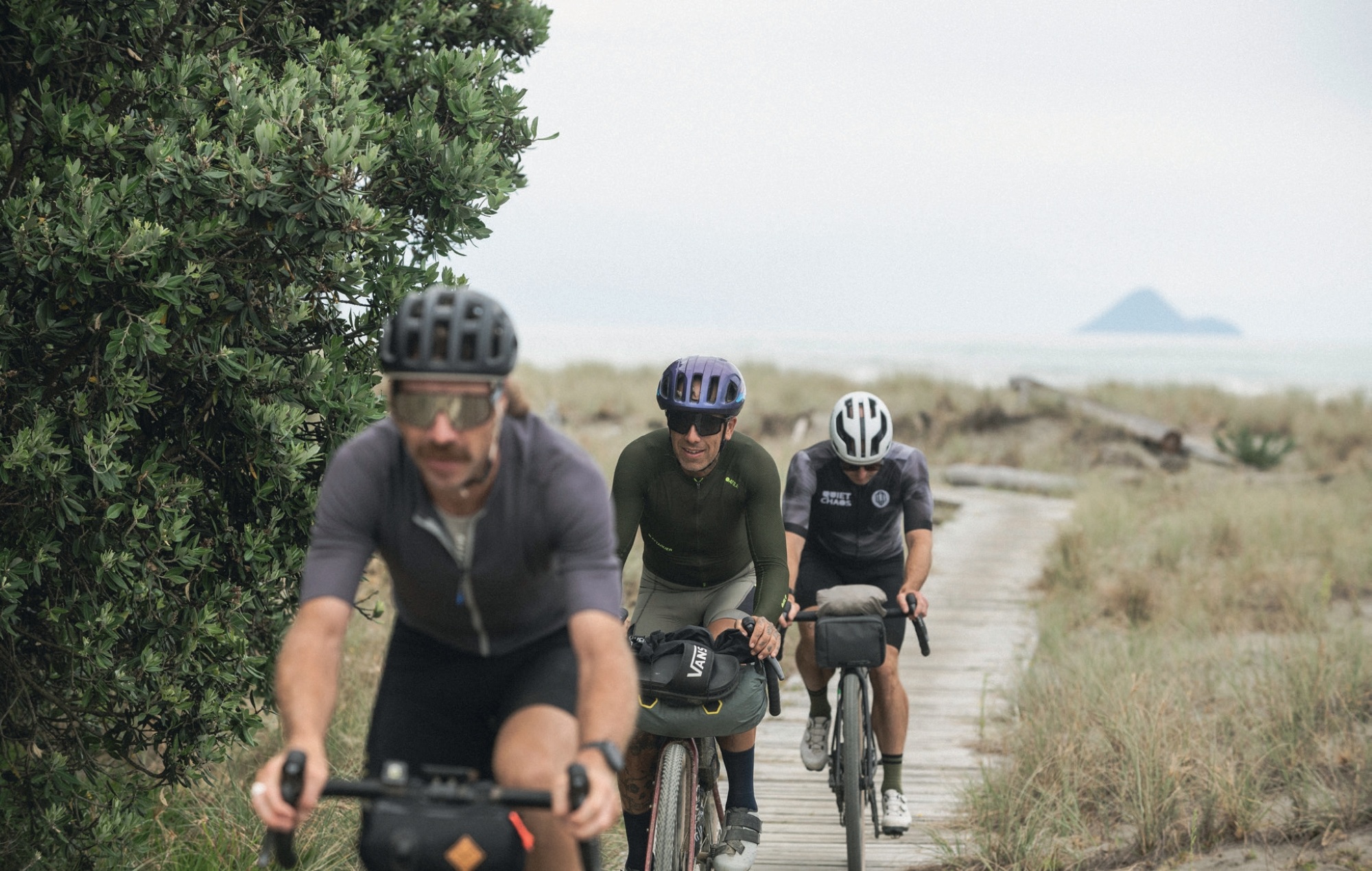
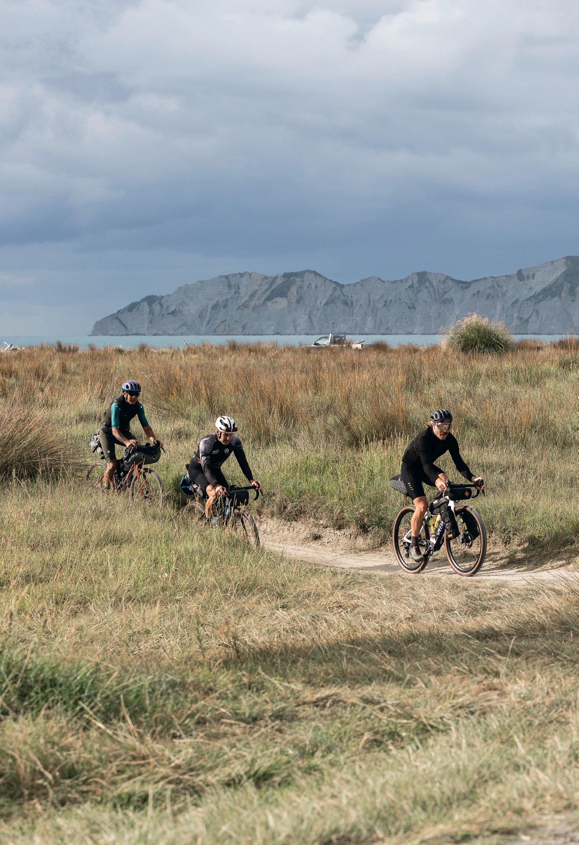
The Dunes trail stretches 10km along the coast in front of the town, weaving its way through the dunes. Sceptics were many during the conception of the trail, but “the proof is in the pudding”, and the trail now sees 20,000+ rides a year, a majority of which are by locals.
Before heading full tilt into the track, we eased into things by watching one of the dune’s pest control team check traps. The program was put in place to help control pests and protect ground-nesting birds in the area. It’s a thankless task for the few people behind the scheme, but the reward they need is to see dead rats or other pests in their traps. Their hard work is paying off; in the last 10 months they’ve removed 120 rats from the dunes, resulting in a return in birdlife to the area.
The Dunes trail is a load of fun, with great sight lines and no blind corners. We pushed the pace, racing each other over the rollers and through the many perfectly formed turns. It’s sort of like a pump track crossed with a roller coaster for gravel bikes, so good!
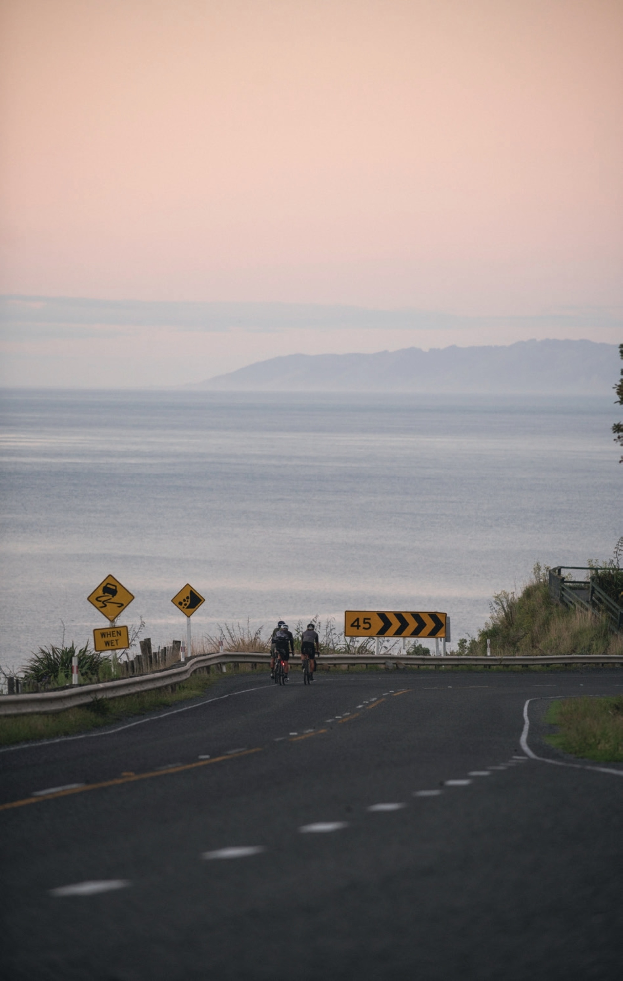
Back on the road, our day was dragging; we’d killed a lot of time chatting at lunch, and we were keen to reach our destination. A team time-trial of sorts ensued on State Highway 35 as we left Ōpōtiki behind us. A quick pitstop at Torere Beach to take some photos on its vacant, rocky shore, and we began the crux of our afternoon’s ride; a solid climb up to Maraenui Hill lookout. This roughly 4.5km climb took us up 160m above the ocean—not a huge deal but a surprise to the legs after the minuscule rollers of the Dunes trail.
After swinging off the road into the lookout to watch the swell roll in, our moment of serenity was interrupted by “the boys in blue”. Well, more specifically, a policeman and policewoman. Our minds immediately rewound to all our riding, and the interactions we’d had since leaving Ōpōtiki, but we couldn’t pinpoint anything which may have ruffled feathers. We figured someone must have complained about us as we climbed to the lookout, but with very few cars and no honking of horns, there was no obvious reason the police should be taking an interest in three Lycra-clad lads chatting surfing on the side of the road.
As it transpired, the policeman was a keen cyclist and as he doesn’t see many groups of riders out this way he wanted to see how we were getting on and where we were headed. As we recounted the story of our day so far, he nodded his head, smiled, and said how much he liked those roads— the 90km loop from Ōpōtiki up the Motu Road and into the Pakihi Track was a favourite of his.
By this point, the skies were threatening rain, and our legs were feeling the morning’s efforts but we pushed on over the final couple of climbs toward the Te Kaha Beach Hotel, keen to beat the impending downpour. We rolled down the road to the hotel, and our luck ran out; the heavens opened just metres from the reception. Mitch was eager to finish the day with a swim, promptly stripping down, “getting the snorkel out” and diving into the sea, washing the day’s efforts away.
The Te Kaha Beach Hotel’s storied history dates back to 1873. Although the current hotel is on the same site as the original, it is far removed from its beginnings. Its modern rebuild took place after a fire in 1995 left it a pile of twisted metal and ash, allowing for a completely clean slate. It’s now not only a fully-fledged hotel, featuring top-shelf accommodation, restaurant, pool and spa, but it serves as a community hub with the area’s only pub, restaurant and shop. A strategically placed couch at the front of our room let us take in the sunset between showers, with an amazing view over the pool and out to the ocean. Our dirty kit in the washing machine, our many devices charging, bellies full from a meal at the restaurant below, we kicked back, rested our legs, sipped some cold Gisborne Golds and dove into an evening of what these trips are all about: stories and banter with your mates.
Day 3
TE KAHA – TE ARAROA
98km
815m
4:26 moving time
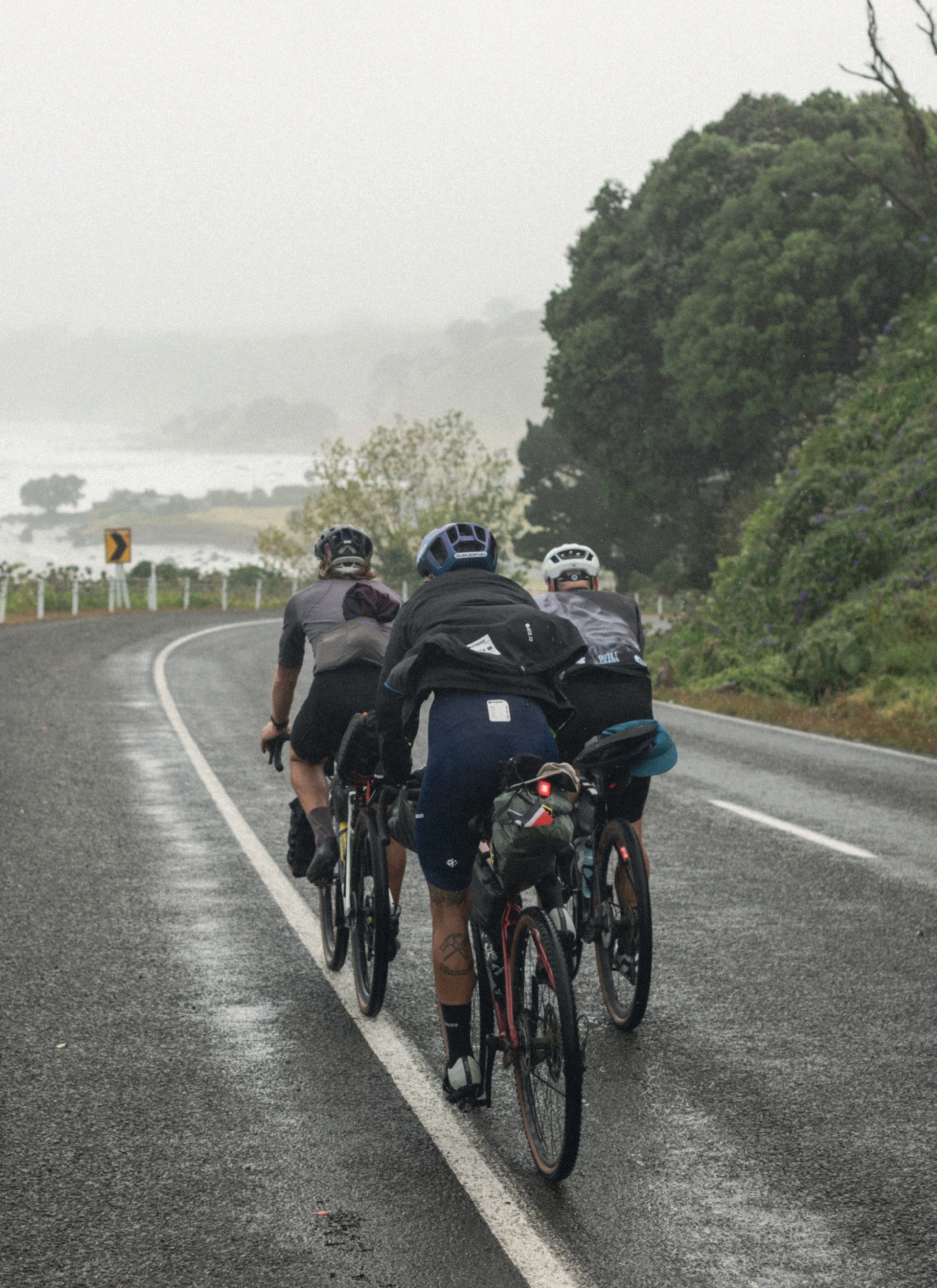
Slowly, we rose to squally showers. I dragged my carcass from the comfort of my bed, with every joint creaking as I moved. Day three is always a tough one; the body becomes accustomed to being on the bike for successive long days. It’s a welcome feeling, meaning I must be doing something interesting, and subsides by the time I’m at breakfast, devouring a stack of eggs and toast with obligatory crispy bacon.
We packed our bags and hit the road. The rain returned; fortunately it was warm, but the wind had now kicked up. With gritted teeth, we tucked in and pushed on. Two of us side by side at the front, and one in the back seat getting a free ride behind. We cycled through, swapping off the front every few minutes. At one point, Mitch and I laughed at how we can be part way through a yarn as one of us swaps off to be replaced by the third member of our trio, only to pick the story up again minutes later once we we’re back together on the front.
The clock struck 10:00 and we knew it was time for smoko. A few minutes later, we were in Whanarua Bay, where we spotted a sign for ‘The Nut House Cafe’. It was that time of day, after all, so we hooked left into their driveway paved with macadamia shells. Unsurprisingly, it’s quite difficult riding on a driveway laid with what are essentially half ‘biggies’ (the big marble in a game of marbles), somewhat like sand but even sketchier. Two of the three of us remained upright while Haimona took one for the team, discovering first-hand what it’s like to crash onto them!
The Nut House was just what we needed, and we fit right in! A long black and some homemade macadamia ice cream hit the spot as we chatted with Graham, the owner, about his six-acre block and his 350 prized macadamia trees, which produce fruit for local and international customers. I was surprised to hear that Tahiti is one of his main overseas markets. The wind had picked up and the weather was all over the place, but between showers we had some great views to see the heavy seas roll into shore. We knew lunch at the famed Waihau Bay store was our next stop and would prove a welcome sanctuary from the elements, so we pressed on.
“What do you think of my gang? They’re pretty choice, eh?”—Alamein to Boy in the Taika Waititi movie, Boy, while in front of the Waihau Bay store.
I’m sure if we’d busted this line out to the guy taking our orders at the store he would have had a good chuckle. A gang of three Lycra-clad lads, dripping wet and shivering in the cold, discussing the huge pile of Pinky bars in the chiller, and ordering a mountain of garlic butter chips.
The store was just another small, country shop until Boy thrust it into the limelight in 2010. The day of our visit, it was epic for a totally different reason: the weather. Today, no one would be hauling in a big catch from the deep seas just a stone’s throw from the deck where we sheltered. The torment in the seas was a sight to see! Hot chips and toasted sandwiches warmed us just enough to take on the sideways rain, and we set off toward our afternoon side quest, Lottin Point. To say the next part of the day was character-building would be an understatement.
Lottin Point is a great little spot just a few kilometres off the main road. There are a couple of steep climbs to get there, though, and what seemed on the map like a quick detour ended up being a pretty epic side quest. As seems to happen when the conditions are tough, we pushed hard up the climbs, Mitch riding H and me off his wheel while nose breathing, the equivalent of a ‘Pogacar vs. club rider’ sort of scenario. We stopped to say ‘hi!’ to the pigs roaming in the paddocks on either side of the road, then headed further down, right to the water’s edge tucked away in a small bay. There’s a DOC camp, complete with a toilet, and I’m told that the spot is epic in summer, with awesome fishing and snorkelling right in front of the camp. Further around the rocks toward Lottin Point, the deep water lends itself to some epic deep sea fishing. There are stories of near record-size Kingfish and Yellowfin tuna caught just around the coast from the little bay where we stood.
Side quests are all part of a trip like this. In a vehicle, little stops like we had at the Nut House or Lottin Point could easily be missed in the bustle and speed of driving from A to B. On the bike, though, at a slower pace, the travel really is the destination, so side quests are all part of the attraction. See the sign, take the turn, ask the question.
In fact, “ask the question” is a phrase that stuck in my mind from this day. Through our entire trip, I was always impressed at how Mitch knew just how to ask the right questions in order to get people to open up, helping us find out more about the characters we met along the way, rather than just having transactional, ‘small talk’, interactions.
We were pretty cooked after battling the elements for most of the day, so arriving at the Te Araroa Holiday Park late in the day felt like a real achievement. We strategically arranged our wet gear inside our rooms, hoping it would dry by morning. It’s probably not recommended to drape wet shirts and jackets over a TV, but, with a fan placed below them pointing upwards, my gear was dry by morning. I did check that the TV still worked afterwards—all clear.
Thirty-Five Eat Street is a food trailer parked up onsite at the holiday park, and even though it was our only option for food, it was a great one. Nina, the owner, started the place three years ago after moving down from Auckland. Leaving a career as a wedding caterer behind, she was keen to stay in the hospo business and identified the food trailer as something that could work. Nina cooked up a mean feed of chips and burgers for the crew, which we enjoyed, washed down with frosty Steinies under a tin shelter, in front of a fire at the back of the holiday park. This is living.
Day 4
TE ARAROA – TOKOMARU BAY
125km
1387m
4:47 moving time
Misty rain hung on the hilltops as we rolled into day four. Our first destination was only a short skip up the road to the East Cape Manuka Cafe. The bacon and egg pies were still steaming, fresh from the oven, as we walked in. We made our best attempts at ordering coffee in Te Reo, as encouraged by a sign on the menu board. We must have got something right, as our coffee promptly arrived. Truth be told, we all went with a long black as it was the easiest for us to pronounce, but, however bad our attempts were, at least we gave it a go.
East Cape Manuka is one of the few Maori-owned apiaries in NZ. Producing honey and manuka oil products for a global market, the team are kept busy year-round, not only working with the bees but planting and tending to blocks of Manuka around the area and, of course, dealing with the increasing mountains of paperwork necessary to keep a Manuka certification. An impressive operation, and a gold star way to kick our day off.
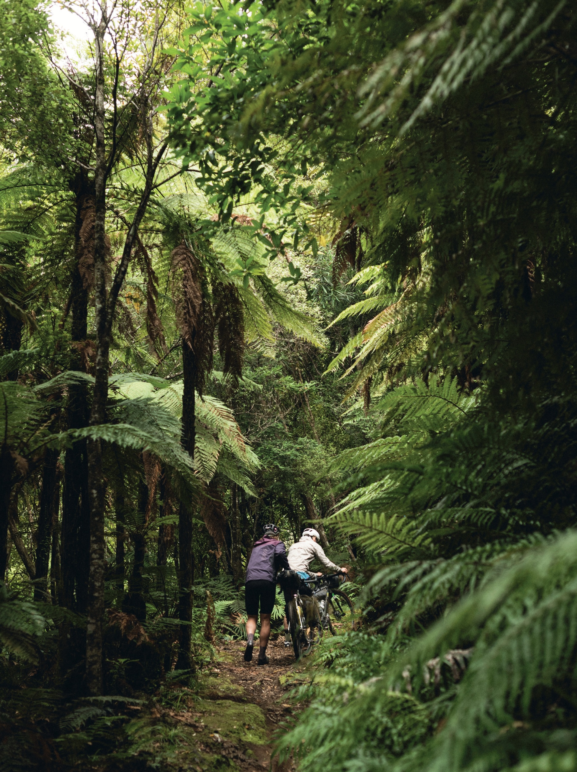
Being in Te Araroa, it was only fitting we journeyed out to the most eastern point in the North Island, the East Cape lighthouse. It turned out that the lighthouse itself was barely visible through the dense fog and drizzle that hung around Otiki Hill on which it is perched. Although the lighthouse was to be the main reason for this little side bar, the ultimate feature ended up being the weather and the mud. Although both made for a tough trip to and from the lighthouse, as all agreed it’s the hard parts and the times when you really need to stretch yourself, that remain etched in our memories.
We battled squalls fired at us from the sea just metres from where we rode; sideways rain, headwinds and in the final few kilometres to the lighthouse carpark: puggy, speed-sapping mud. Our visit was short; we turned around and continued our battle with the elements all the way back to the main road. What an epic morning. Although it’s a main route, I was continually surprised by the lack of vehicle traffic throughout our entire trip down Highway 35. We were given a wide berth and had no issues with vehicles, and were even graced with a few waves from car windows. As we headed south towards more populated areas, the traffic grew more frequent but still far less than expected. I’d imagine over the January summer holiday period it could be a different story as holiday makers flock to the area. Come February, when we rode, it’s all good.
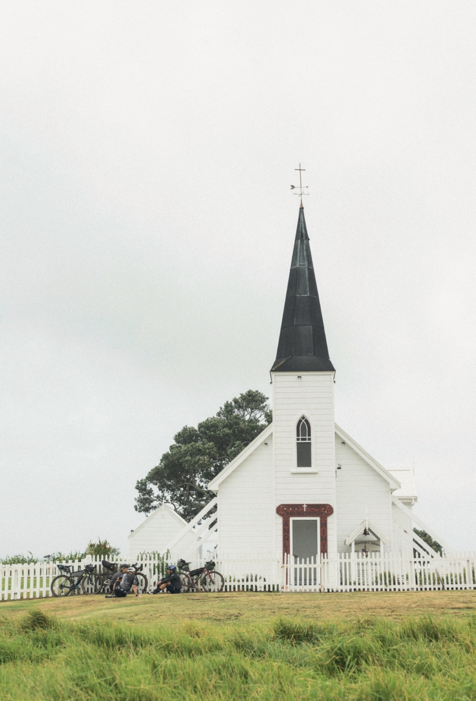
Temperatures climbed as we continued south, the weather clearing as if every kilometre we ticked off turned the ‘weather tap’ off a little more. Arriving in Tikitiki, a small town on the northern bank of the Waiapu river, we’d had a tip off to stop and have a look at St Mary’s Anglican Church, which sits atop a rise as you enter town, keeping watch over the area. After a tough morning on the bike, we peeled off our damp socks, chipped dry mud from our crusted legs and entered the church. We paused for a moment of solace and reflection as we took in the details of the 100-year-old building, built as a memorial to local Māori soldiers who’d lost their lives in World War 1. The main feature of the church is the stained glass window, front and centre, depicting two soldiers kneeling at the foot of Jesus. The church is a real celebration of Maori craftsmanship and design with many carvings and tukutuku (woven panels) throughout.
While St Mary’s is a hub for the local community, equally so (possibly more) is the Tikitiki RSA. A meeting place, not only for a pint, but for community meetings or Friday night fish and chips. Even on a random weekday afternoon, the place was busy. As we waited for our lunch, yes, hot chips and toasted sandwiches again, we wandered the building, taking in the portraits of locals lost to early wars. It’s evident the region has a strong connection to the World Wars, with many people along our journey mentioning the generations missing from the area, lost to war.
Onwards to Tokomaru Bay. We couldn’t believe the swing in the weather, now sunburn and humidity were our adversaries for the afternoon. We’d be staying the night at Te Poutapeta—The Post Office, a 100-year-old post office, now converted into accommodation. Stepping through the door felt like stepping into a time machine, such is the period-correct detail throughout the place. We’d entered through the back door, and as I opened the front door from inside, I was met with the most ‘East Coast’ of views; two young girls riding their horses down the centre of the road. This view summed up the afternoon for me; fun and carefree.
Day 5
TOKOMARU BAY – TATAPOURI
95km
912m
3:39 moving time
With promises of a banger sunrise, day five kicked off early to catch the light and make the most of a balmy morning. A few laps around town, while we waited for Cafe 35 to open for breakfast, helped us ignore our grumbling bellies.
The first pie of the day down, it was time for the main course: Cafe 35’s specialty, a Pāua pie. Mitch took one for the team and, in true form, jumped in first, taking a huge, almost half-pie-sized bite. The look on his face spoke more than the words in his podcast regarding his thoughts on a Pāua pie; a unique flavour, somewhere between a seafood chowder and a creamy mushroom pie. Neither seafood nor mushrooms are near the top of my favourites list, so when it was my turn, a much smaller bite, but no less volume was spoken by the look on my face. It’s fair to say a Pāua pie is an acquired taste: liked by some and not by many.
Well fuelled, we hit the road for another day of side quests and long yarns. I’m not sure what it is with some of the little bays we visited along our route, but it’s almost as if they’re all hidden behind punchy climbs, protecting them from weary cyclists or low-powered vehicles that don’t know what they’re in for. The gatekeeper, as I’ll call it, is only 800m long, but it’s a heck of a grovel up to the lookout before surfing the descent into Anarua Bay.
Anaura Bay is a small settlement of a few houses and a couple of campsites along the front of an amazing white sand beach. A great, quiet spot. We hadn’t arrived here by accident, however; Haimona’s cousin lives here, and it was only right to stop in for a korero with her about tā moko and the significance of her moko kauae. A refill of our bidons and we were back on the road. Keen to get to our destination of Tatapouri with enough daylight left to enjoy it.
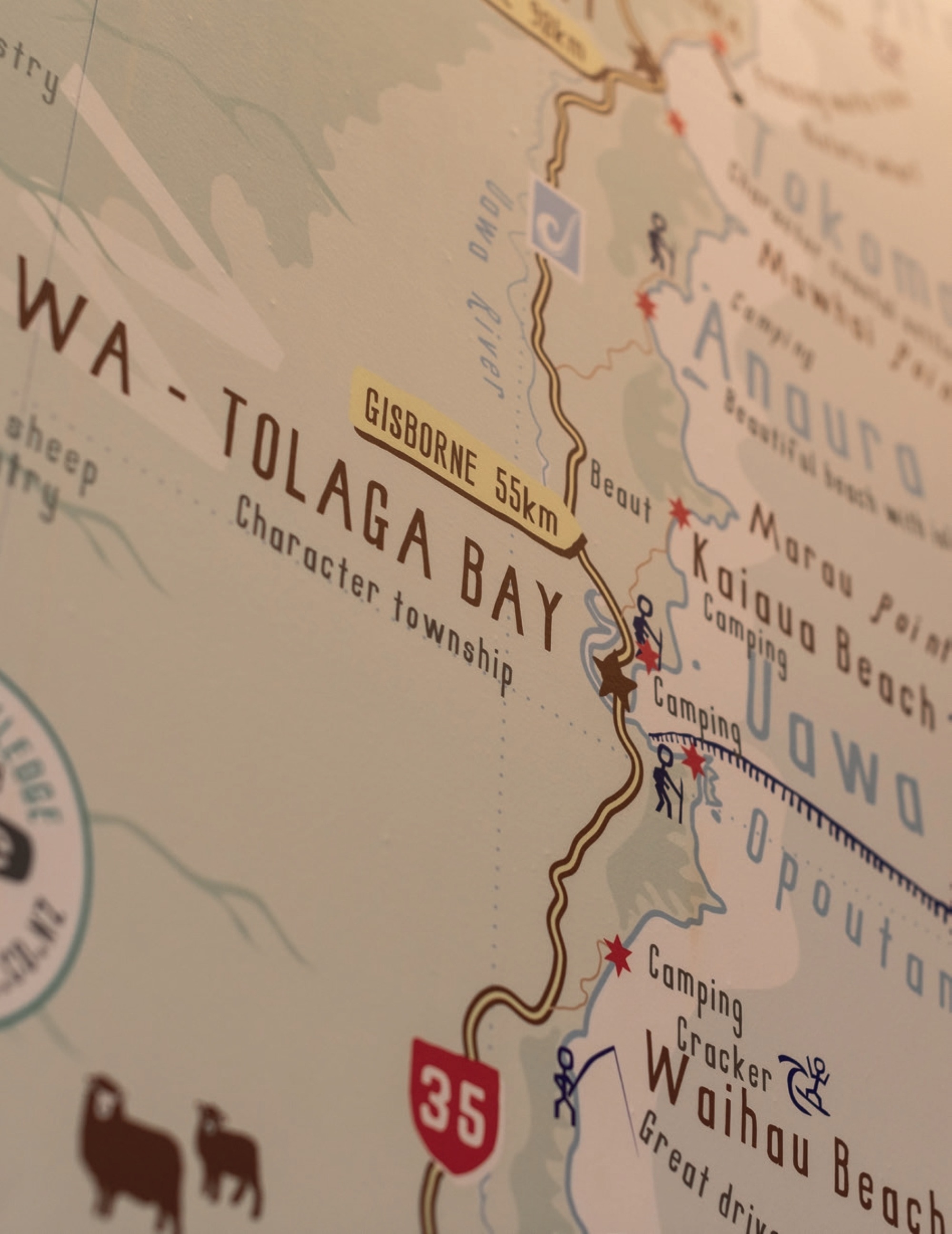
We paused for lunch at the ‘Black Market’ food trailer in Tolaga Bay. Surprised with the fare on offer, we filled up on Thai salads, loaded fries and obligatory Cokes, finished with some extra kick from a long black. As usual, we blew a lot of time over lunch, chatting with locals and generally enjoying not being sat on our saddles and, of course, no trip to Tolaga Bay is complete without a visit to its iconic wharf.
In its heyday, over the 1930’s, the 160m long Tolaga Bay wharf serviced some 130 ships; its size and positioning in deep ocean waters allowed large vessels to dock near to the shore, allowing easy access for loading stock, meat, wool and other supplies that couldn’t otherwise make its way to the area via the limited road access of the time. These days, locals drop a line in the hope of “catching a big one”, although the guys we talked to hadn’t caught anything all day.
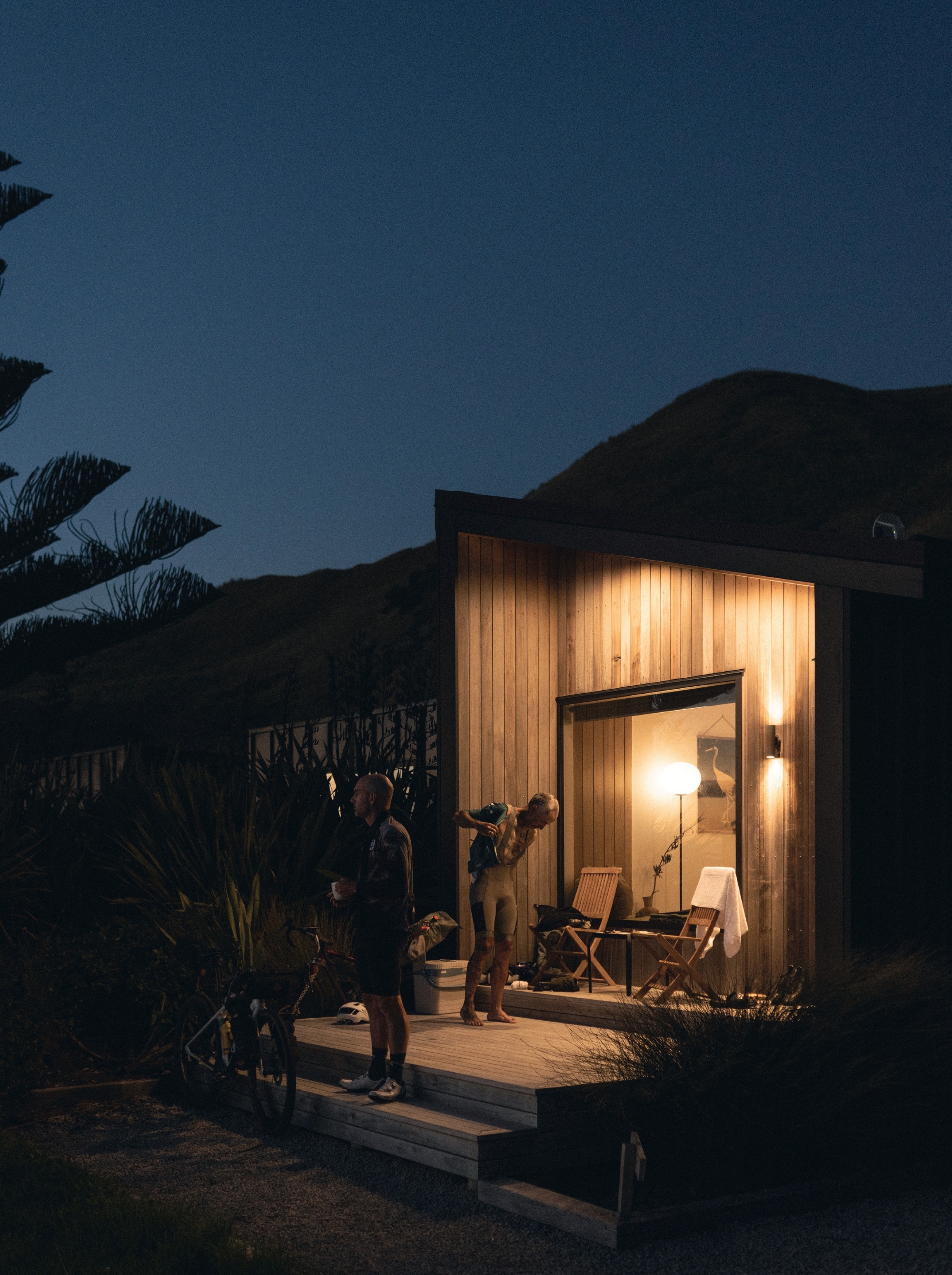
Tatapouri Bay Oceanside Accommodation was the perfect place to wrap up our trip. Just ten kilometres from Gisborne, this beachy campground has accommodations for all levels, from grassy campsites to the literal beachside luxury cabins, which would be our resting place for the night.
The first thing on our list after settling in was a sauna. Mitch and I sweated out the previous four days of pies, chips, beer and generally unhealthy foods. Reliving the trip, we discussed how laid back and friendly everyone we’d met along the journey had been. Everyone mentioned deep connections to the land and sea, and although many had spent large periods of time living elsewhere, they’d all felt the call of the land and returned to put down roots, with no thought of ever leaving.
Day 6
TATAPOURI – HOME
10km or so
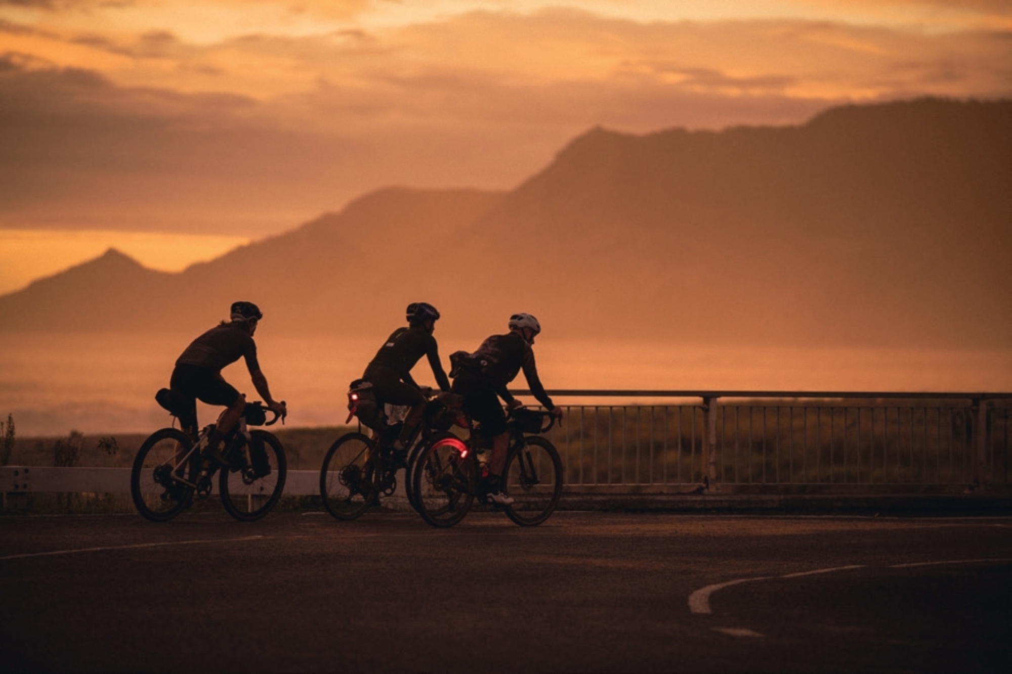
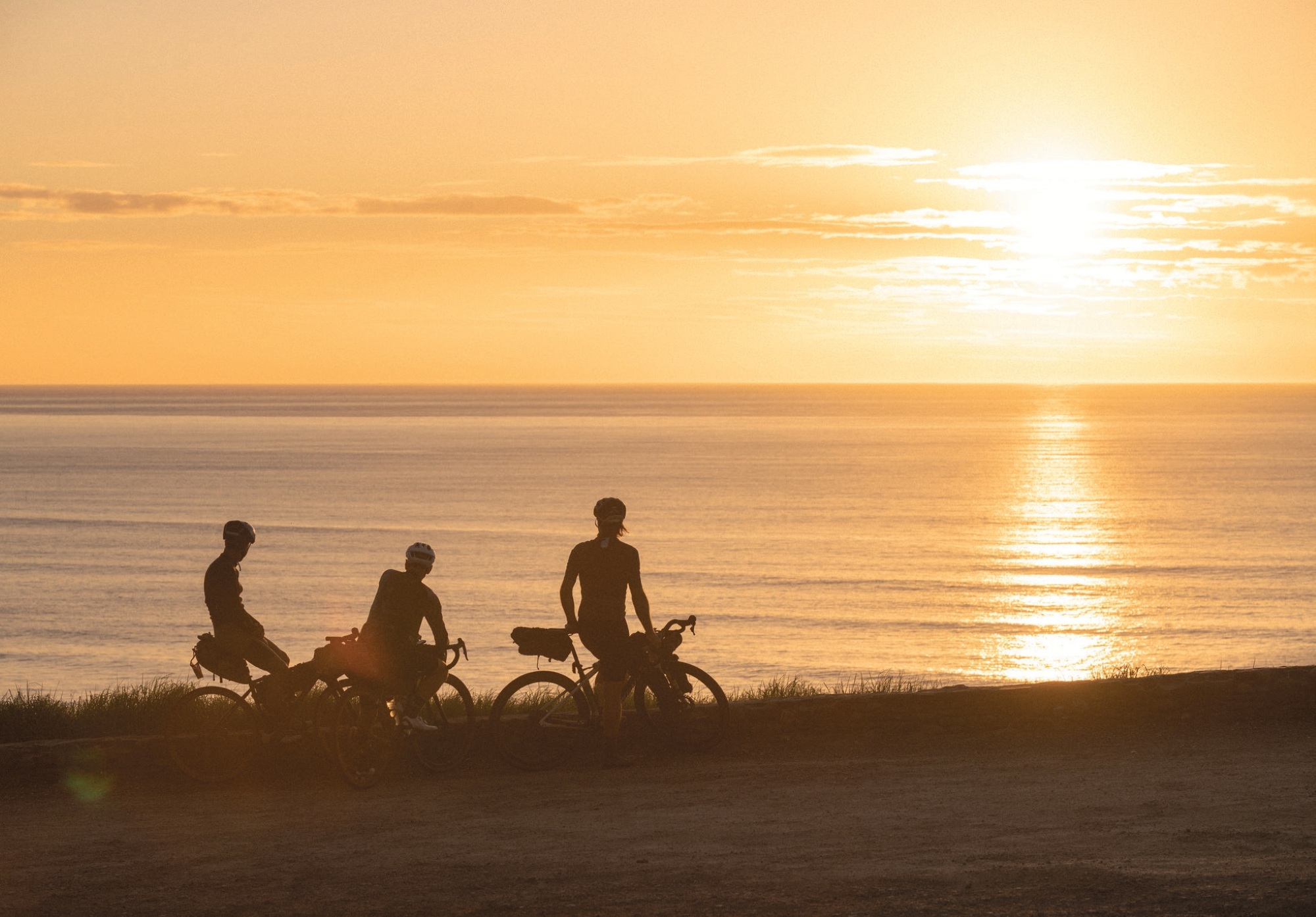
Our final day began predawn. Greeted by a warm sea breeze and dew on the grass, we climbed from the campground up to a lookout to welcome the first light of the day. The sun blanketed the bay across toward Gisborne, our final destination and, although I was keen to be home, I didn’t quite feel ready for the trip to be done.
As we rolled towards town, I reflected on the value in the kilometres of this trip. Perhaps it could be a measure of not just the number of kilometres covered, but the experience and value per kilometre ridden. It’s fair to say the Ride 35 route packs a lot of life and experiences into its almost 600km, but it’s up to us as riders to get the most out of it.