
Words Lester Perry
Images Cameron Mackenzie
‘TWAS THE NIGHT BEFORE THE COROMANDEL MISSION, WHEN ALL THROUGH THE HOUSE NOT A CREATURE WAS STIRRING, NOT EVEN A MOUSE; THE BIKE BAGS WERE PACKED AND HUNG ON THE BIKE WITH CARE, IN HOPES THAT A GOOD GRAVEL TIME SOON WOULD BE THERE;
THE CHILDREN WERE NESTLED ALL SNUG IN THEIR BEDS, WHILE VISIONS OF LONG DUSTY CLIMBS DANCED IN MY HEAD; I’D JUST SETTLED DOWN FOR A LONG NIGHT’S NAP.
WHEN INTO MY HEAD CAME A THOUGHT WITH A CLATTER! I SPRANG FROM THE BED TO SEE WHAT WAS THE MATTER; TO CHECK THE DISTANCE OF THE ROAD FROM TAPU TO COROGLEN.
TO MY DISMAY THE GOOGLE MAP WAS BROKEN…. ….IT WOULDN’T ROUTE THROUGH, AND THAT WAS NO JOKE!
DAY ONE
And there lies the first lesson of bikepacking trips: always double-check your route before you embark. With the Tapu to Coroglen road confirmed closed, a late-night re-route was made, and a slightly altered plan was hatched.
Come dawn the following morning, the previous night’s phone calls and speedy map reading were a distant memory. We were off to our revised rendezvous point: Coromandel Town. Day one looked somewhat shorter than originally planned, so an extra cup of coffee and a more leisurely morning was welcome after our late night re-routing session.
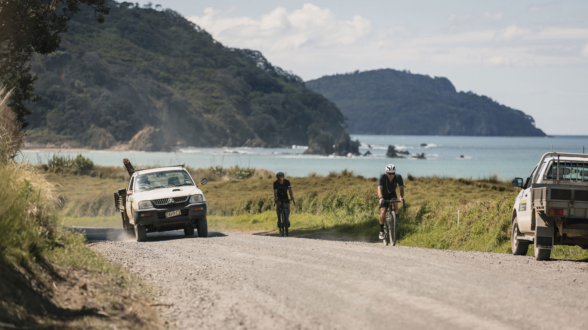
Clear weather greeted us as we made our way up the west side of the Coromandel Peninsula, her rocky bays graced us with turquoise water, blue skies…. and a long line of slow traffic. Thanks to the weather havoc over the last year or so, the roading in the area is still in a bit of a state, with some single-lane sections and roadworks slowing the traffic flow. Although, according to locals, the media is inflating how bad it really is, causing holidaymakers to steer clear – so we’ll avoid doing that! The reality is, the region has bounced back remarkably well and, aside from the slow traffic, only two road closures remain in the area, one of which was a key part of our original plan for Day 1.
JUST A FEW CLICKS AND ONE CLIMB NORTH OF COROMANDEL TOWN IS SHELLY BAY, THE START AND END POINT FOR OUR RIDE.
Just a few clicks and one climb north of Coromandel town, is Shelly Bay – the start and end point for our ride. Although now departing later in the day than originally planned, we were still optimistic we’d summit the final climb over Whangapoua Hill on our return, just as the sun began to set, before dropping back towards Coromandel town for the night. Hopefully.
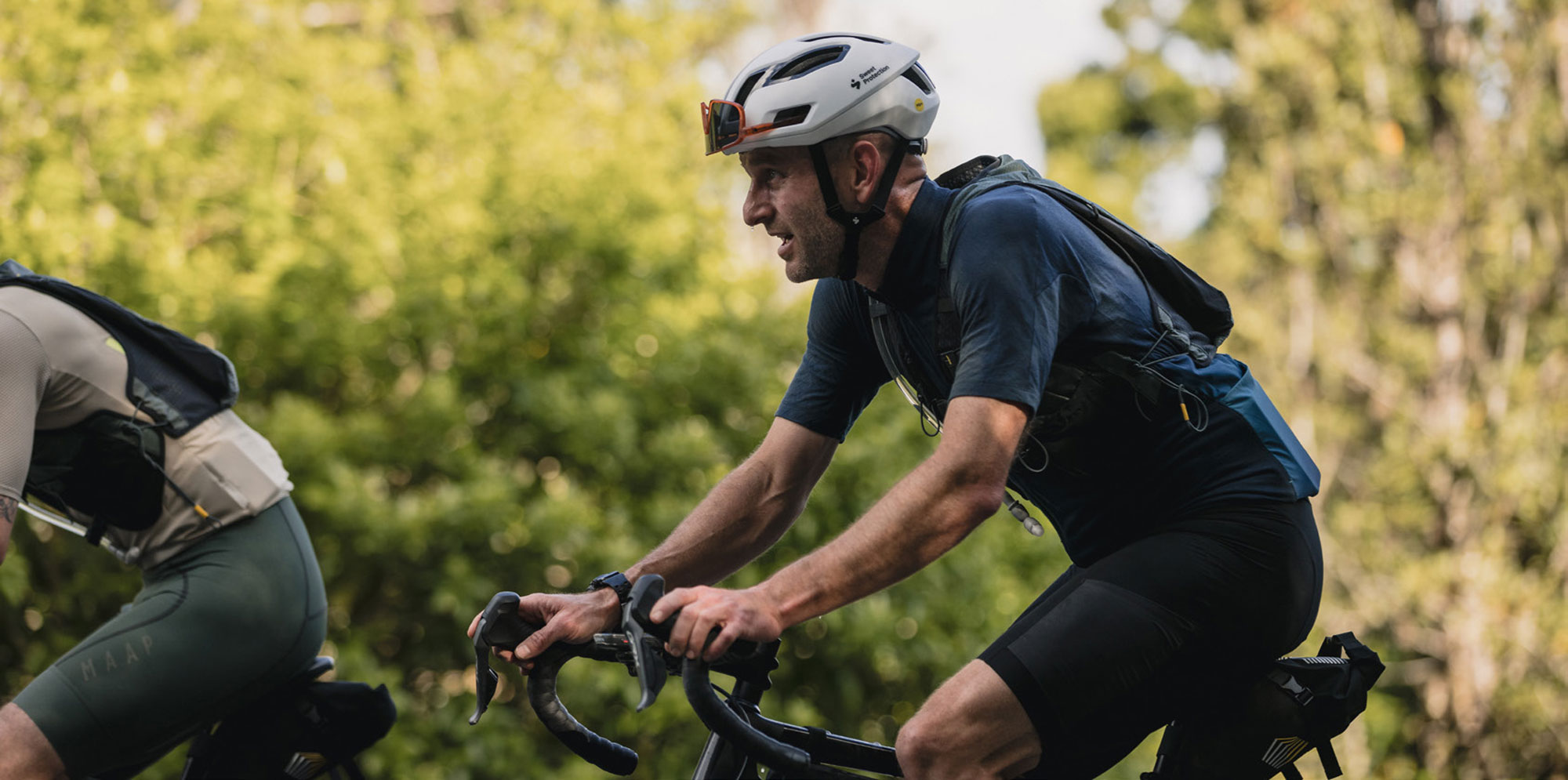
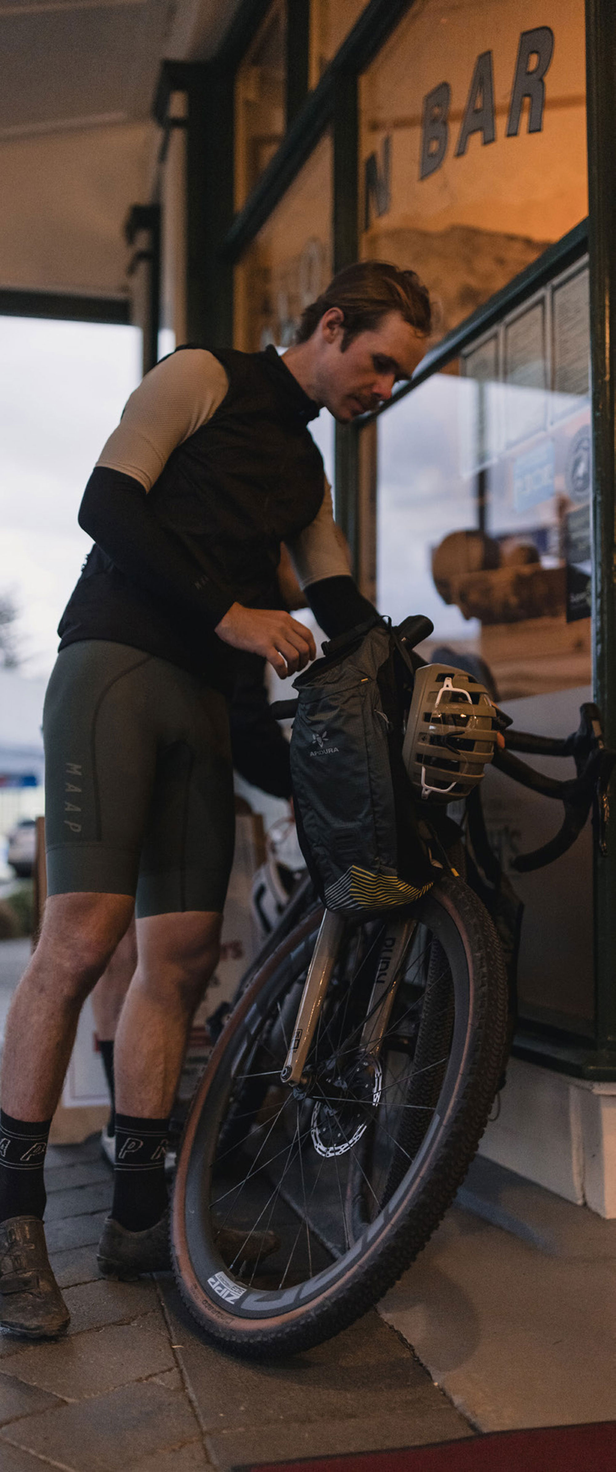
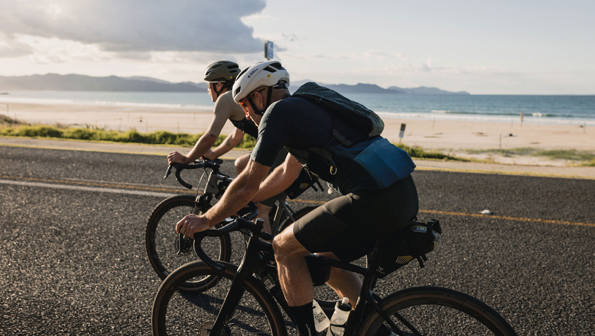
My companion for the trip was Jakob Lester, an Industrial Designer-in-training, a bike mechanic, an ex-roadie-come-trackie turned mountain biker and gravel connoisseur. I’d never met Jakob before, but we have mutual friends and, with bikes as a common thread of interest, I knew I’d be in good company. I was right. Jakob embodies everything a cliched modern gravel rider embodies; he’s smallish in stature, has the ‘souplesse’ in his cadence of someone who’s spent years aboard a bike and, although he considered himself “not a climber”, he effortlessly danced away from me on most of the climbs. Then there’s his design ‘bent’ to take in to account – reflected in his muted earthy-coloured kits – and, finally, his moustache; not too bushy, not too svelte, but very ‘cycling’. He’s a great bloke and a perfect ride companion. Cheers mate!
Climbing out of town, we chatted – the usual top-level sort of stuff, nothing too deep (yet), mere pleasantries really. Onto the gravel of the 309 road and it was game on, we were tapping out a good pace, confident we’d make our sunset deadline. We rounded a bend while climbing and saw pigs – all over the road there were pigs! Big ones, small ones, all smelly and dirty. It seems local fella, Stu Edmonson, began raising them back in 2005 and they now enjoy rolling in the dirt beside the road and fossicking in the surrounding hills. We’re not sure what Stu’s up to these days, and there was no sign of him as we ambled past, but if he’s a smart man he’d have been out enjoying the fine gravel roads of the region – just like we were.
Day One Ride StatsTOTAL DISTANCE 68KMTOTAL ELEVATION 970MMOVING TIME 2HRS, 54MIN
We were soon forced to a stop by traffic lights governing the passage through road works repairing subsidence in the road. This stopped us in our tracks for half an hour, about 25 minutes longer than the lollipop man told us. “Just five minutes,” he said. I guess his watch was broken.
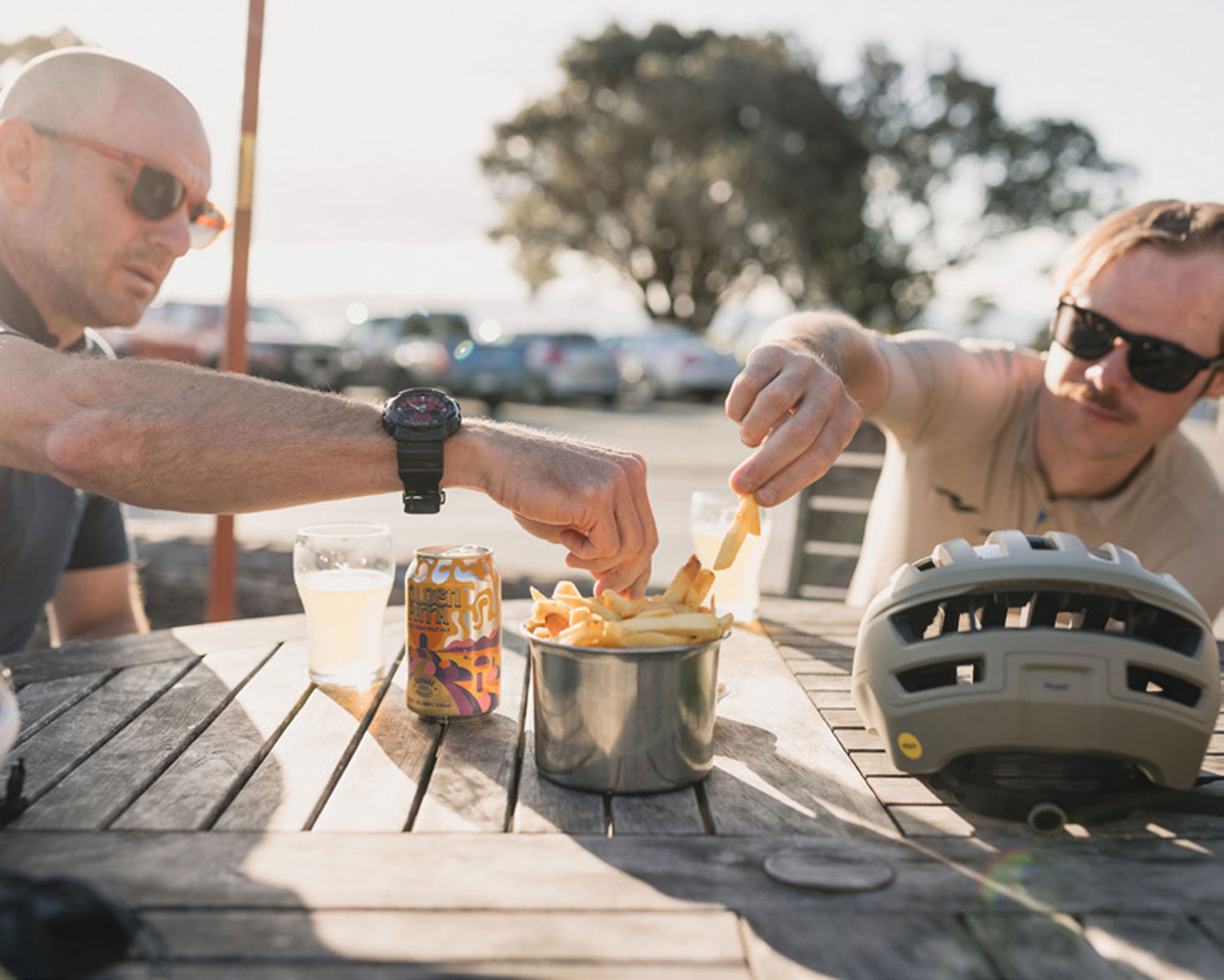
Leaving our newfound lollipop-man-friend in the dust, we put our heads down, knowing we were now behind schedule. Soon after, we were back on tar seal, skirting Whitianga and continuing north toward our stop-over spot, Lukes Kitchen, in Kuaotunu. Picture this, a bustling casual restaurant full of patrons tucking into a late afternoon ‘all you can eat’ taco fiesta…. and us. Two dust-covered sweaty boys, clad in dirty Lycra, tap-dancing shoes on our feet and no doubt a particularly spicy aroma, trying to decide if we had time for a few tacos, or just a handful of fries and a quick Hazy. Pulling the “we’re here for a quick time, not a good time” we decided on the latter, enjoying our brew n’ chips whilst watching seagulls scavenge for their evening feed on the beach across the road. Luke’s is certainly a spot to carve out some time for if you’re in the area. We didn’t have time to make the most of the place as we had hills to climb and sunsets to see, so we pushed on.
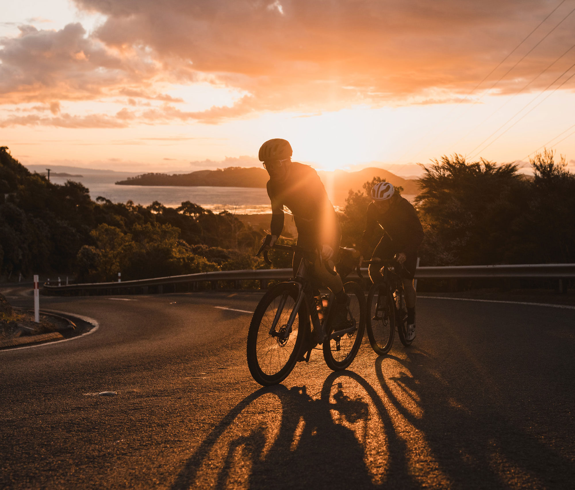
THE LAND BELOW US WAS LIT IN ORANGE HUES AS THE SUN'S RAYS REACHED INLAND FROM OUT AT SEA, OVER THE ISLANDS TO THE SHORE, IGNITING COROMANDEL TOWN AND FLICKERING UP THE HILL TO MEET US, PERCHED IN AWE AT THE TOP. AMAZING.
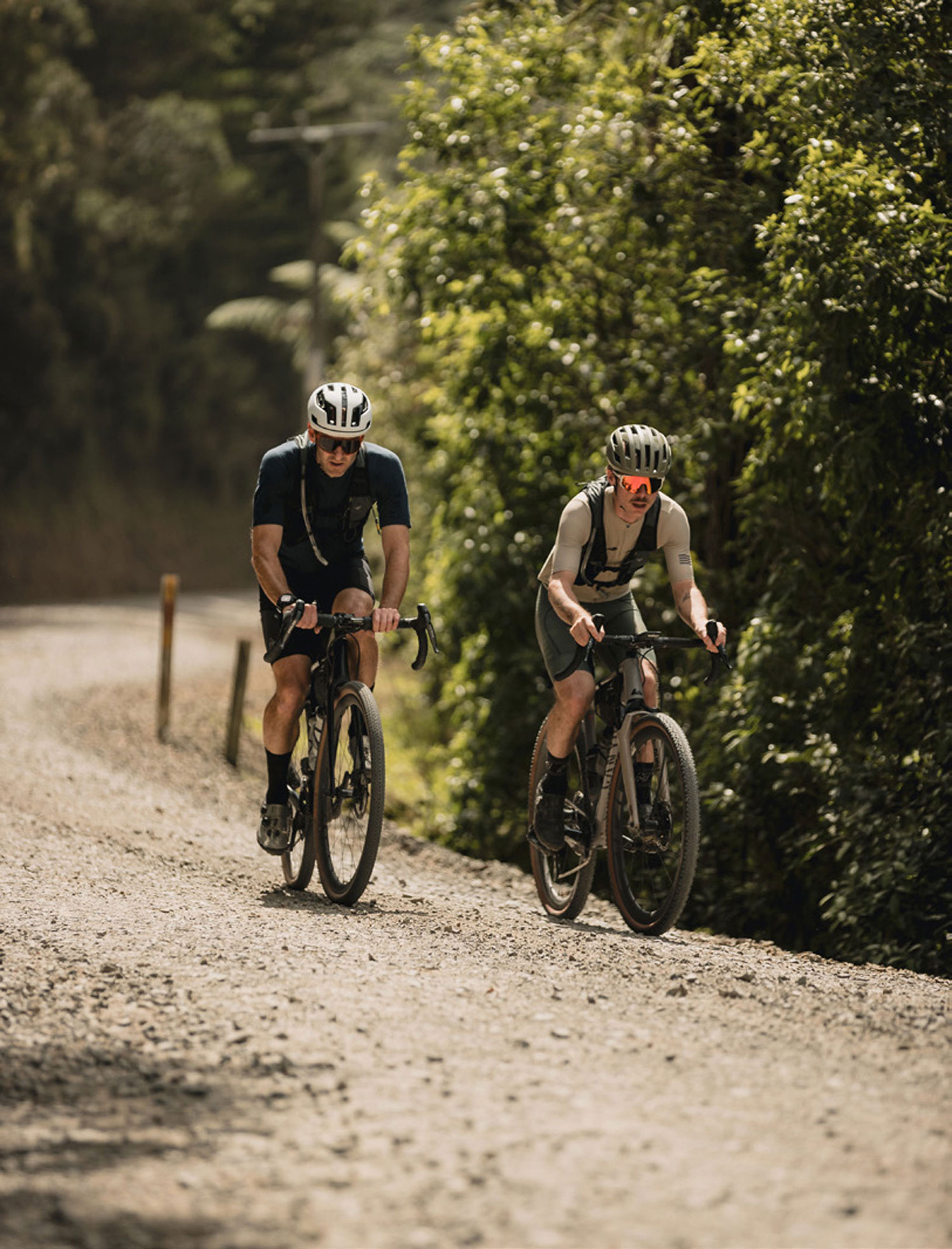
Continuing on pavement, we began to head west toward Coromandel again. Having ridden these roads several times in the now defunct ‘K2’ cycle race, I knew we had some taxing climbs ahead. Our priority being the sunset, we pushed on with fervour. Grinding our way over Kuaotunu hill towards Whangapoua, we were becoming increasingly conscious we had no lights on our bikes. As the sun dipped low in the sky, we decided the sensible thing was to hop a ride and load our bikes into a vehicle; making haste to the top of Whangapoua Hill. This would ensure we (hopefully) made it in time to enjoy the sunset in all its glory, allowing just enough light to safely bomb the descent into Coromandel for dinner.
Watching the sun go down from the lookout atop Whangapoua hill, the frustration and dirty feeling of having to drive to the top was washed away by seeing the stunning sunset in what I can only describe as a surreal and world-leading setting. The land below us was lit in orange hues as the sun’s rays reached inland from out at sea, over the islands to the shore, igniting Coromandel town and flickering up the hill to meet us, perched in awe at the top. Amazing. We dropped into the descent – it’s a thing of beauty. The black serpent hugging the right-hand side of the hill, a perfect tarmac surface and gradient that just screams “faster”. It’s not one for the careless though, with successive 25km/hr corners it would be easy to overcook it!
Arriving just on dark at the Star and Garter pub, we were ready for a big meal, our earlier handful of chips just didn’t cut it. We hobbled in, somewhat sweatier and crustier than our stop at Luke’s earlier in the day. The publican didn’t bat an eyelid at our state, just casually handed us some menus and asked what we were drinking. Hearty meals all around and we were ready for some shut-eye in prep for a big day in the saddle the following day.
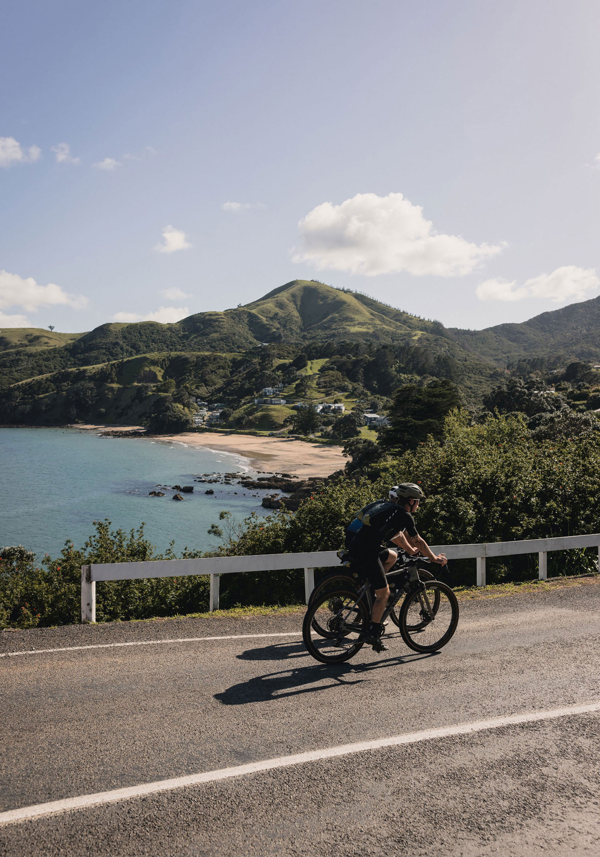
DAY TWOHUGGING THE COASTLINE, THE POT-HOLE-FREE SURFACE HAD BEEN RECENTLY GRADED, WITH ROLLING SPEED NOW CLOSE TO THAT OF A SEALED ROAD, WE CRUISED EFFORTLESSLY ALONG BENEATH THE HUNDREDS OF POHUTUKAWA TREES PATIENTLY COUNTING DOWN THE DAYS TO THEIR CRIMSON RED PRE-CHRISTMAS BLOOM.
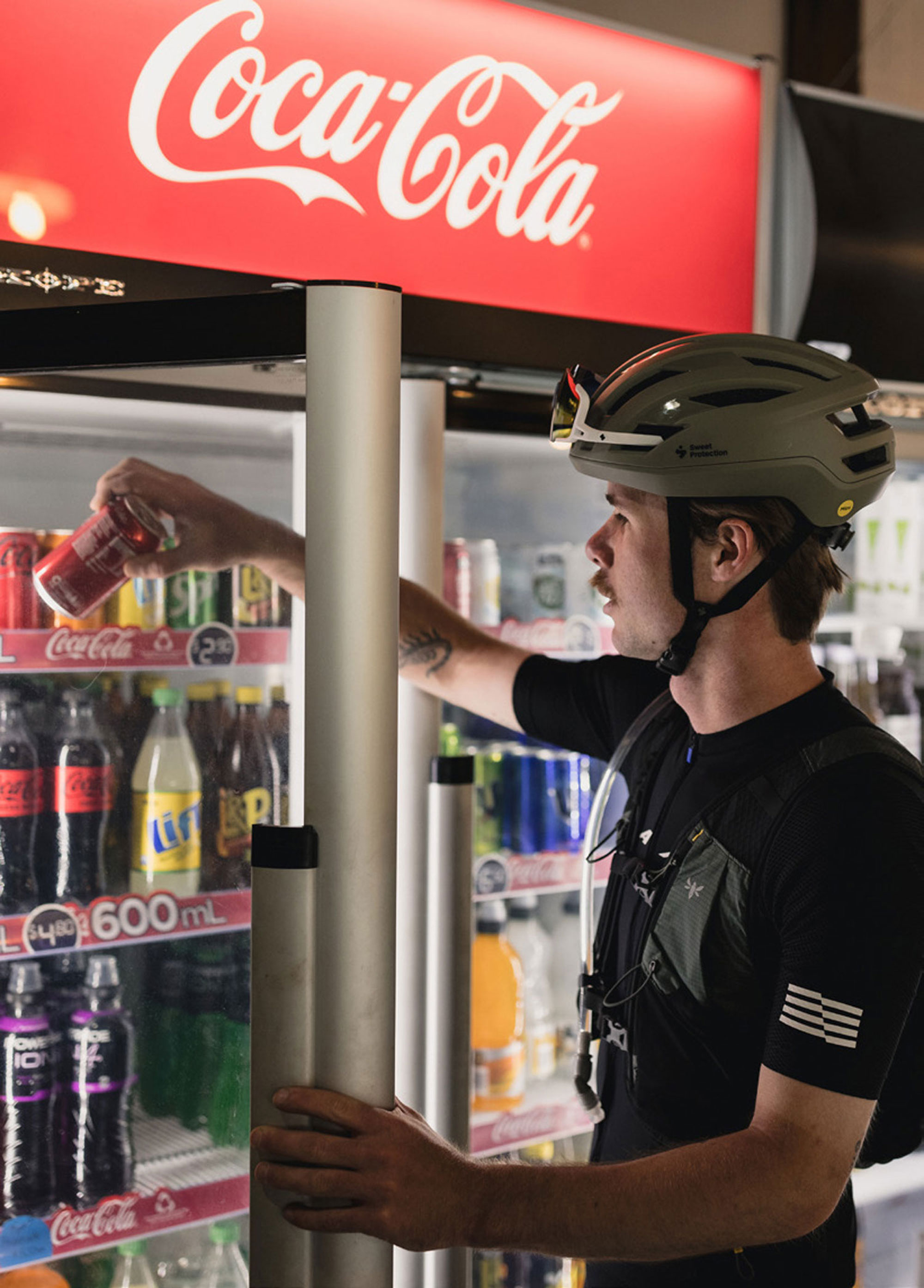
Starting our day early, we shot through from our Shelly Bay base to Coromandel town for breakfast. Here’s where we learned another valuable lesson – if you’re relying on a cafe for breakfast, don’t trust their advertised hours and always have a backup plan! We rocked up to more than one cafe during their ‘opening hours’ to find doors closed and no one around. Thankfully, the local Four Square was a hive of early morning activity and sorted us out with fresh pastries, granola pots and Up and Go. Fortunately, we found decent quality coffee just across the road at The Naughty Bean.
Adequately caffeinated, we loaded our bike bags with enough snacks for the day and got stuck into the job at hand. The warm morning sun blanketed the roads ahead as we pedalled our way up the Western coast of the peninsula. Making quick work of the tar-sealed section from Coromandel to Colville, we marvelled at the rolling hills and mentioned how fortunate we were to have the weather gods on our side.
A quick stop at the Colville General Store and Jakob was reaching for a 9:30 am can of Coke. Our pace was either too hard too early, or so sedentary that he needed more caffeine to simply stay awake.
Five minutes later, after a left turn towards Port Jackson, we were on the gravel. Hugging the coastline, the pot-hole-free surface had been recently graded, with rolling speed now close to that of a sealed road, we cruised effortlessly along beneath the hundreds of Pohutukawa trees patiently counting down the days to their crimson red pre-Christmas bloom.
Heading north, the number of high-end palatial houses with multi-million dollar views dwindles, replaced by all manner of self-built holiday spots and full-time ramshackle abodes. It seems the further north we go, the less the building code applies. I wonder if the joke is on all those who adhere to the rules – most of these makeshift, off-grid spots have the best views.
Forty-five kilometres into our morning, the Ohinewai Stream drops from the hills beside, intersecting the road with a well-formed concrete ford; we manage to keep our feet reasonably dry, just enough splash to help keep the warming temperatures at bay. The water looks clean but with a large herd of stock swarmed beside the water higher up, I certainly wouldn’t be topping up my hydro-pack here.
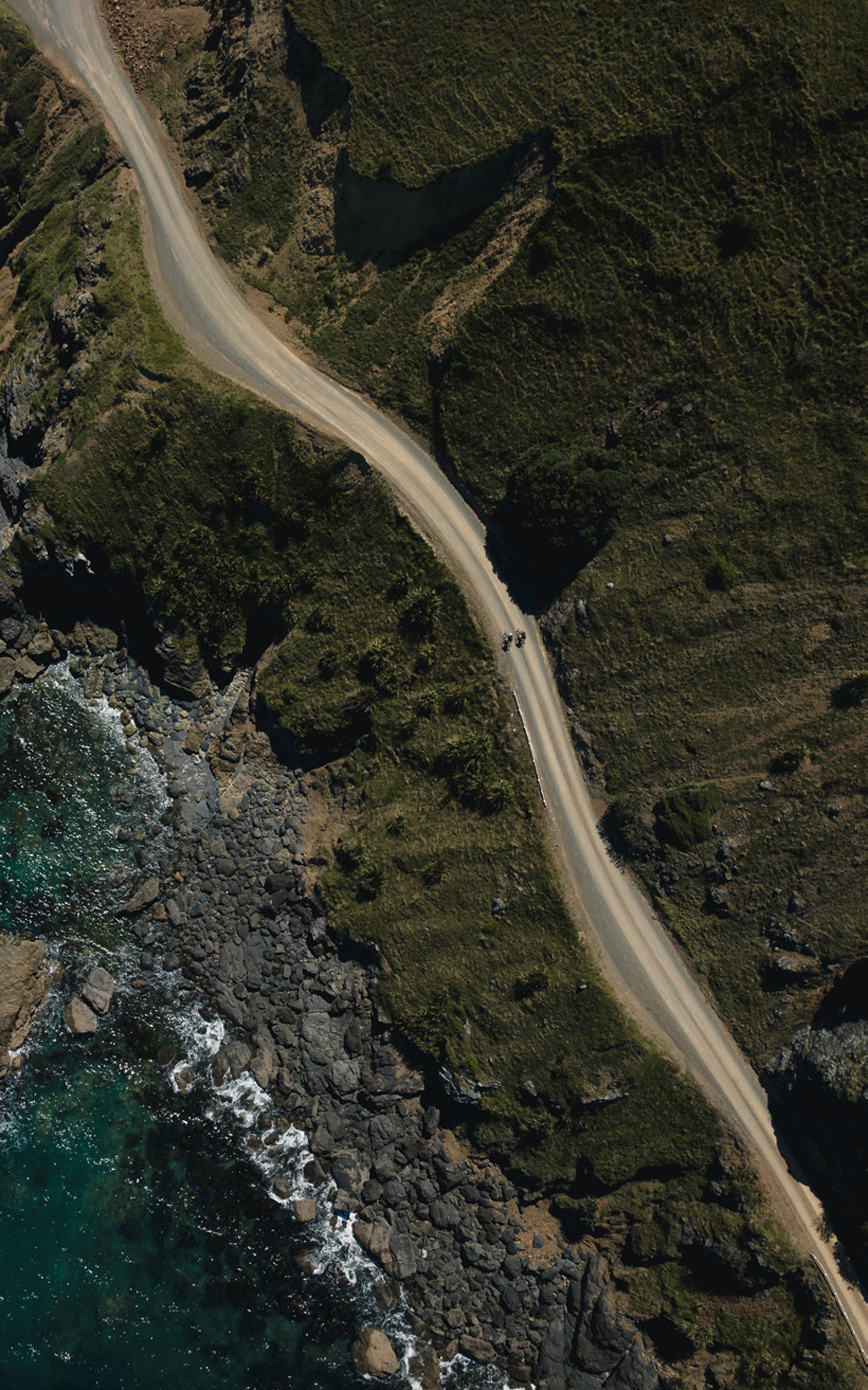
The road accessing the northwestern bays of Coromandel is balancing a fine line in areas, between having a landslide from above come down onto it, and the road itself slipping away into the ocean on the left. Either would render access north near impossible.
As we pushed north, the road elevation between each bay kicks up, meaning some nuggety little climbs but descents just long enough for reprieve. The views from the high points were simply stunning. Not far north of Fantail Bay, we were on one such bluff, looking out across the Hauraki Gulf to Kawau Island when we heard a motorbike coming in the opposite direction. The quadbike slowed and its driver gave us a slightly puzzled look. It’s not surprising – we were far from anywhere and on skinny-tyred bikes with drop- bars, after all. “You guys might want to give it ten minutes, there’s a truck coming down the road,” he offered. With that brief one-sided interaction, he was off, leaving a plume of dust in his wake.
AS WE PUSH NORTH, THE ROAD ELEVATION BETWEEN EACH BAY KICKS UP, MEANING SOME NUGGETY LITTLE CLIMBS BUT DESCENTS JUST LONG ENOUGH FOR SOME REPRIEVE.

HITTING THE FLAT COAST ONCE AGAIN WE’RE SURPRISED AT HOW MANY VEHICLES WE’D SEEN ON THE EAST COAST COMPARED TO THE WEST COAST WE’D PEDALLED EARLIER IN THE DAY. IT’S EASY TO TELL WHICH SIDE OF THE PENINSULA SEES THE MOST PEOPLE.
Minutes later, right on cue, the truck rounded the bend we were stopped on. This wasn’t any small, Budget Rental, hire-for-a-weekend, tipper deck- type truck…. this was a monster cattle truck, fully loaded. We sure wouldn’t have had much space to get around it on the bikes had we met it without prior warning. The nervous look on the driver’s face confirmed our assumptions that this road would have been no fun for anyone in his position.
Grinding our way over the pass toward Port Jackson, just three hours since we embarked, the heat of the day was kicking in and we stopped at the top to look out, stuffing our faces with sugar-heavy snacks as we took in the view. With little knowledge of what was still to come, it was a daunting feeling knowing we weren’t even halfway into the day.
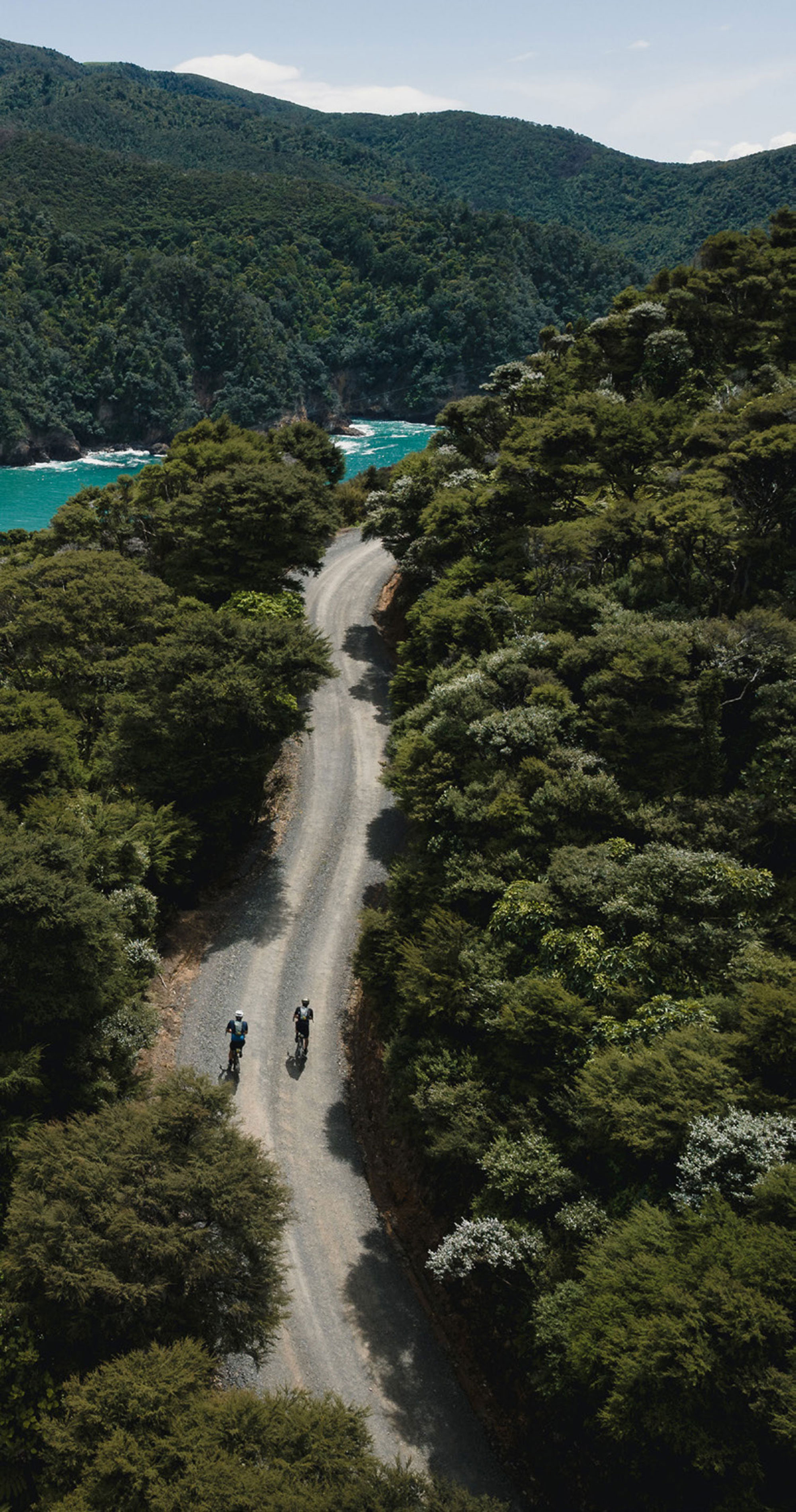
We pushed on, over the final pinch of gravel to Fletchers Bay; the road narrowing even more than previous, seemingly petering out to a grass track as we dropped the final metres and onto the Fletchers Bay beach. Some quick photos, then we departed Fletchers Bay, climbing over a fence stile onto a grass track at exactly 12:12 pm, marking the end of our morning on well-formed gravel roads, and beginning our next chapter into an afternoon where we weren’t quite sure what to expect. Ten years ago, during the Colville Connection, I’d ridden from Stony Bay to Fletchers Bay via the DOC coastal walking track; an 8.5 km undulating stretch with roughly 400m elevation climbed. This track was now an out-and-back affair from either end, with the severe weather events of the previous year having washed sections of the track away. According to the woman who had made our coffee that morning, the largest slip was completely impassable. Word over the brew was that it may never reopen due to difficulty getting machinery in to repair the slip. Our preferred route from Fletchers to Stony Bay was now not an option and we were forced to go via the “DOC Mountain Bike Track”.
The mountain bike track follows the walking track for about a kilometre from Fletchers Bay, then hooks off as you pass a dilapidated tin shed, followed by a short pinch, a quick lefthand switchback, then it’s all upwards from there to the top – some 450 metres above you at an average gradient of 15%. Dispersed by some mellow, almost flat sections for a few metres, each adjoining pitch began with us in our easiest gear, though only for a short time, then I’d dismount and begin my push while Jakob would continue the knee-exploding grind as long as possible until inevitably the effort became too much and he too dismounted. From the Fletchers Bay fence stile to the top of the ridge took us just under an hour. Had we been on actual mountain bikes with a wider range of gears, we could have gone quicker but probably not by much – it’s a haul for sure.
The descent into Stony Bay proved to be almost as much of a challenge as getting to the top. A 3.7km mainly hardpacked red-clay 4×4 track drops you 500m down to the shore. Again, this section would be much easier on a mountain bike, but on the skinny tyres and with a hint of moisture in the dirt, we were walking a fine line of traction and braking. I’m not too proud to say self-preservation had me dismounting over a couple of sections; the risk vs reward calculation just not adding up. Descending through regenerating native bush, the trail eventually levels out; we crossed a stream and closed the page on that chapter of our travels, glad to have it behind us.
A beachside stop to take in another couple of handfuls of snake lollies, a pack of salt ‘n vinegar chips (you know, the real good Wakachangi ones) and a couple of Pop- tarts and we were back on the road.
Having stopped and chilled for 15 minutes, the climb out of Stony Bay put a sting in the legs and Jakob and I both commented that we were beginning to feel the fatigue of the day. The dusty grind up the hill was rewarded by a great descent into Port Charles, though. Hitting the flat coast once again we were surprised at how many vehicles we’d seen on the east coast compared to the west coast we’d pedalled earlier in the day. It’s easy to tell which side of the peninsula sees the most people.
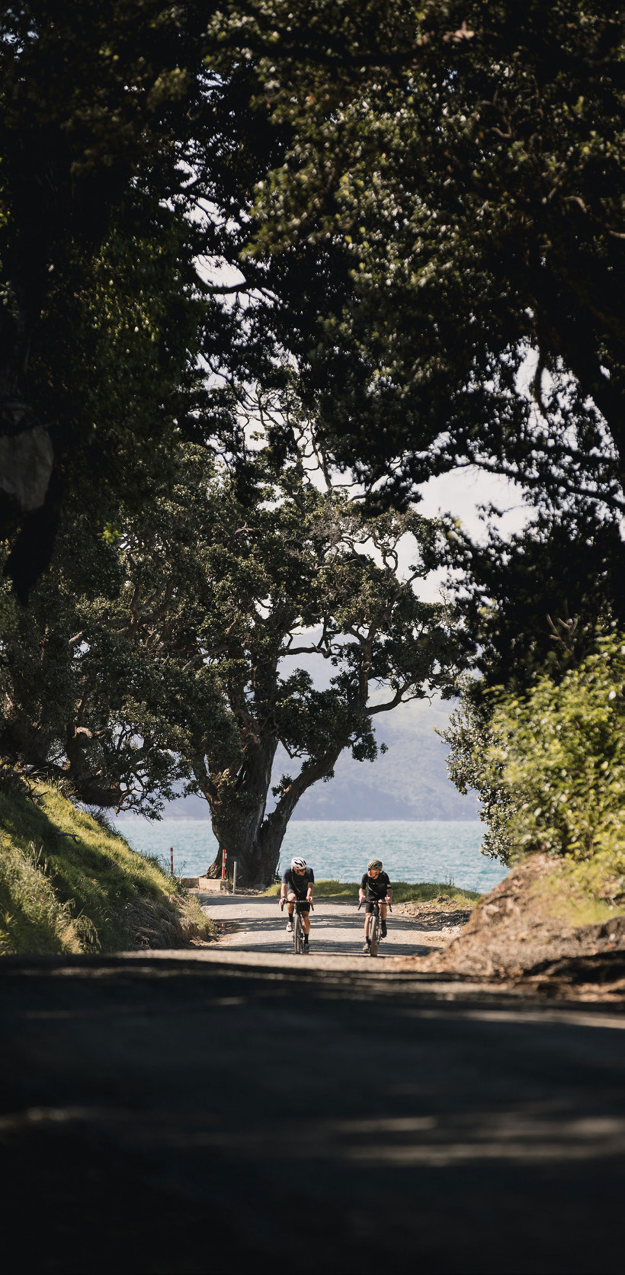
We paced on, leaving Port Charles in our dust and entering a section of lush native bush. The road kicked up once again, yet another reminder that our legs had lost their spring. We left the Port Charles road behind, veering left onto Waikawau Road and, to the relief of our tender rumps, some smooth pavement for a quick minute or two.
BIKES BREAK DOWN BOUNDARIES, BRING PEOPLE TOGETHER, AND ARE JUST A DAMN GOOD EXCUSE TO EXPERIENCE THIS AMAZING COUNTRY OF OURS IN A WAY THAT ONLY THOSE WHO’VE EXPERIENCED IT IN THIS WAY, WILL EVER TRULY UNDERSTAND.
Day Two Ride StatsTOTAL DISTANCE 125.71KMTOTAL ELEVATION 3,078MMOVING TIME 7HRS, 4MINS
Continuing towards Waikawau Bay, the landscape changed to barren farmland for a spell. Spotted with the odd cluster of Nikau Palms, its flatter terrain brought relative relief to our climbing- hardened legs. Reaching the bay, we were once again rewarded with some sealed road – but only for a few minutes. The relief was short, though, as we quickly embarked on another 200-plus metres of vertical gravel climb. At the summit of the Tuateawa Road climb, we ticked over 100km, 2560 metres of climbing and five and a half hours of riding time since we’d embarked on our journey. Our route was only 125km in total, so surely we were on the downward slide to the finish line?
Cruising through Kennedy Bay, I was amazed by how low-lying the houses are. There are some amazing and unique houses right on the water’s edge, although, there’s evidence of a recent high tide depositing driftwood on the edge of the road and surely a king-tide or climate-change- induced sea level rise will render several houses in the area unliveable in a matter of years.
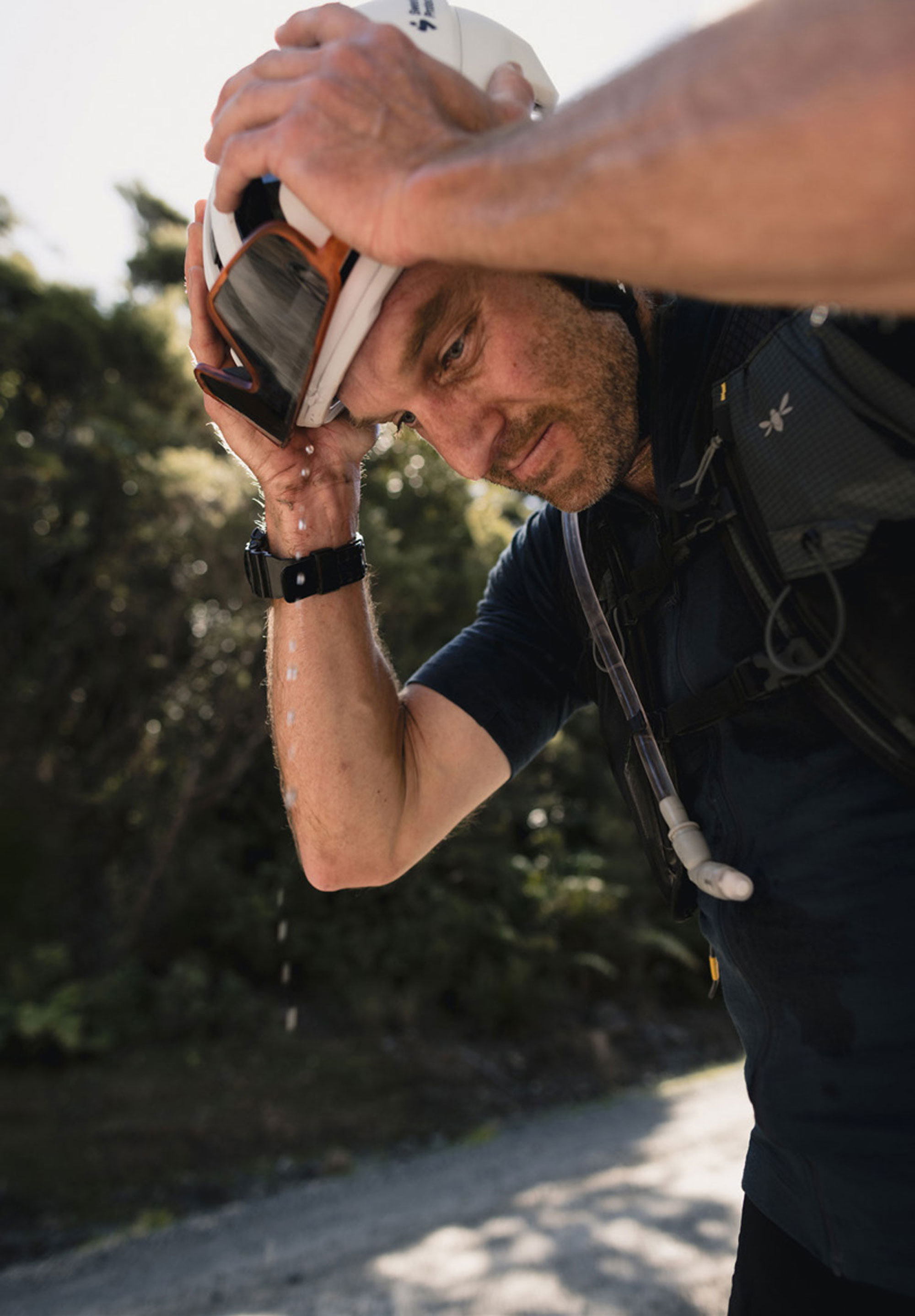
We moved onto tar-sealed roads and traded pulls, Jakob’s longer than mine, towards the crux-move of the day: the infamous Kennedy Bay climb. The climb ridden singularly would be painful enough, but with over 110km of largely gravel, and 2700 metres vertical in the legs it may as well have been an Everesting attempt (for me at least!). The climb begins on the seal and only rises gradually, lulling you into a false sense of security. Just as you begin to think, ‘I’ve got this’ – the gradient steepens; the seal turns to gravel and it gets very real, very quickly. We provided some entertainment for the groups of road workers dotted along the climb, who’d freshly watered the road leaving it pretty puggy and slow. “You going to ride all the way up?” one called. “Let’s see how the legs go!” I replied, no energy for a smarter quip and, at that stage not honestly sure I’d make it without a break. Spotting a strange hole in the side of the bank beside the road, I swung over – this was the perfect time for a quick break in proceedings and I was looking for any excuse! About half the size of a regular door, I crouched through the opening to discover the hole went horizontally back into the hill about ten metres, then opened up to a 7-foot high ‘igloo’ shaped cavern at the end. I think it has something to do with draining water from within the hill above during heavy downpours, but I haven’t found any evidence that this is the case, so it could just be an alien hideout, not too sure. Whatever the case, it’s bizarre to say the least, although a handy spot to take shelter or have a breather whilst climbing that damn hill!
Jakob danced away from me on the upper slopes and put a few minutes into me by the summit. After a round of high fives and a can of Coke – which, in hindsight, I should have had before the climb – we descended our final hill towards Coromandel Town, returning again to where we’d set off It seemed like we’d only been gone a couple of hours but, at the same time, it felt like we’d been gone a week; our brains were full of all the little moments which, combined, made for the epic day we’d just wrapped up.
As we sipped cold beers on our finish line, a restaurant deck – by far the most underdressed, dirty and smelly of all its patrons – we reminisced our two days “up the ‘Mandel”. What struck me as we sat there, is that although Jakob and I had only met the previous day and have very little in common in our wider lives, our shared passion for bikes – and the journeys they enable us to take – was common enough ground to form a bond that allowed us to have two unforgettable days together. Bikes break down boundaries, bring people together, and are just a damn good excuse to experience this amazing country of ours in a way that only those who’ve experienced it in this way, will ever truly understand.