
Words Liam Friary
Images Cameron Mackenzie
ESCAPADE (NOUN);
AN ACT OR INCIDENT INVOLVING EXCITEMENT, DARING, OR ADVENTURE
As the seasons changed and the days grew longer, I started daydreaming about riding trips. I was distracted from whatever I was supposed to be doing, building a perfect route. It would connect two southern regions: Waitaki and Otago; traverse high country passes, intersect gravel roads and cycle trails and, perhaps most importantly, the route would connect some historic backcountry pubs as well. I vaguely plotted the bikepacking trip to take around three days. I kept things a little flexible with regards to the accommodation – there’s a heap of options in these regions. Also, you don’t always know what you’ll encounter en route, so having absolute distances to cover can be a little stressful. For me, it’s best to be a little fluid and just see how everyone on the trip is feeling throughout the days of riding. It’s about breaking away from the regular structure of life and into the realm of spontaneity.
DAY ONE;
The lure of this iconic and diverse region always grips me. This was a scratch I really needed to itch, so I made plans to make it happen. I roped in a mate, Andrew Pike, who didn’t hesitate to commit when the call was made. As they say down these ways: ‘good on ya mate.’ The weather wasn’t really on our side as the Radio New Zealand news announced there would be showers, high wind, and snow freezing level to 1200m for the next forty-eight hours. This was spring deep in the South Island after all, so we ensured our woollies, Merino, jackets, gloves, hats, and a good dose of courage were packed.
The trip went from being a distraction, to a reality. A lengthy commute by plane and car got us to our start destination of Duntroon. For most of the transit we were listening to the Rugby World Cup quarter final: All Blacks vs Ireland. It’s amazing when you listen to coverage on the wireless as you need to imagine what’s going on rather than seeing. The atmosphere at the game could be felt in the vehicle, even as the patchy reception dropped in and out. The snow on Lindis Pass was beautiful to witness, however, when we jumped out of the warm truck into the freezing temps, I did wonder: how could we be riding in this?! Luckily, as we made our way down Waitaki Valley, the snow cleared and gave way to pockets of sunshine.
It’s about the journey and exploring places you wouldn’t normally venture – the bike helps you take it all in at a human pace.
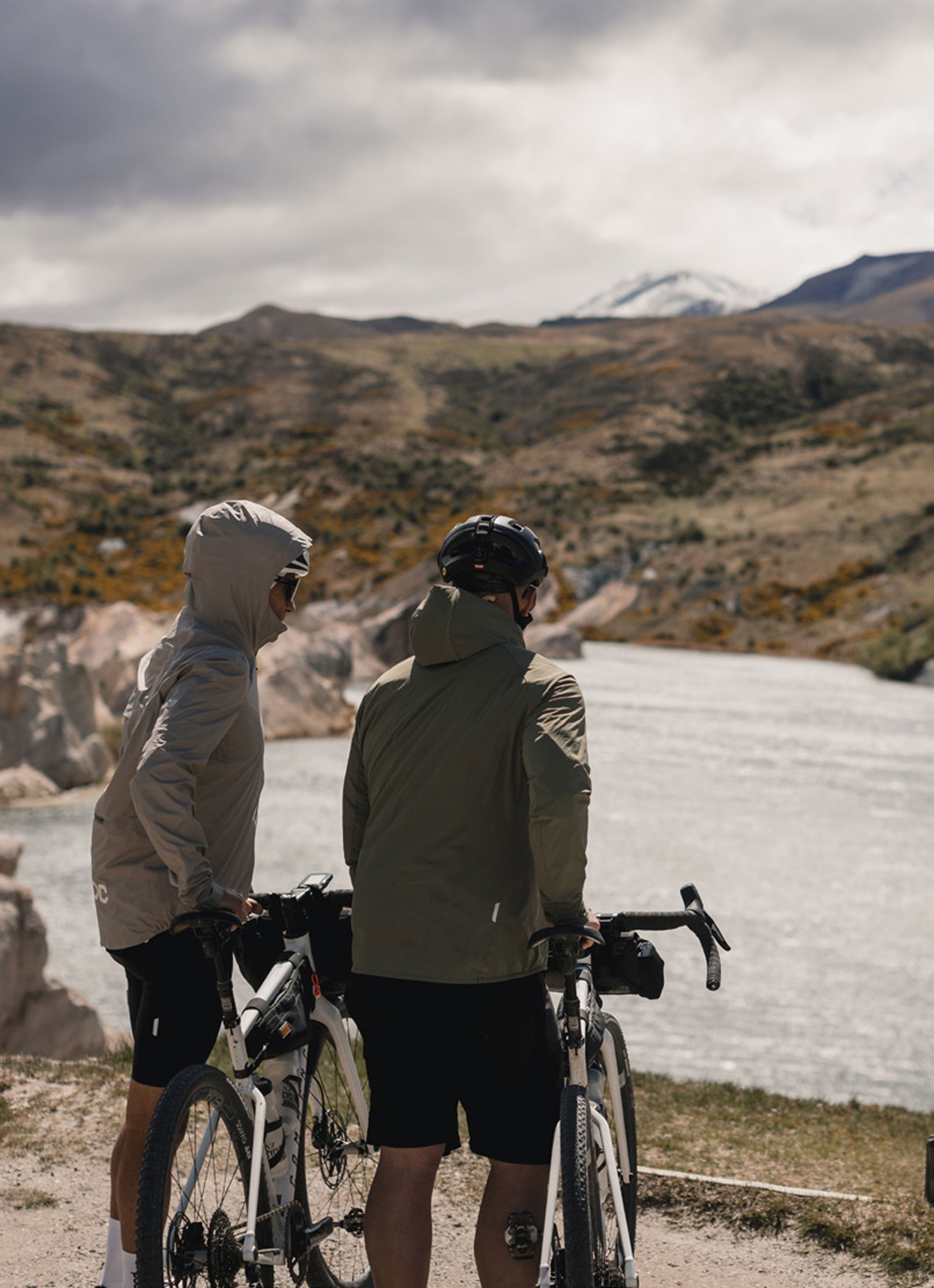
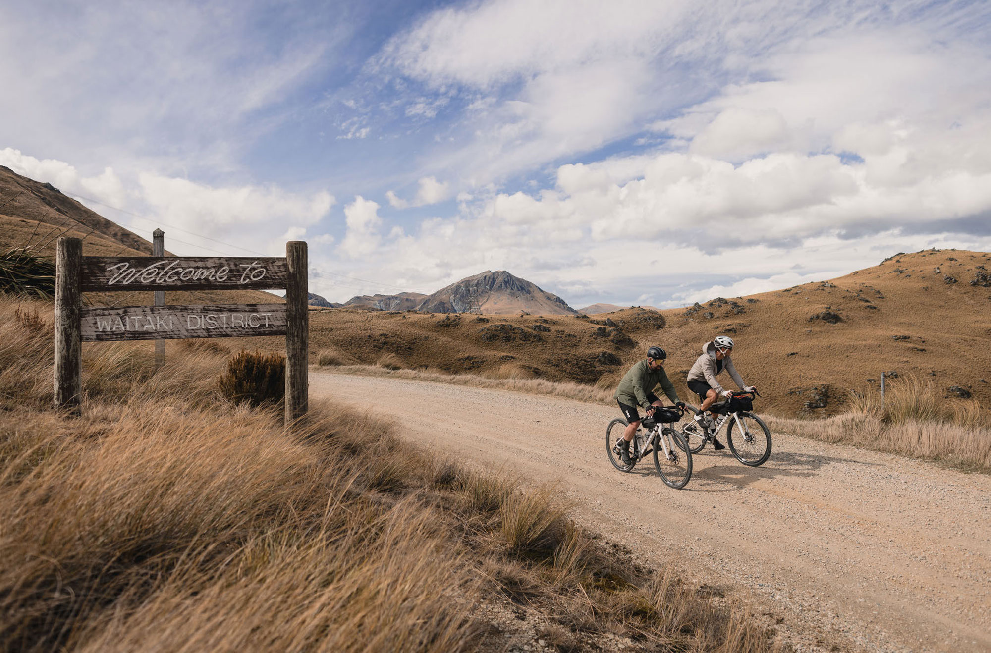
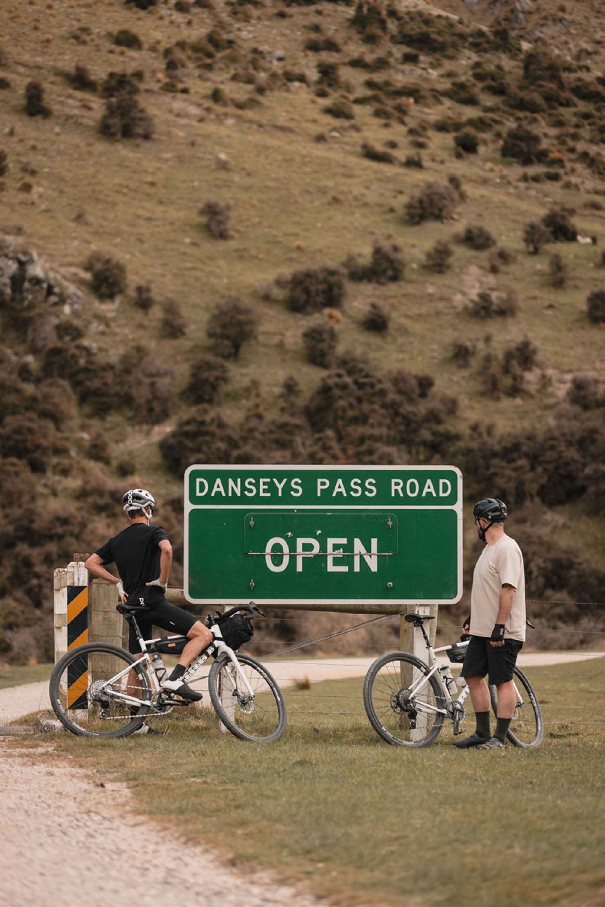
Duntroon is a small farming town, and would be the start of the border run from Waitaki into Otago – we’d eventually finish in Cromwell. The three-day bikepacking journey would have us overnight in Naseby and Clyde…. if everything worked out. As mentioned, the route was marked out, but I always allow for detours and deviations with most of these trips. It’s about the journey and exploring places you wouldn’t normally venture – the bike helps you take it all in at a human pace.
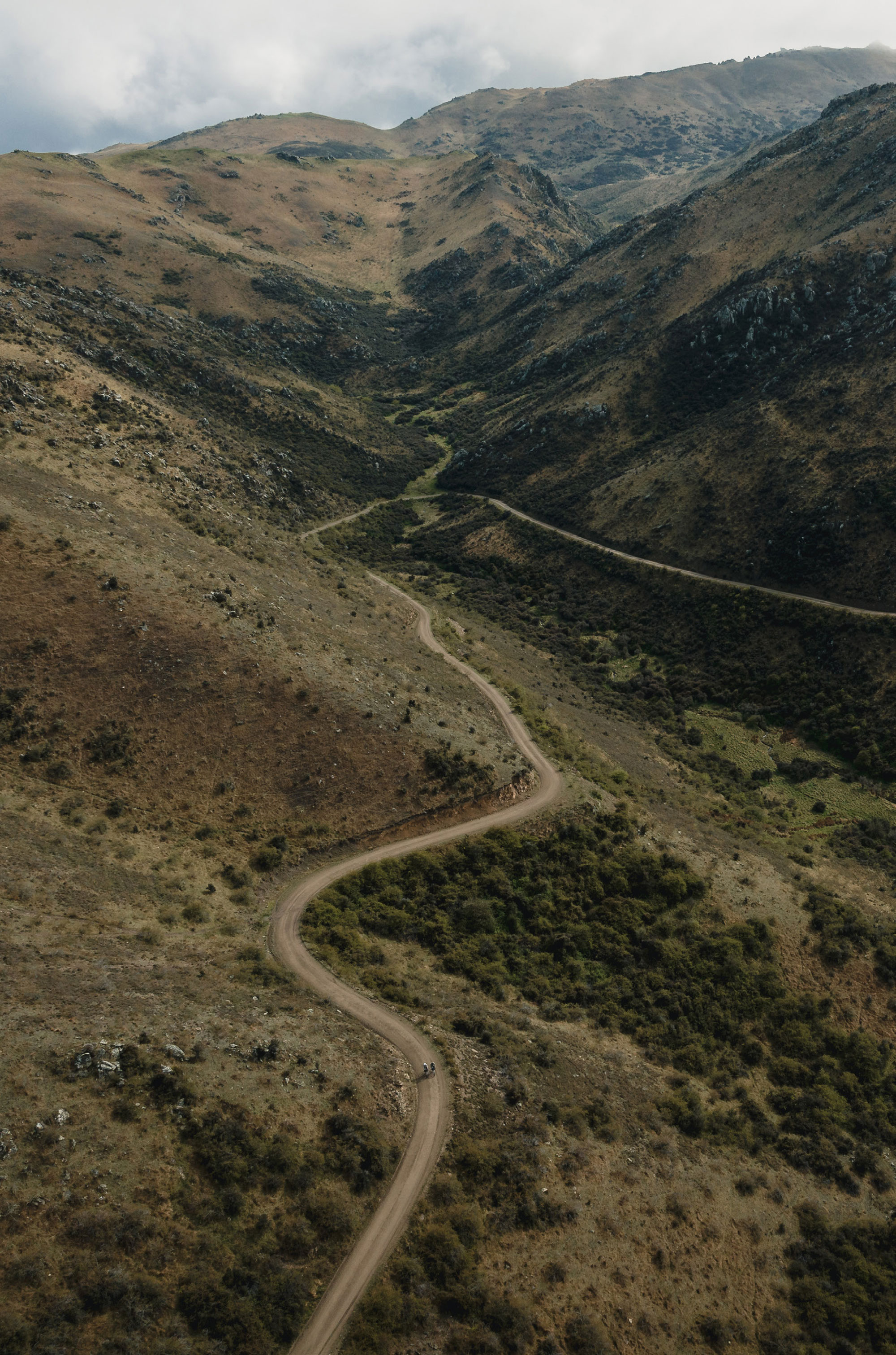
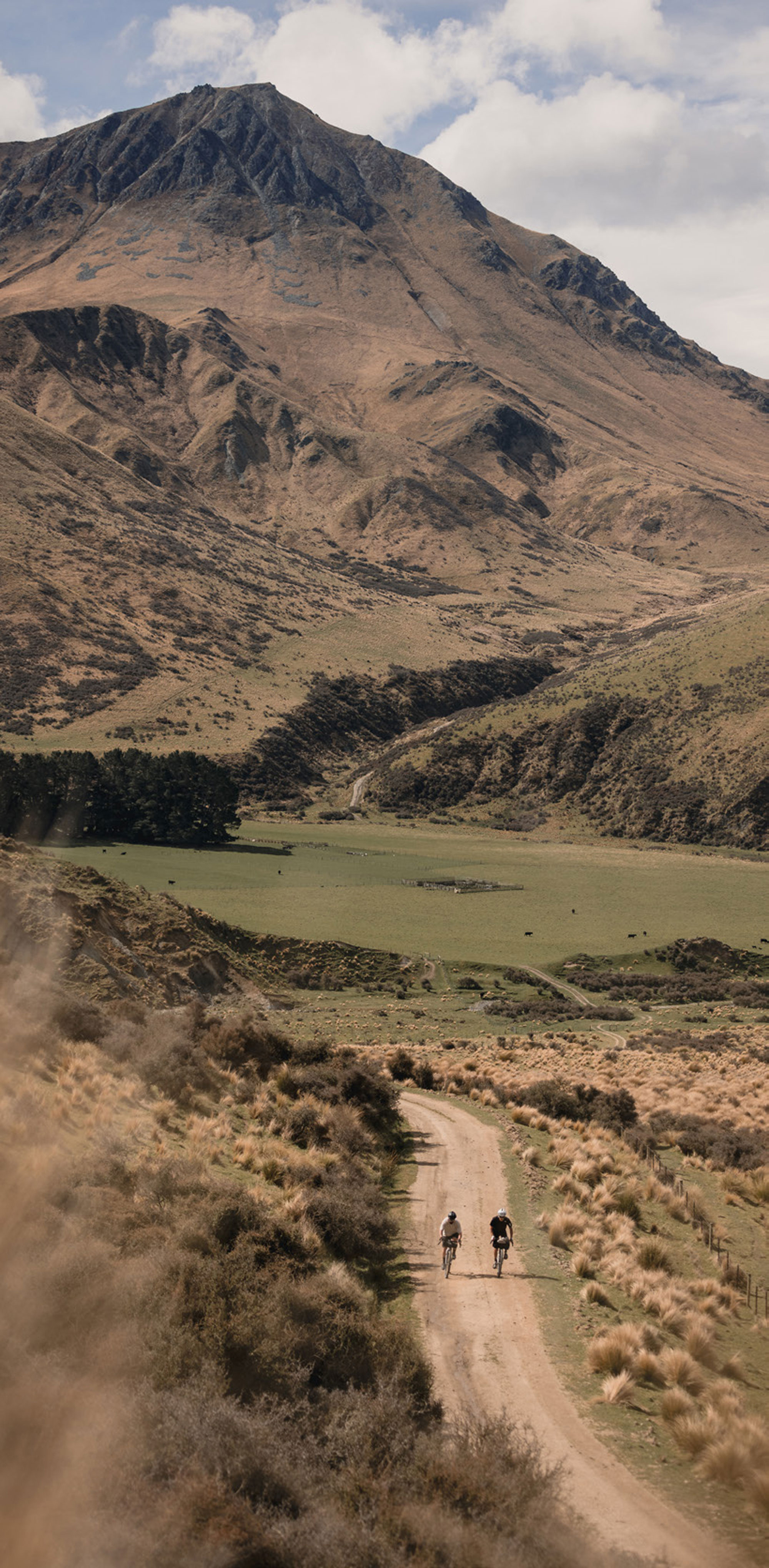
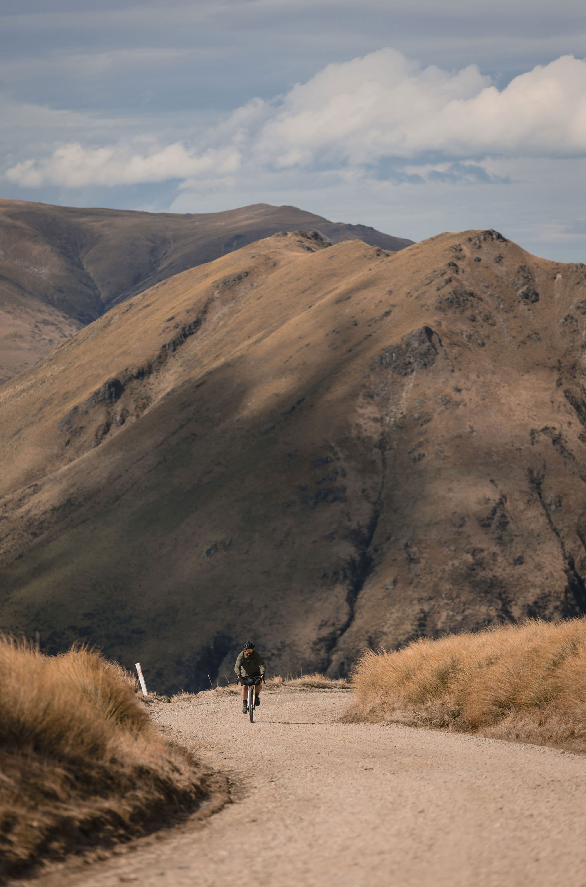
Bikes unloaded, bags mounted; we changed into some riding attire and pushed off. The route out of Duntroon led us to Danseys Pass Road. Large dairy farms were flanked by the high mountains that loomed in the distance, with a fresh dusting of snow. It wasn’t long before we had to stop for cattle crossing on the road – it didn’t really matter as we weren’t in any rush. A quick wave to the farmer then we were on our way again. Dark clouds on the horizon turned into a brief shower as we started to gradually climb. The pedals got harder to turn as the road wound its way out of the valley floor. I looked up to the golden peaks that we’d need to somehow navigate over and around, and realised this would be a tough pass.
Danseys Pass (935m) is a mountain pass located in the Kakanui Range. The pass itself is located at the boundary of the Waitaki and the Central Otago districts. The road lies between the Maniototo Plain (part of the Taieri River water catchment) and the northern foothills of the Kakanui Mountains (part of the Waitaki River catchment). Much of the road going over Danseys Pass is unsealed and is occasionally cut directly from the Haast schist bedrock. The road was built for the owners of large sheep runs, brothers Allan and John McLean.
We must have been a few hours in and had already gone up and down and up again a few times. The countryside became more isolated and barren. After passing one farmhouse that gave us a good wave, we pulled up for a snack and drink. Sustenance was needed as this was the start of the actual climb that would take us up and over, into Otago. It would be exposed, and the afternoon wind was starting the blow. The climb didn’t relent and as we inched towards the summit it got steeper and steeper. The views were impressive…. if I could only see past my suffering. The steep gradient and loose gravel meant for sustained seated power. We both stopped to put on another layer as the temperature dropped, figuring it was better to grab another layer before we got cold, knowing it would be needed on the descent. The summit greeted us to views all the way to the east coast and right up to St Bathan’s Range. The road snaked down ahead of us and we didn’t hesitate to bomb down. After all, the lure of our first historic pub, Danseys Pass Hotel, wasn’t far now. The wind howled up the descent, but we pushed the pedals as hard as we could against it. Craggy rocks overhung the road with the Kyeburn River ravine running beside us.
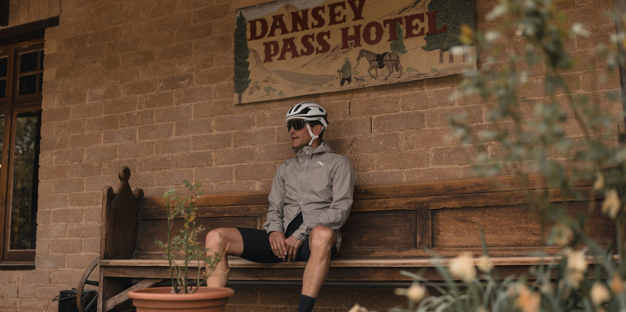
At last, the entrance to Danseys Pass Hotel appeared. Located deep within the Kyeburn Diggings, the hotel has a colourful history traced back to the 1860’s, when it serviced a multicultural gold-prospecting community of 2000. Teamsters with their wagon trains, plying trade between the Waitaki Basin and the Central Otago gold fields, used the Coach Inn as a topover when traveling on to the more remote gold prospecting areas of Central Otago. Teamsters with their wagon trains, plying trade between the Waitaki Basin and the Central Otago gold fields, used the Coach Inn as a stopover when traveling on to the more remote gold prospecting areas of Central Otago.
The Danseys Pass Hotel was built in 1862, with the original stonework constructed by a mason known as ‘Happy Bill’. Bill’s remuneration was in beer, and he received one pint for every schist boulder shaped and laid. Legend has it that, after a particularly busy day, the blithe craftsman fell into an open grave at the cemetery and slept the night away. Today, the Danseys Pass Hotel, standing at 600m above sea level, remains to remind travellers of the colourful history of the area and its community. At its peak, the population of the town was around 4000 miners and 18 stores, 14 hotels, two butcheries and a hospital were built to service the community.
There were farm Utes parked out front with ol’ mates yarning, a few dirt bikes being ridden by teenagers, and a couple of gents sitting on the veranda drinking tall Speights bottles. The historic building was something to behold, so we ventured inside to find a large space with a roaring open fireplace. I ordered a Speights and bowl of chips for both of us, and we plonked ourselves on the large couch in front of the fire. A few patrons were interested in our journey, so we got yarning. I was spent and could have stayed the night in this iconic hotel, however, we needed to push on a little more. Perhaps the idea of staying wouldn’t have been a bad option as within minutes of being back on our bikes we were riding into strong block headwinds. It was an unrelenting hour or so before we finally reached Naseby.
Teamsters with their wagon trains, plying trade between the Waitaki Basin and the Central Otago gold fields, used the Coach Inn as a stopover when traveling on to the more remote gold prospecting areas of Central Otago.
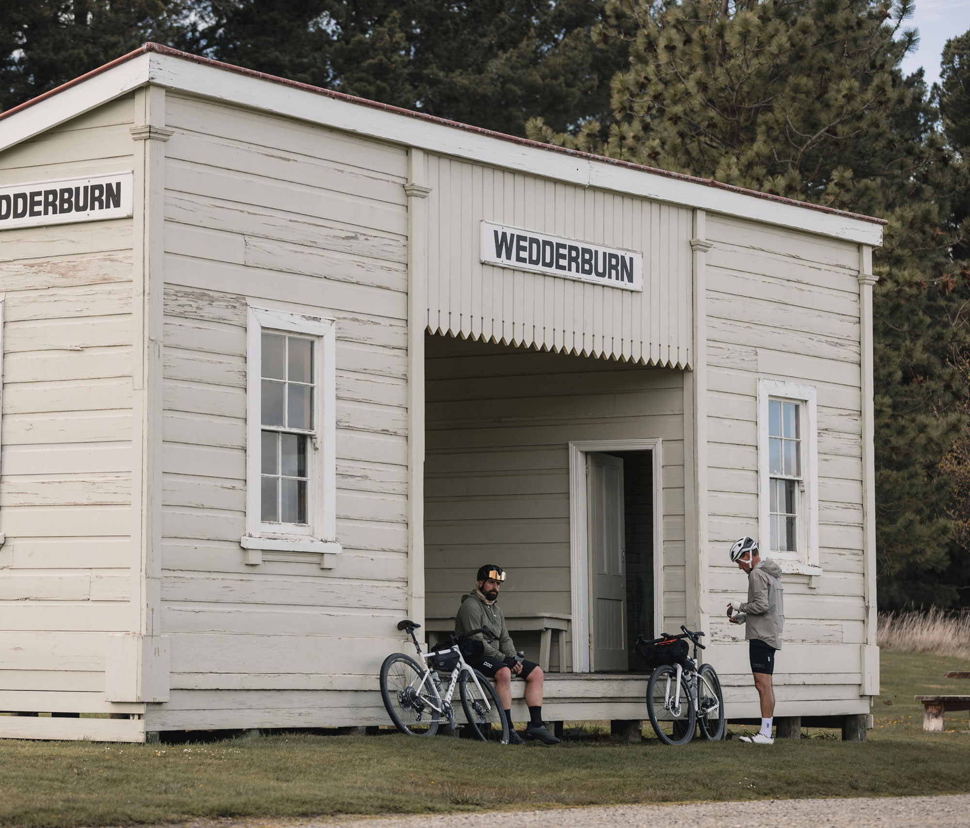
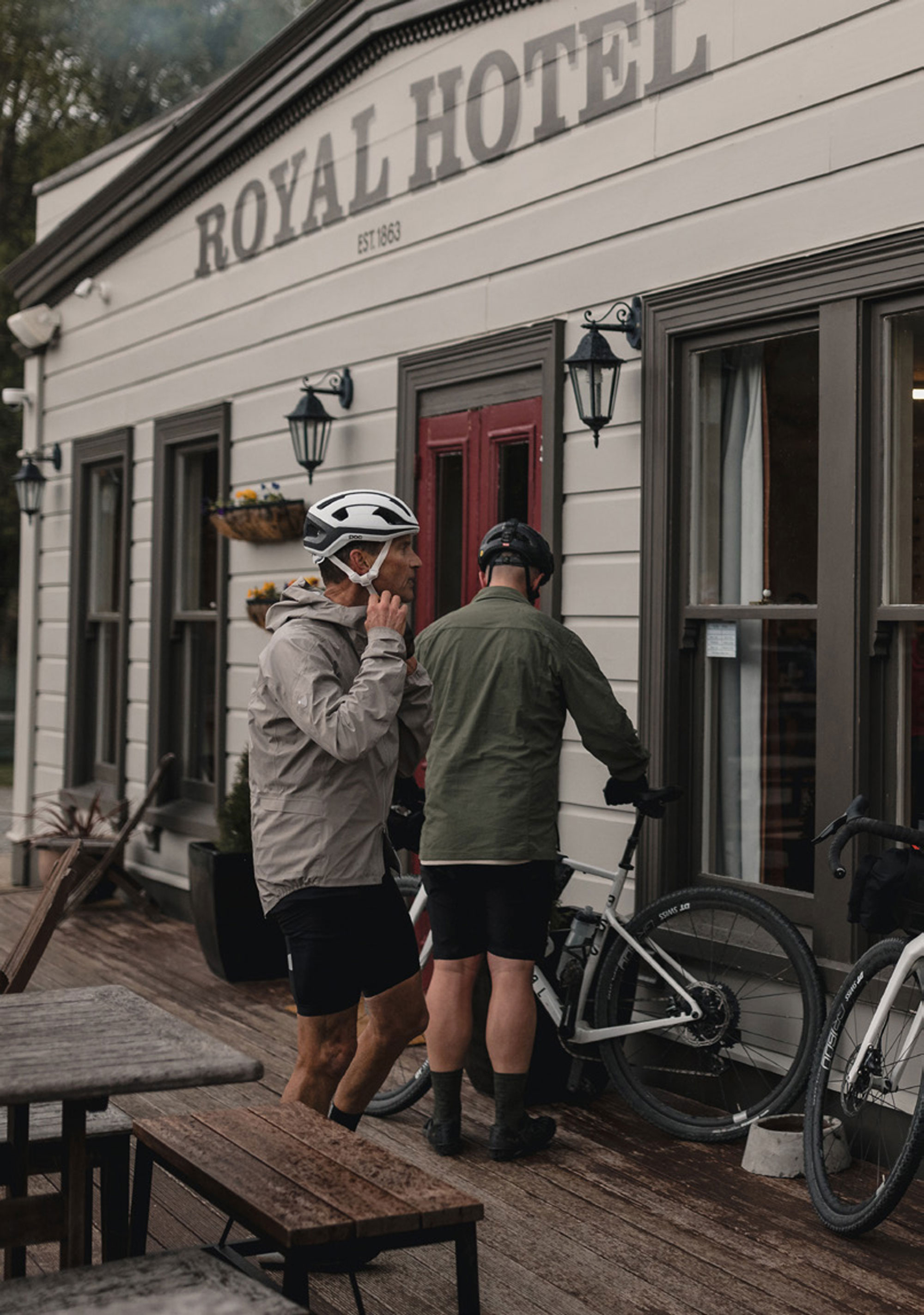
Naseby is a small town in the Maniototo area of Central Otago. An important township during the gold rush of the 1860s, gold was discovered in the Hogburn in 1863. At its peak, the population of the town was around 4000 miners and 18 stores, 14 hotels, two butcheries and a hospital were built to service the community. In 1898, a railway line was constructed 12km away, in Ranfurly, and as a result services gradually moved away from Naseby. By the time administrative boundaries were changed in the 1980s, it had become New Zealand’s smallest borough, with a population of around 100.
Our tired bodies could feel the temperature dropping as we reached this high-elevation town. The Royal Hotel sorted us out with some good country fare and beer. Again, some of the patrons were taken aback by where we’d ridden from and where we’d be heading in the days to come. The publican was kind enough to make a few calls and sort us out some digs in the old schoolhouse for the evening – there’s that southern hospitality!
At its peak, the population of the town was around 4000 miners and 18 stores, 14 hotels, two butcheries and a hospital were built to service the community.
DAY TWO;
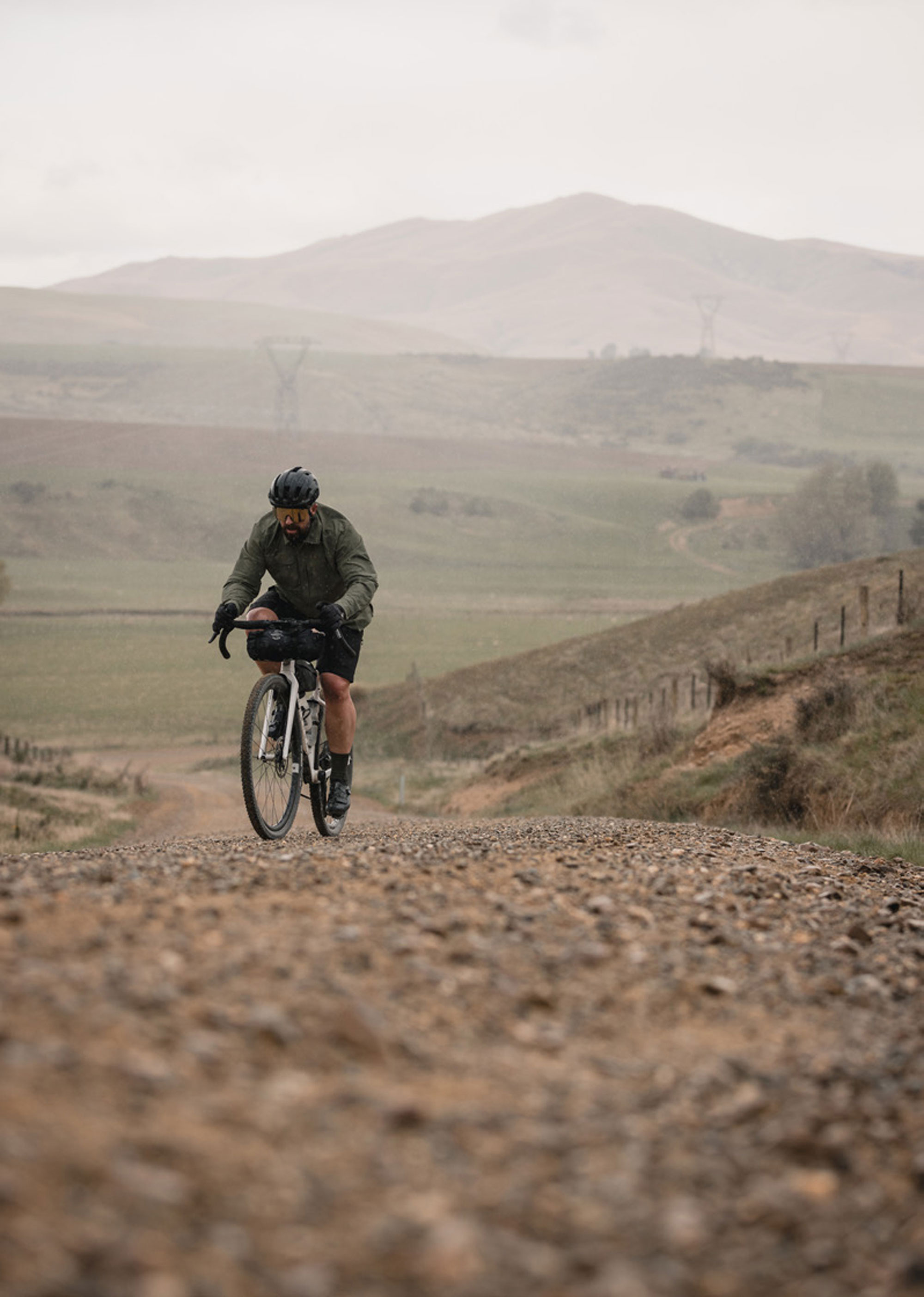
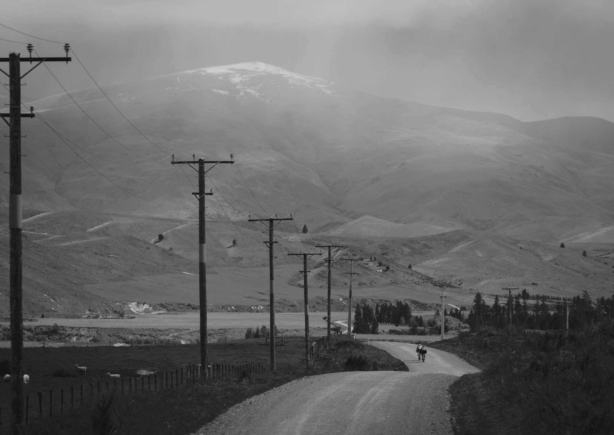
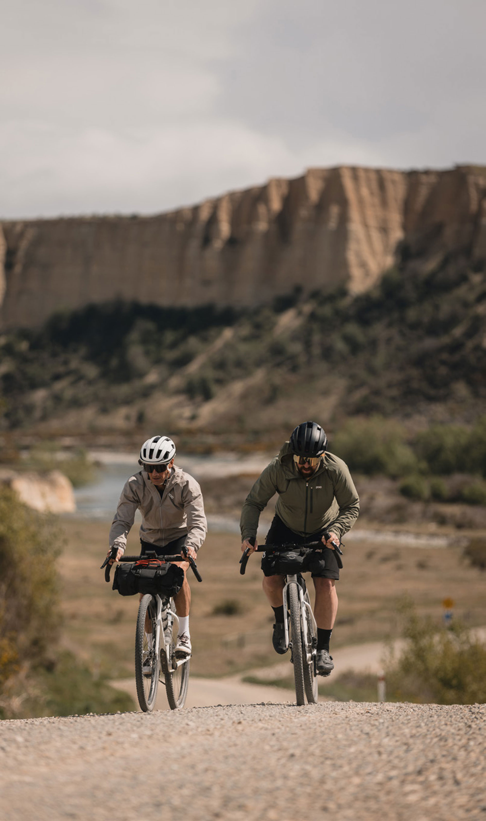
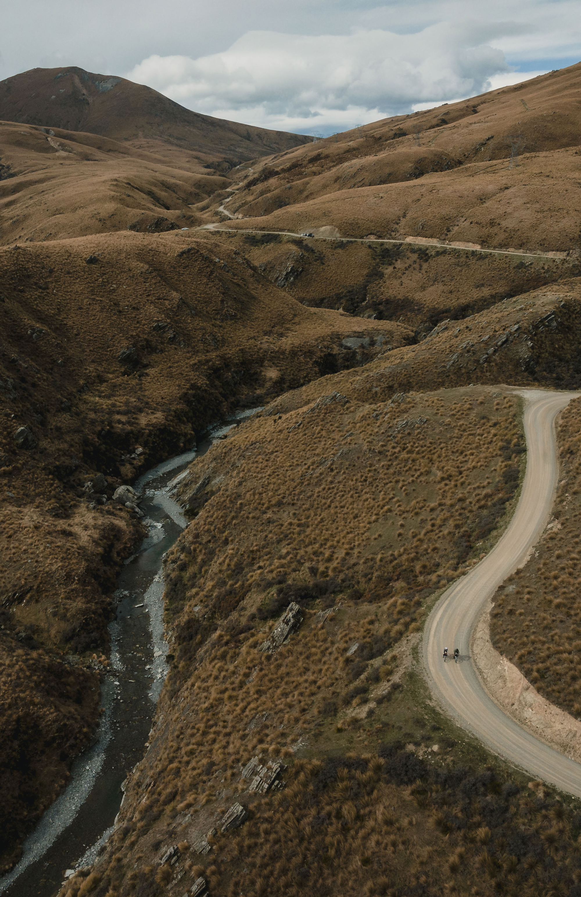
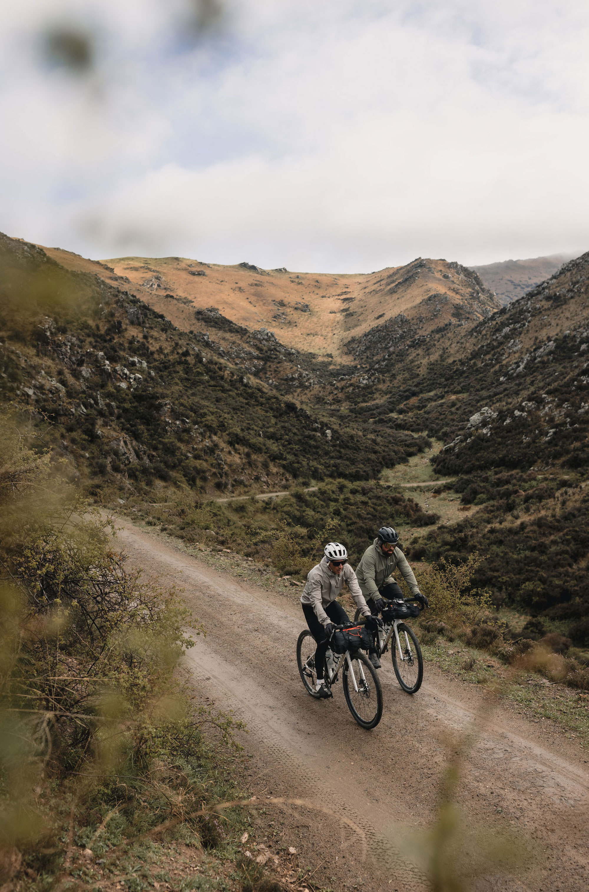
The next morning, we pedalled around Naseby. It’s quaint, cute and stuck in a time of years gone by. It wasn’t exactly bustling, but I quite liked that and we even had to wait for the coffee shop to open around 8am. Fed and caffeinated, we left town and could see the tall mountain ranges ingulfing this small town. It was about a minute before we were back on the quiet country roads. It was today that we’d intersect some of the Otago Rail Trial, en route to either Tarras – if we could get over Thomson Gorge Road – or into Clyde if not. In any case, we would be in for another tough day as the wind started to howl from the west.
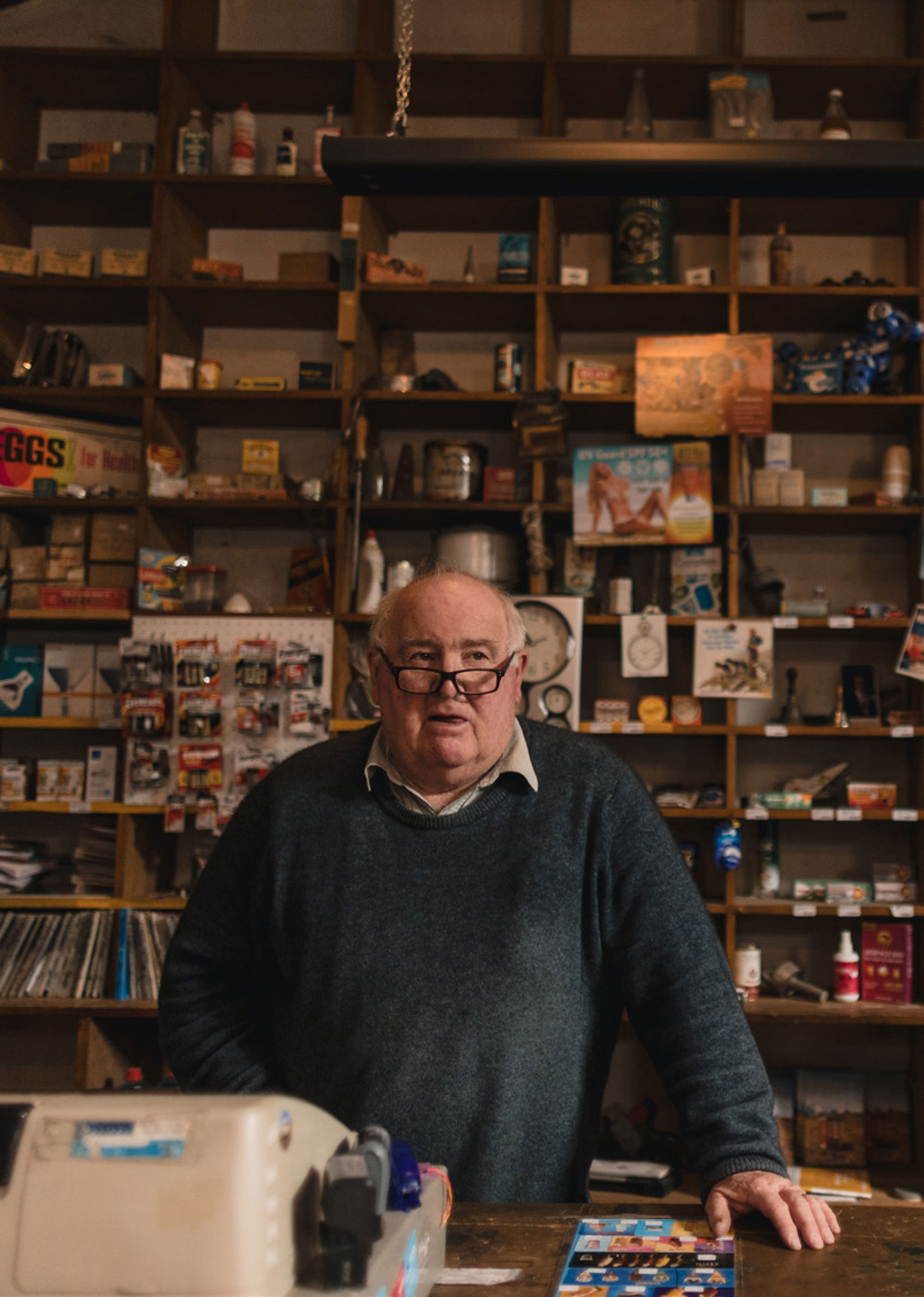
A few hours in, we reached Oturehua Otago Rail Trial. I was curious about the Gilchrist’s General Store and walked inside to find a museum of yesteryear. It’s almost unchanged in appearance since 1899 – the products on the display shelves behind the long counters will bring back nostalgic memories for many.
The current owner was like a historian telling us about all the old times. He was also a rugby fanatic – I asked about the recent All Blacks game and he gave us a full breakdown analysis. Forget the rugby pundits, this bloke ran rings around them! The conversation turned to our route onwards and, with his suggestion, we made the detour from there up to St Bathan’s Vulcan Hotel.
This place had been on our radar, but it was hard to make the route intersect with this location as it’s bloody remote. However, this journey was about historic pubs, and this was one of them.
I did question this detour quite a few times as I pushed hard into the block headwind. But, this was about braking normality, exploring and immersing ourselves in an experience that will be imprinted in our memories for a long time.
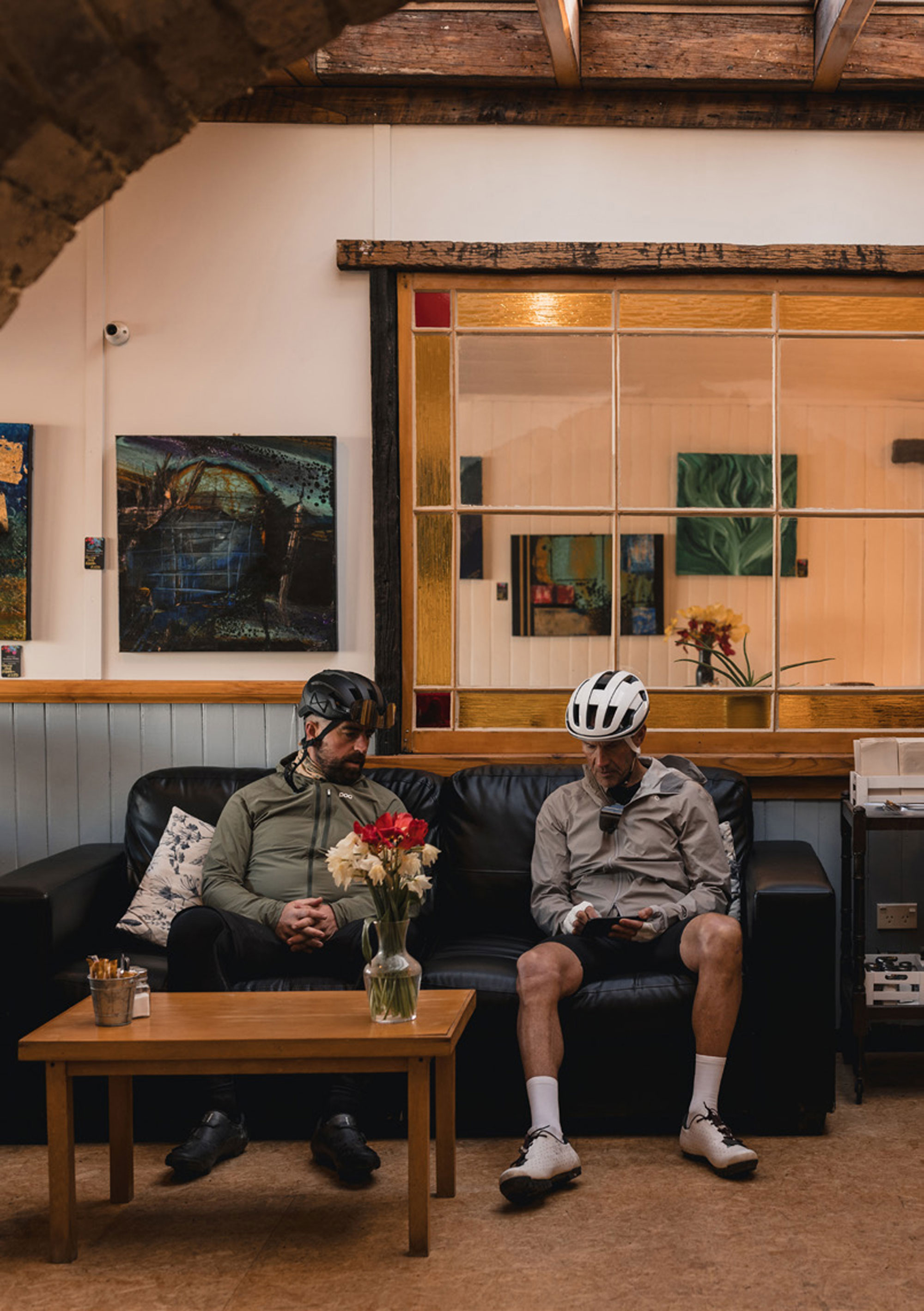
This section was hard – wind gusts were very high, and the terrain was relentless. We’d also been slowly climbing, which made things even tougher. They don’t make the best pubs easy to get to, that’s for sure! I did question this detour quite a few times as I pushed hard into the block headwind. But, this was about braking normality, exploring and immersing ourselves in an experience that will be imprinted in our memories for a long time. The visit to Vulcan Hotel was well worth it! The old brick frontage, with a bar that was just inside the doorway, was a nod to earlier times. The food was fantastic, and the historic pub even had its own brew on tap!
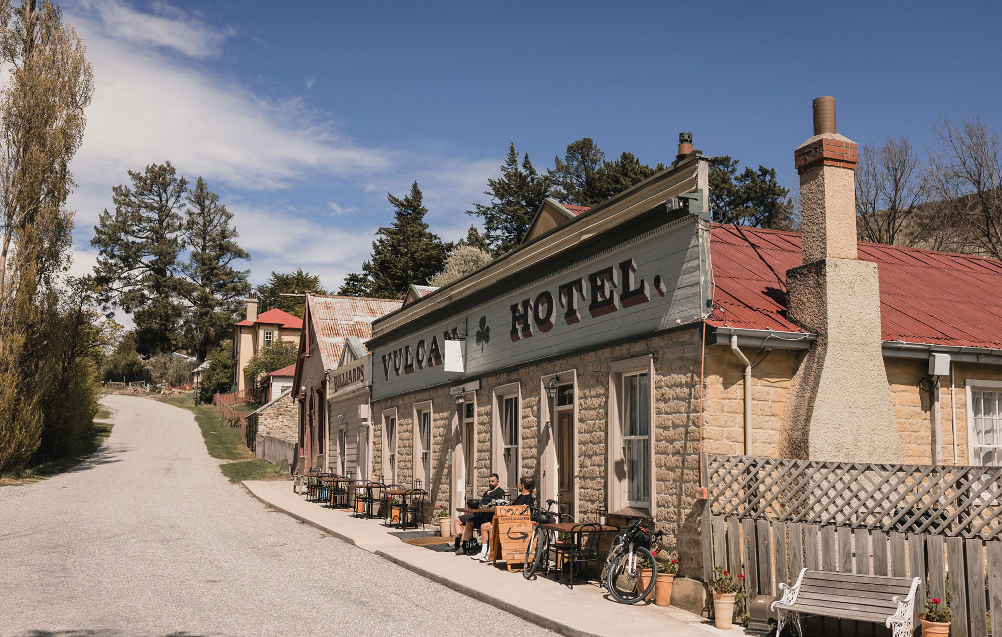
To the famous Vulcan Hotel in St Bathan’s, a stunning village steeped in gold mining history and surrounded by rolling farmlands and rugged mountains. It’s also home to the man-made Blue Lake where you can view sluicings and gold mining remains. The iconic pub has been serving locals and visitors since 1869 and there’s a bit of a spooky story here. So it goes, Rosie was a sex worker who plied her trade from Room One of the Vulcan Hotel back in the gold rush days of the 1860s. Back then, St Bathan’s had 13 pubs and up to I couldn’t put the whole experience into words, as we encountered so much on this journey and time is needed to really absorb it all. 2000 miners working their claims. She was killed in the room by a person – or persons – unknown, who took the small quantity of gold that she had from her dealings with miners, and absconded, never to be found. Rosie’s ghost is said to still be about, perhaps seeking justice for her fate.
Out of St Bathan’s, we headed south to either connect back with the Otago Rail Trail or head over Thomson’s Gorge Road. The best local intel – after numerous discussions with people en route – was to ask the Omakau garage and petrol station if we could go through or not. We did have some doubts as the winds were high, snow was forecast up there and lambing season had just started. The lady at the gas station was lovely and happened to know the farmer at the base of Thomson Gorge Road. A quick call quickly ended our aspirations of going over this road into Tarras. She did say that we’d be crazy given the current weather and the forecast conditions. And with that we headed into Alexandra via the Otago Rail Trail. It was great to intersect the Otago Rail Trail with gravel roads and trails, and to hardly touch any bitumen. Once we reached Alexandra, we jumped onto the river track into Clyde which ended our rather monstrous day. The Post Office served us chips and beers as we sat, tanks empty, around the table. After that, we rolled around the road to Clyde Central and met the lovely owner, Fizz, who kindly offered us a room for the night. She’s also a rider and asked about our journey – and we gave some advice for her upcoming bikepacking trip, too. We hit bed early as the day’s toll had caught up with us by then!
DAY THREE;
The day of the final transfer across the mountain range dawned; and it brought with it moody conditions. This would be straight out of Clyde and…. Up! This road is called Hawksburn Road – it’s amazing and offers scenic views across the top. Like the previous days, the terrain was unrelenting but rewarding and, thankfully, the wind had dropped away. The road dropped us swiftly into Bannockburn which we then connected with river tracks into Cromwell. Taco Tuesday at Amigos filled up our empty bodies and we reflected on a brilliant three days of the border run. I couldn’t put the whole experience into words, as we encountered so much on this journey and time is needed to really absorb it all.
I had well and truly scratched the itch, and could return home a somewhat tired but incredibly elated man. Of course, there’s always more to do when you enter these areas but, often, you need to tackle small bits at a time. I’ll leave the plotting of another route for another time.
On these sorts of trips, it’s always best to have buddies that are just as enthusiastic! Andrew brought his energy, enthusiasm and hype for this journey. Being curious, detouring from our set route and, most of all, letting go of any expectations, made this an epic adventure. Of course, the trip is really made up of the iconic places and real-life characters you meet along the way. It’s one thing to ride solo, but sharing a grand experience is by far the best way to do it.
Of course, the trip is really made up of the iconic places and real-life characters you meet along the way. It’s one thing to ride solo, but sharing a grand experience is by far the best way to do it.
Being curious, detouring from our set route and, most of all, letting go of any expectations, made this an epic adventure.